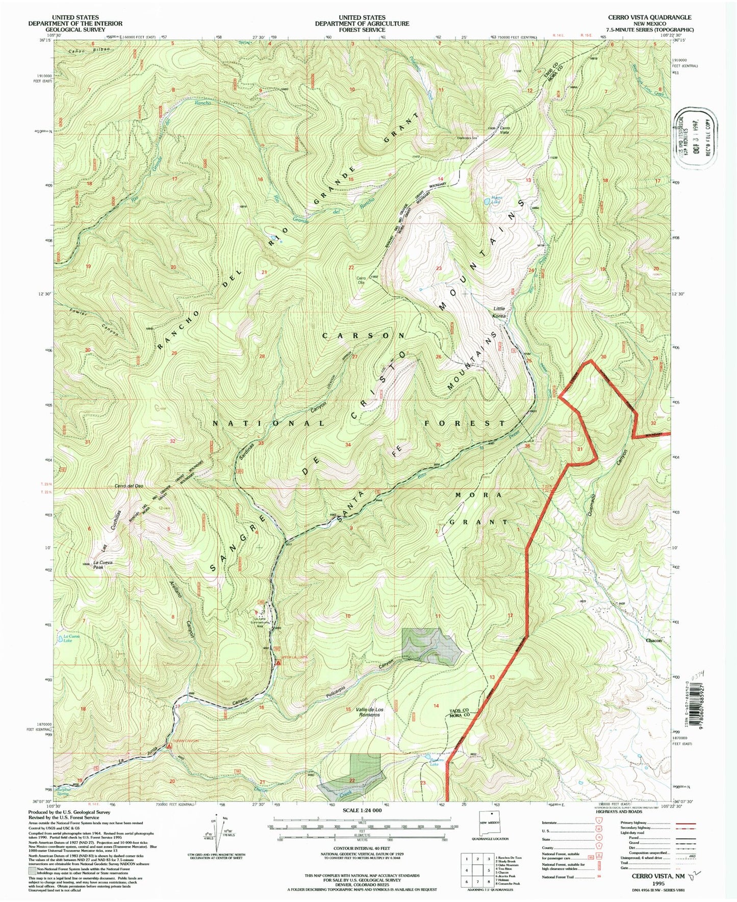
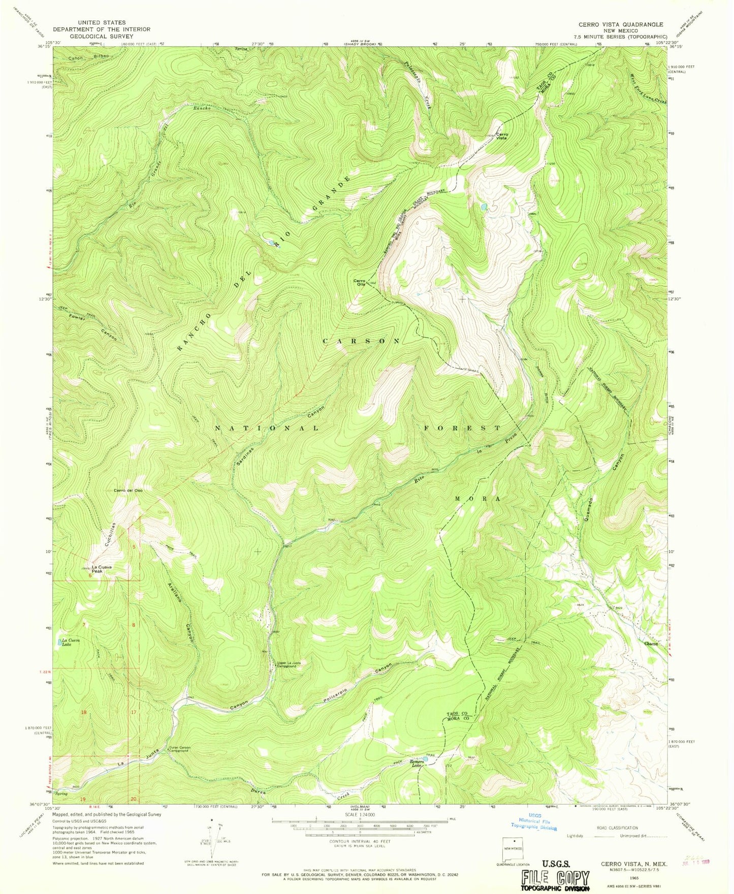
MyTopo
Classic USGS Cerro Vista New Mexico 7.5'x7.5' Topo Map
Couldn't load pickup availability
Historical USGS topographic quad map of Cerro Vista in the state of New Mexico. Typical map scale is 1:24,000, but may vary for certain years, if available. Print size: 24" x 27"
This quadrangle is in the following counties: Mora, Taos.
The map contains contour lines, roads, rivers, towns, and lakes. Printed on high-quality waterproof paper with UV fade-resistant inks, and shipped rolled.
Contains the following named places: Arellano Canyon, Cerro del Oso, Cerro Olla, Cerro Vista, Cuchillas, Duran Canyon Campground, Duran Creek, La Cueva Lake, La Cueva Peak, Policarpio Canyon, Romero Lake, Sardinas Canyon, Sierra Ditch, Upper La Junta Campground, Huero Lake, Little Korea, Valle De Las Romeros, La Junta Summerhome Area, Policarpio Creek, Sulphur Spring