MyTopo
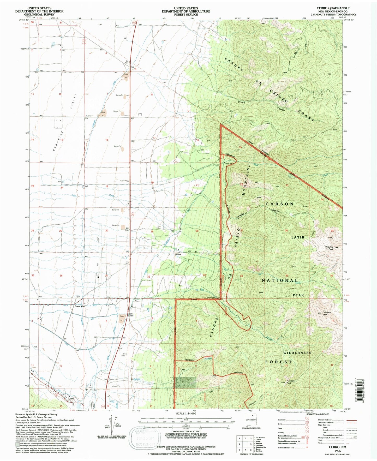
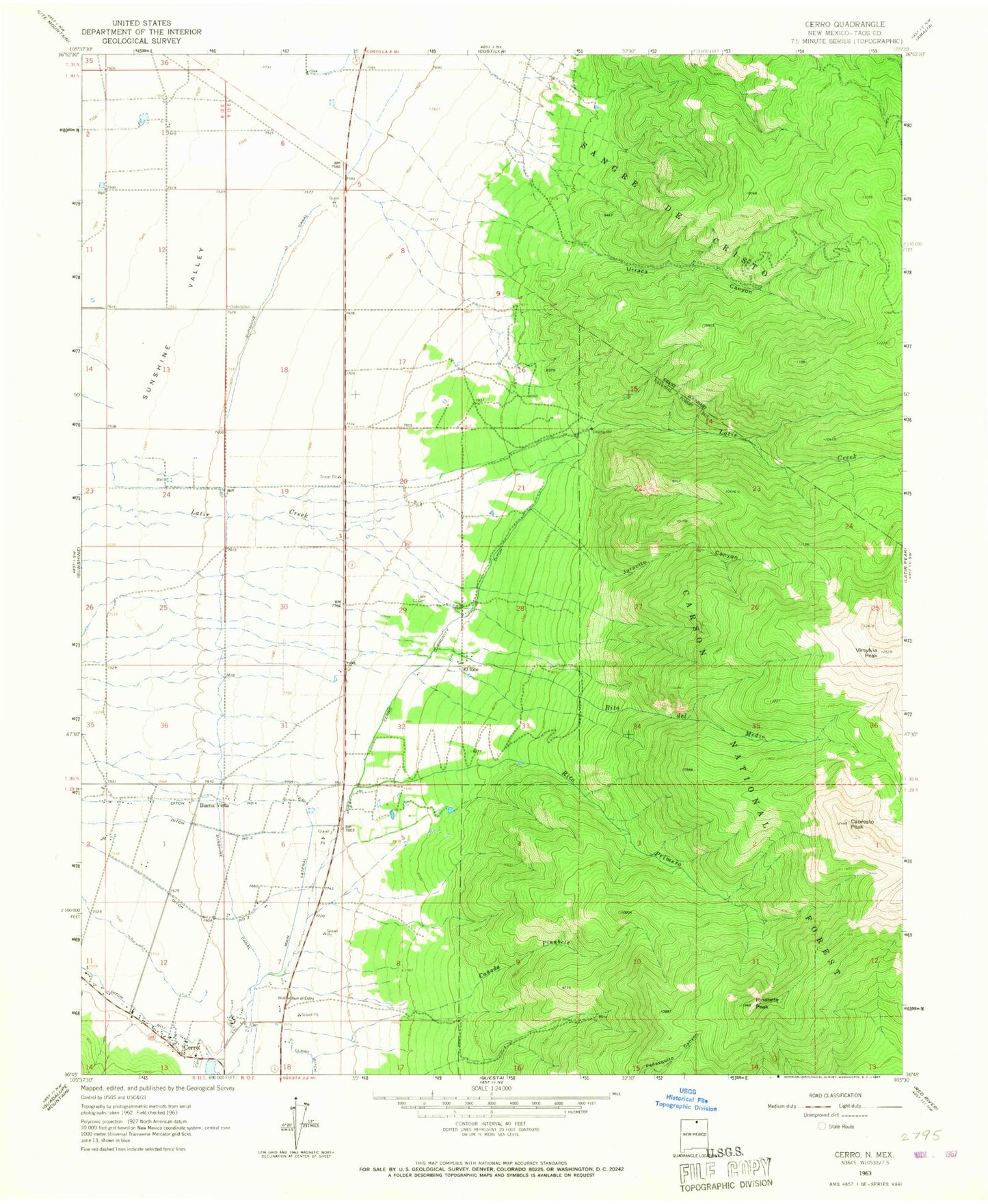
Classic USGS Cerro New Mexico 7.5'x7.5' Topo Map
Couldn't load pickup availability
Historical USGS topographic quad map of Cerro in the state of New Mexico. Typical map scale is 1:24,000, but may vary for certain years, if available. Print size: 24" x 27"
This quadrangle is in the following counties: Taos.
The map contains contour lines, roads, rivers, towns, and lakes. Printed on high-quality waterproof paper with UV fade-resistant inks, and shipped rolled.
Contains the following named places: Buena Vista, Cabresto Peak, Canada Pinabete, Cerro, Community Ditch, Number Two Ditch, Number Three Ditch, Number Four Ditch, Jaracito Canyon, Latir Cemetery, Main Lateral, Pinabete Peak, Rito del Medio, Rito Primero, Sunshine Canal, Urraca Canyon, Pinabete Canyon, Sawmill Canyon Prospect, Esperanza Claim, Revelation Manganese D Mine, Latir Peak Wilderness, Cabresto Lake Dam, Testhole R4 Water Well, 10021 Water Well, Water Well 2, Water Well 3, 10108 Water Well, Water Well 1, 10110 Water Well, 10112 Water Well, 10055 Water Well, 10022 Water Well, PUBSUP Water Well 1, 10111 Water Well, 10032 Water Well, Water Well 1, Water Well 2, 10054 WAter Well, 10026 Water Well, 10051 Water Well, El Rito, Cerro Community Ditch, El Cerro Cemetery, Cerro Weather Station, Questa Municipal Number 2 Airport, Cerro Post Office, Latir Volunteer Fire Department, Questa Fire Department Station 2 - Questa Airport Substation, Cerro Volunteer Fire Department