MyTopo
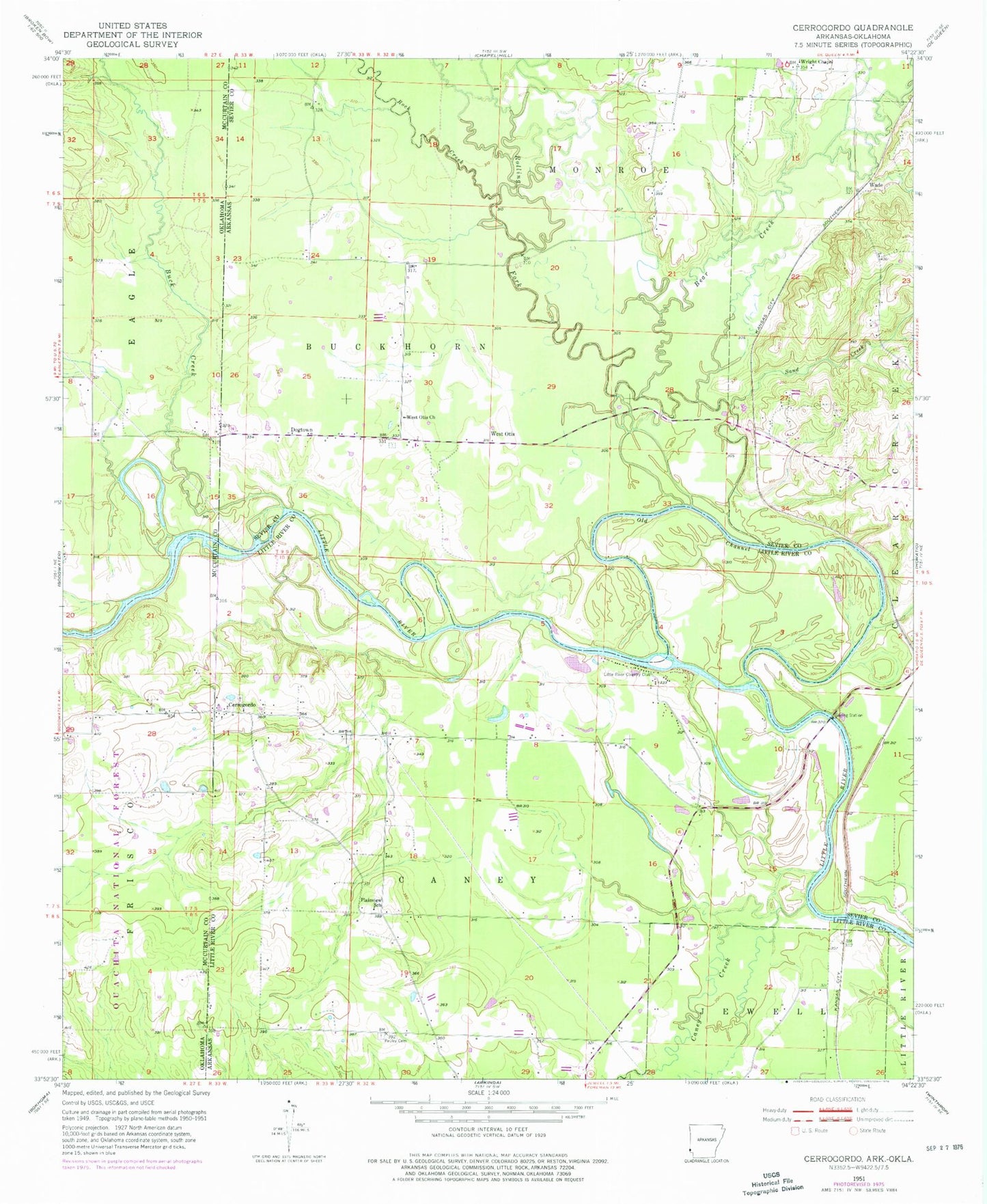
Classic USGS Cerrogordo Arkansas 7.5'x7.5' Topo Map
Couldn't load pickup availability
Historical USGS topographic quad map of Cerrogordo in the state of Arkansas. Map scale may vary for some years, but is generally around 1:24,000. Print size is approximately 24" x 27"
This quadrangle is in the following counties: Little River, McCurtain, Sevier.
The map contains contour lines, roads, rivers, towns, and lakes. Printed on high-quality waterproof paper with UV fade-resistant inks, and shipped rolled.
Contains the following named places: Bear Creek, Billingsleys Corner, Boring Crossing, Buck Creek, Caney Creek, Cerro Gordo Volunteer Fire Department, Cerrogordo, Cerrogordo Cemetery, Dog Town Bridge, Dogtown, Gin House Ford, Green Wood Ferry, Green Wood Shoals, Line Ford, Little River Country Club, Morris Ferry, Old Channel Little River, Parker Crossing, Pauley Cemetery, Plainview School, Rock Creek, Rolling Fork, Sand Creek, Sorghum Patch Ford, State Line Baptist Church, Township of Buckhorn, Township of Caney, Wade, West Otis, West Otis Cemetery, West Otis Church, Wright Chapel, ZIP Code: 71866