
MyTopo
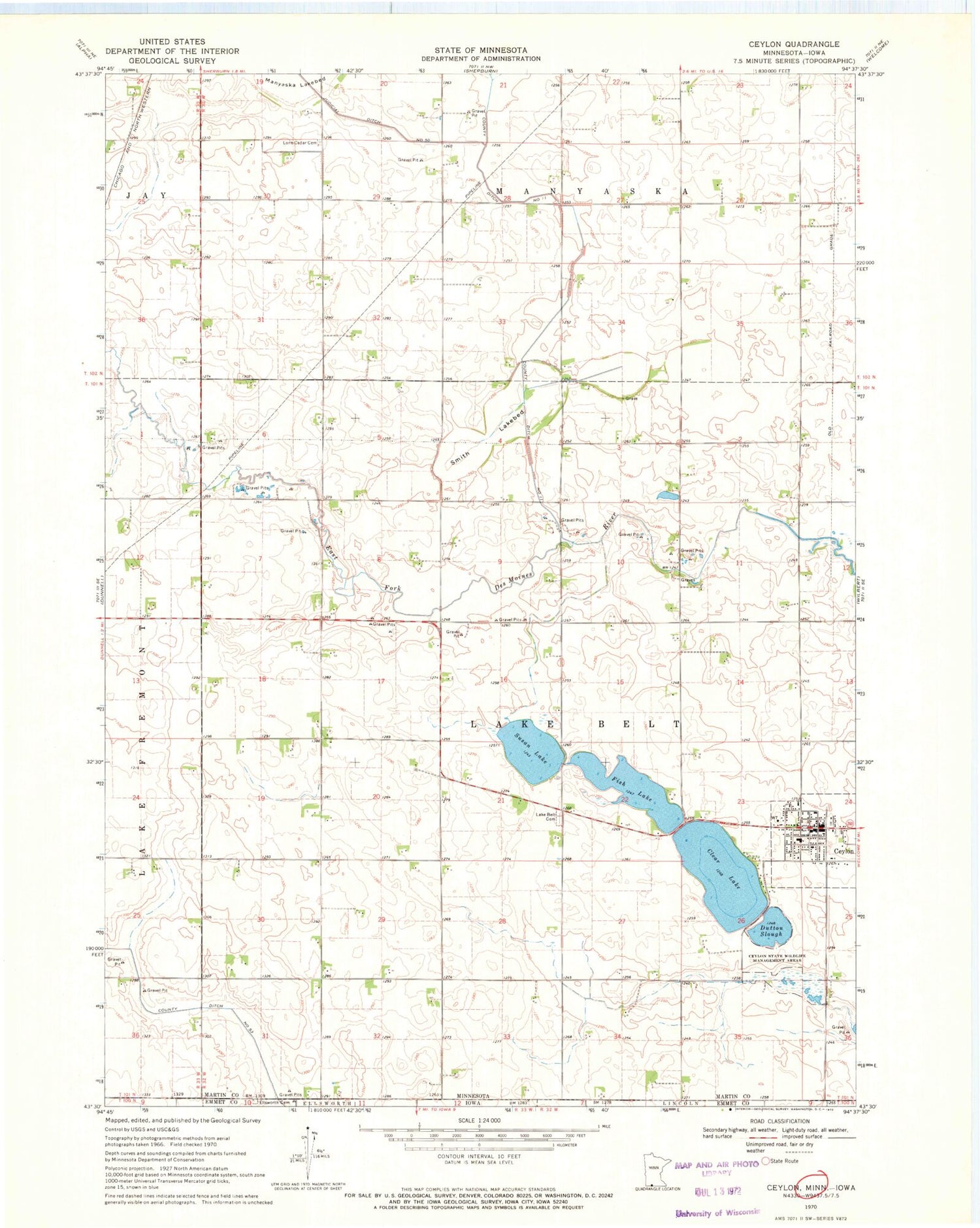
Classic USGS Ceylon Minnesota 7.5'x7.5' Topo Map
Couldn't load pickup availability
Historical USGS topographic quad map of Ceylon in the states of Minnesota, Iowa. Map scale may vary for some years, but is generally around 1:24,000. Print size is approximately 24" x 27"
This quadrangle is in the following counties: Emmet, Martin.
The map contains contour lines, roads, rivers, towns, and lakes. Printed on high-quality waterproof paper with UV fade-resistant inks, and shipped rolled.
Contains the following named places: Ceylon, Ceylon Fire Department, Ceylon Post Office, Ceylon State Wildlife Management Areas, City of Ceylon, Clear Lake, County Ditch Number Eleven, Doliver Lutheran Church, Dutton Slough, Ellsworth Cemetery, Fish Lake, Judicial Ditch Number Fifty, Lake Belt Cemetery, Lone Cedar Cemetery, Martin County Library, Our Saviour Lutheran Church, Saint John's United Church, Saint Peter Lutheran Church, Smith Lakebed, Susan Lake, Township of Lake Belt


