MyTopo
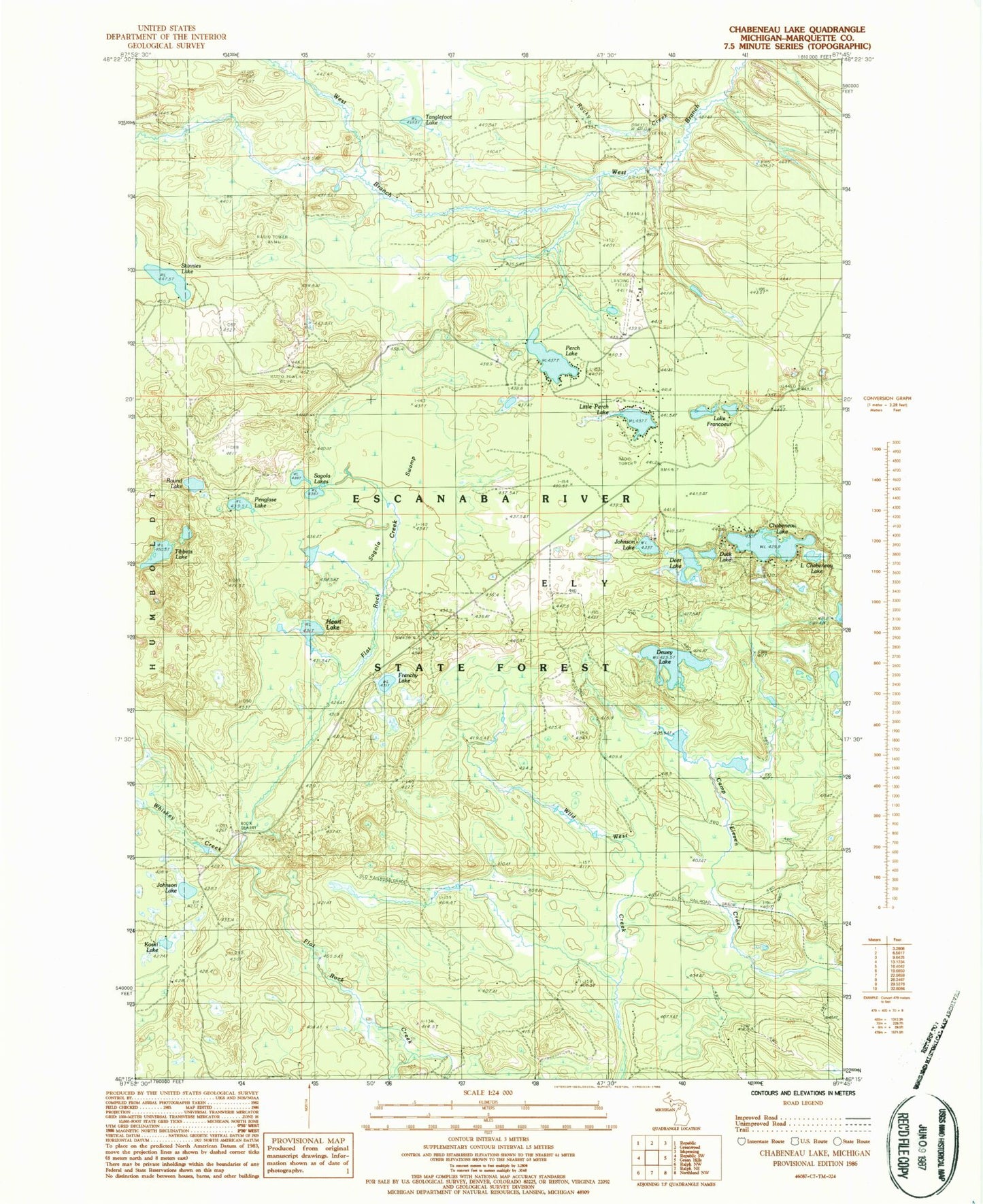
Classic USGS Chabeneau Lake Michigan 7.5'x7.5' Topo Map
Couldn't load pickup availability
Historical USGS topographic quad map of Chabeneau Lake in the state of Michigan. Map scale may vary for some years, but is generally around 1:24,000. Print size is approximately 24" x 27"
This quadrangle is in the following counties: Marquette.
The map contains contour lines, roads, rivers, towns, and lakes. Printed on high-quality waterproof paper with UV fade-resistant inks, and shipped rolled.
Contains the following named places: Chabeneau Lake, Deer Lake, Dewey Lake, Duck Lake, Edward F Johnson Airport, Frenchy Lake, Heart Lake, Johnson Lake, Kaski Lake, Lake Francoeur, Lake Pork Chop, Little Chabeneau Lake, Little Perch Lake, Penglase Lake, Perch Lake, Rocky Creek, Round Lake, Sagola Lakes, Sagola Swamp, Skinnies Lake, Tanglefoot Lake, Tibbets Lake, WJMY-TV (Marquette), WLUC-TV (Marquette), WNMU-FM (Marquette), WNMU-TV (Marquette)