MyTopo
Classic USGS Chalk Mountain Arizona 7.5'x7.5' Topo Map
Couldn't load pickup availability
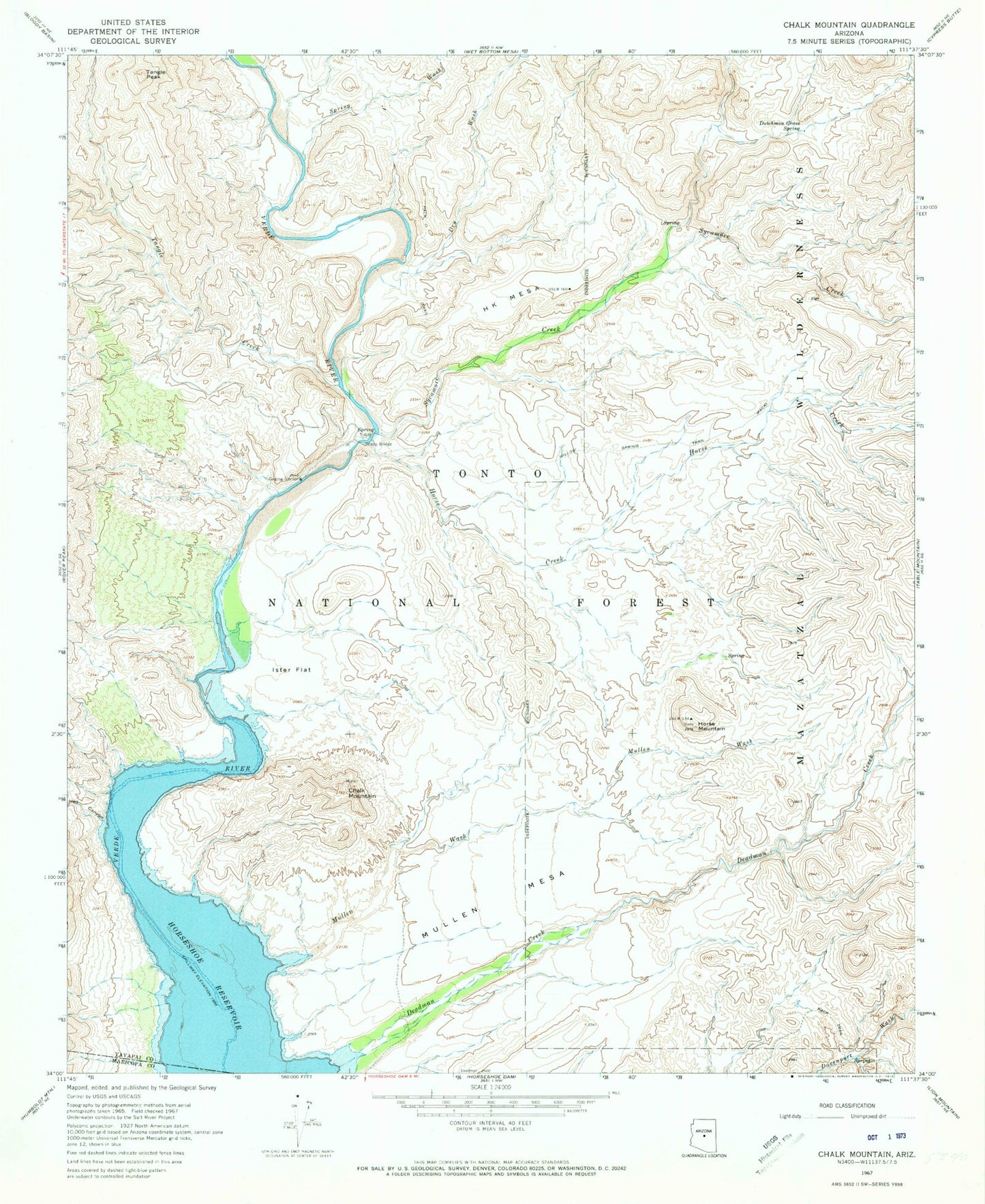
Historical USGS topographic quad map of Chalk Mountain in the state of Arizona. Typical map scale is 1:24,000, but may vary for certain years, if available. Print size: 24" x 27"
This quadrangle is in the following counties: Maricopa, Yavapai.
The map contains contour lines, roads, rivers, towns, and lakes. Printed on high-quality waterproof paper with UV fade-resistant inks, and shipped rolled.
Contains the following named places: Chalk Mountain, Deadman Creek, Dry Wash, Dutchman Grave Spring, H K Mesa, Hell Canyon, Horse Creek, Horse Mountain, Horseshoe Reservoir, Ister Flat, Mullen Mesa, Mullen Wash, Sheep Bridge, Spring Wash, Sycamore Creek, Tangle Creek, Tangle Peak, H K Ranch, JS Ranch, Verde River Trail Number Eleven, Andrea Spring, Sheep Bridge Recreation Site, Manterola Spring, Lower Dutchman Grave Spring, The White Bluffs