MyTopo
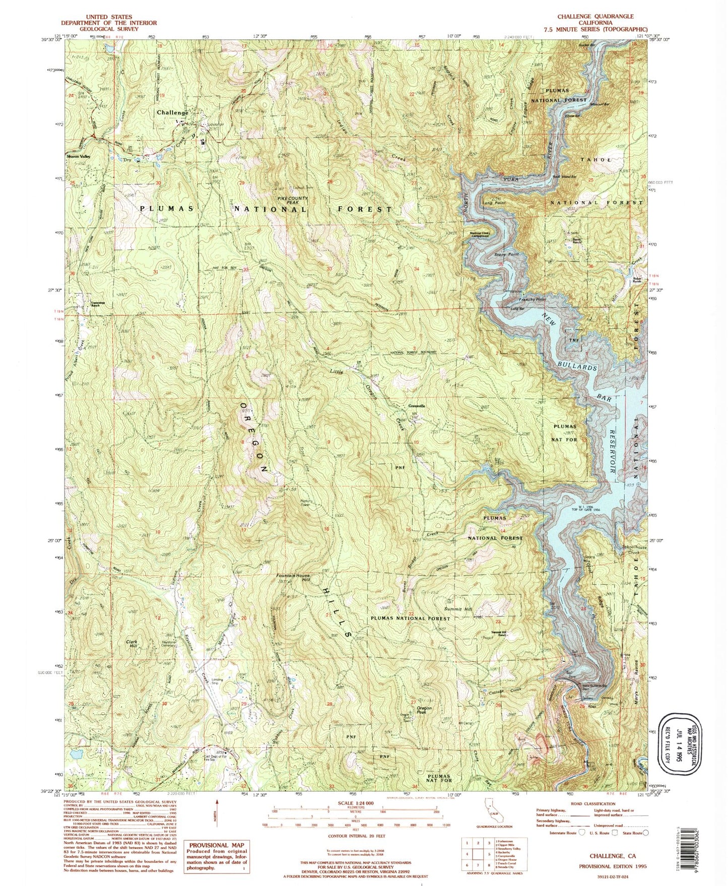
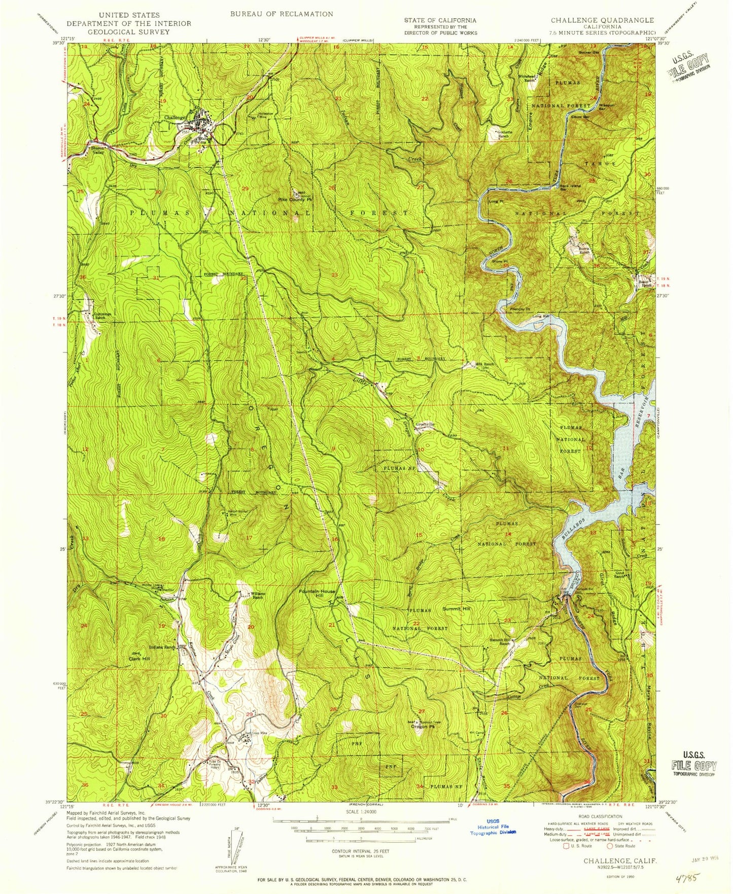
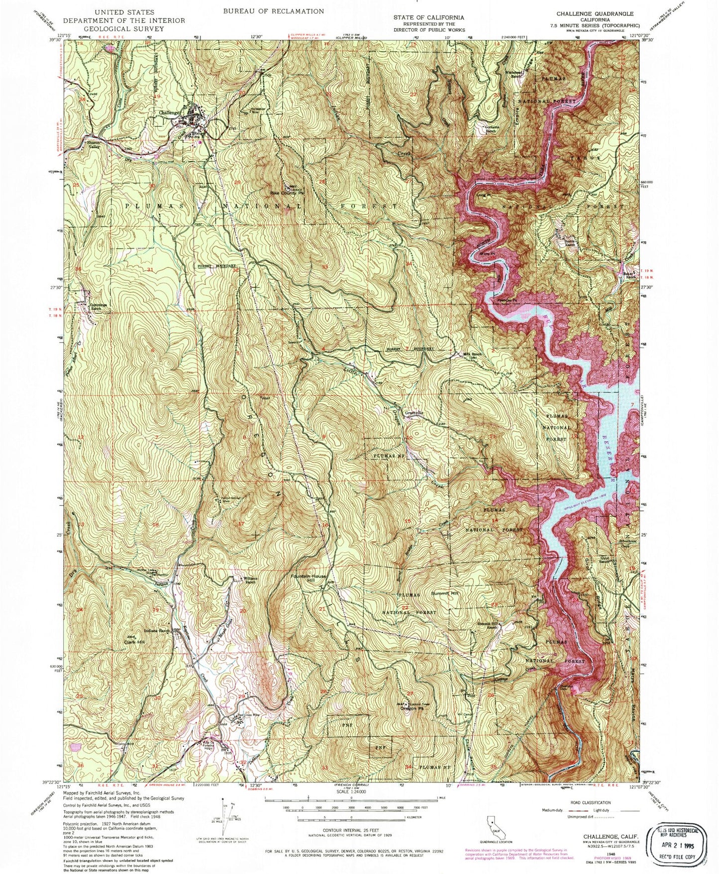
Classic USGS Challenge California 7.5'x7.5' Topo Map
Couldn't load pickup availability
Historical USGS topographic quad map of Challenge in the state of California. Map scale may vary for some years, but is generally around 1:24,000. Print size is approximately 24" x 27"
This quadrangle is in the following counties: Nevada, Yuba.
The map contains contour lines, roads, rivers, towns, and lakes. Printed on high-quality waterproof paper with UV fade-resistant inks, and shipped rolled.
Contains the following named places: Baker Ranch, Bullards Bar, Bullards Bar Dam, Burnt Bridge Campground, Burnt Bridge Creek, Burris Ranch, Challenge, Challenge District Ranger Station, Challenge Post Office, Clark Hill, Clayton Ranch, Costa Creek, Cottage Creek, Cummings Ranch, Elbow Bar, Empire Creek, Foster Bar, Fountain House Hill, Frenchy Point, Frenchy Point Campground, Garden Point Campground, Girot Ranch, Girot Ridge, Gochette Ranch, Greenville, Hinton Surnuf Mine, Horseshoe Mine, Indian Creek, Indiana Creek, Indiana Ranch, Keystone Cemetery, Keystone Creek, Little Oregon Creek, Long Bar, Long Point, Madrone Cove Campground, Maple Grove Creek, Marys Ravine, Milk Ranch, Mill Creek, Missouri Bar, Mother Lode Mine, New Bullards Bar 1034 Dam, New Bullards Bar Dam, New Bullards Bar Reservoir, Oregon Hills, Oregon Peak, Pike County House, Pike County Peak, Red Cross Mine, Rich Gulch, Rock Island Bar, Schoolhouse Creek, Sharon Valley, Slapjack Creek, Stony Point, Sucker Bar, Summit Hill, Summit Hill Ranch, Whitehead Ranch, Williams Ranch, Yellowjacket Creek, Yuba County Forestry Headquarter, Yuba Feather Elementary School, Yuba Foothills Division, ZIP Codes: 95925, 95935