MyTopo
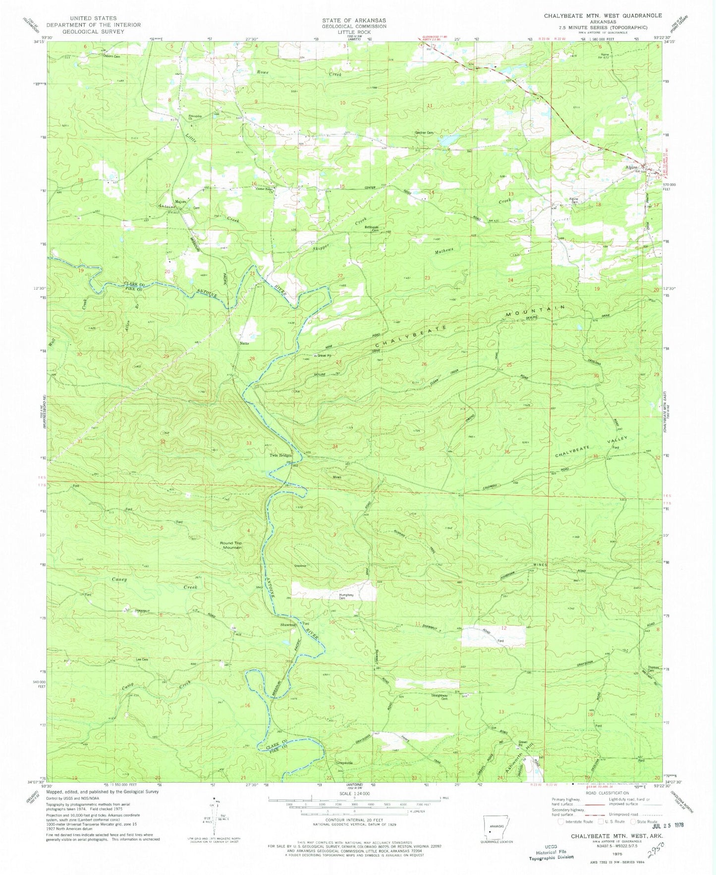
Classic USGS Chalybeate Mountain West Arkansas 7.5'x7.5' Topo Map
Couldn't load pickup availability
Historical USGS topographic quad map of Chalybeate Mountain West in the state of Arkansas. Map scale may vary for some years, but is generally around 1:24,000. Print size is approximately 24" x 27"
This quadrangle is in the following counties: Clark, Pike.
The map contains contour lines, roads, rivers, towns, and lakes. Printed on high-quality waterproof paper with UV fade-resistant inks, and shipped rolled.
Contains the following named places: Allen Branch, Alpine, Alpine Cemetery, Alpine Census Designated Place, Alpine Post Office - CPO, Alpine Volunteer Fire Department, Ashworth Hill, Bethsaida Cemetery, Camp Creek, Caney Creek, Caney Fork Church, Center Ridge Church, Center Ridge School, Dwiggins Lake, Dwiggins Lake Dam, Free Hill School, Friendship Church, Gardner Cemetery, Graysonia, Humphrey Cemetery, Lee Cemetery, Little Antoine Creek, Majors, Mathews Creek, Nutts, Osborn Cemetery, Round Top Mountain, Rowe Creek, Runyan Trail, Shawmut, Shawmut School, Skipper Creek, Straightway Cemetery, Thomas Cemetery, Twin Bridges, Wall Creek, ZIP Code: 71921