
MyTopo
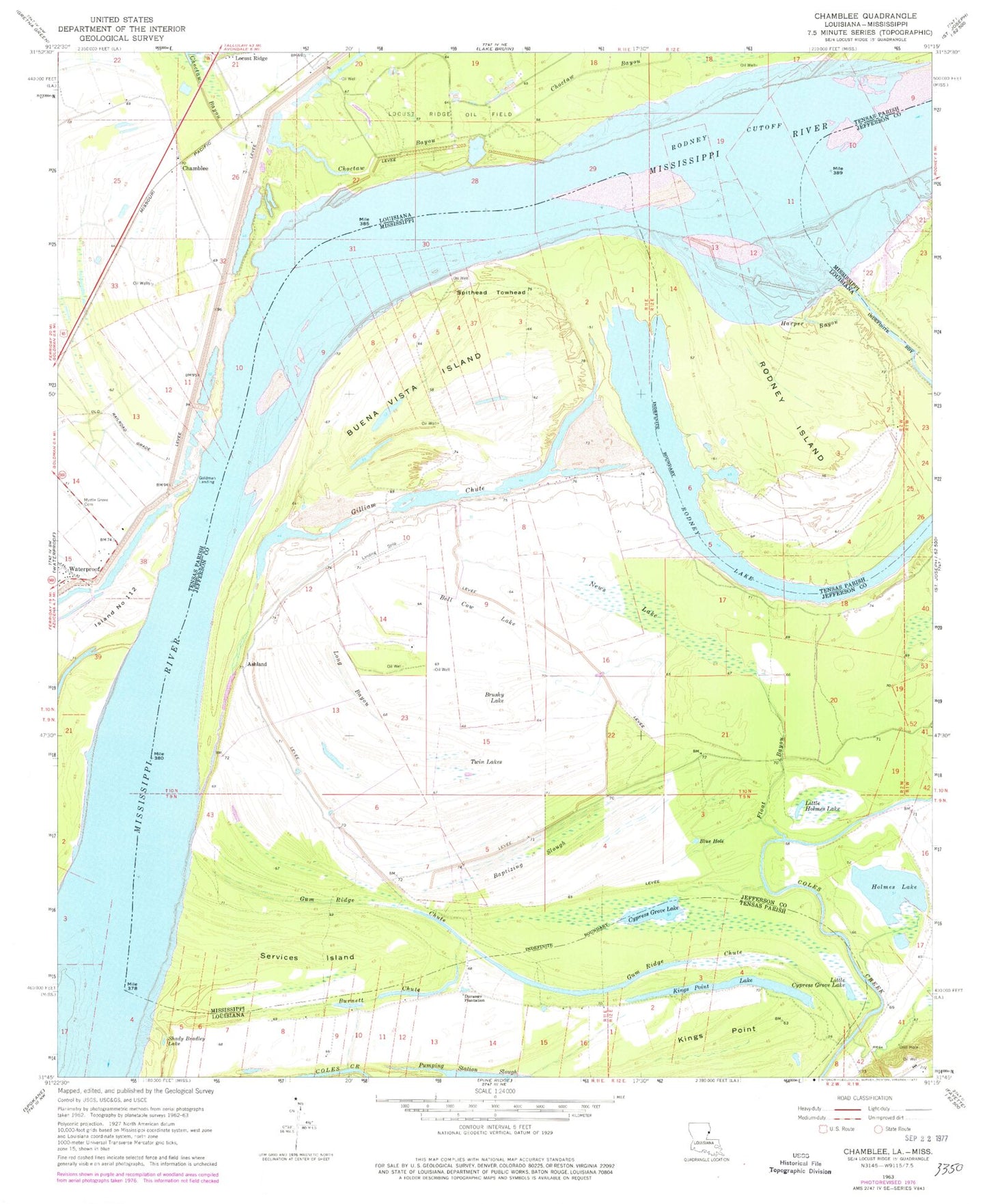
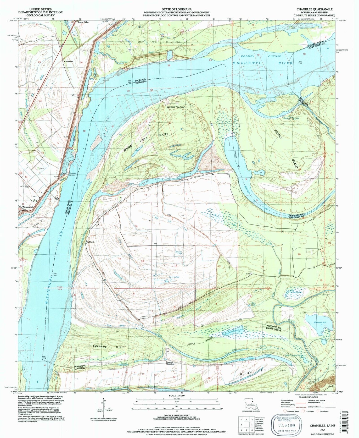
Classic USGS Chamblee Louisiana 7.5'x7.5' Topo Map
Couldn't load pickup availability
Historical USGS topographic quad map of Chamblee in the states of Louisiana, Mississippi. Map scale may vary for some years, but is generally around 1:24,000. Print size is approximately 24" x 27"
This quadrangle is in the following counties: Adams, Jefferson, Tensas.
The map contains contour lines, roads, rivers, towns, and lakes. Printed on high-quality waterproof paper with UV fade-resistant inks, and shipped rolled.
Contains the following named places: Ashland, Baptizing Slough, Bell Cow Lake, Bieller Light, Blue Hole, Browns Field Revetment, Brushy Lake, Buena Vista, Buena Vista Church, Buena Vista Island, Buena Vista Landing, Buena Vista Oil Field, Burnett Chute, Chamblee, Choctaw Bayou, Cottage Bend, Cypress Grove Lake, Durango Landing, Durango Plantation, Float Bayou, Gilliam Chute, Gilliam Chute Oil Field, Gilliam Landing, Goldman Landing, Goldman Lower Landing, Gum Ridge Chute, Harper Bayou, Harper Landing, Hedgeland, Holmes Lake, Island Number Onehundred and Twelve, Kempe Bend, Kempe Bend Revetment, Kemps Bend Bar, Kings Point, Kings Point Lake, Little Cypress Grove Lake, Little Holmes Lake, Long Bayou, Millerfield, Myrtle Grove Airport, Myrtle Grove Cemetery, New Zion Church, News Lake, Old Kempe Bend Revetment, Pumping Station Slough, Rodney Bend, Rodney Cutoff, Rodney Island, Rodney Island Bar, Rodney Island Oil Field, Rodney Lake, Services Island, Servis Landing, Shady Bradley Lake, Spithead Towhead, Twin Lakes, Waterproof Bar, Waterproof Dikes