MyTopo
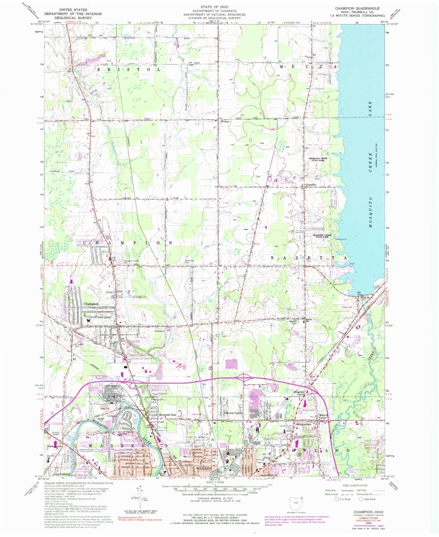
Classic USGS Champion Ohio 7.5'x7.5' Topo Map
Couldn't load pickup availability
Historical USGS topographic quad map of Champion in the state of Ohio. Map scale may vary for some years, but is generally around 1:24,000. Print size is approximately 24" x 27"
This quadrangle is in the following counties: Trumbull.
The map contains contour lines, roads, rivers, towns, and lakes. Printed on high-quality waterproof paper with UV fade-resistant inks, and shipped rolled.
Contains the following named places: Bazetta Cemetery, Bazetta Elementary School, Bazetta Fire Department Station 11, Big Run, Brookside Park, Brown Corner, Burbank Park, Champion, Champion Center Cemetery, Champion Central Elementary School, Champion Heights Census Designated Place, Champion High School, Champion Hills Plaza Shopping Center, Champion Middle School, Champion Police Department, Champion Post Office, Champion Presbyterian Church, Champion Township Fire Department Station 21, Clovercrest Golf Course, Confusion Run, County Infirmary Farm, Elm Road Triple Drive In Theatre, Emerson School, Ewalt Cemetery, Forest Grove Mobile Home Park, Hardscrabble, Hoagland Corner, Howland Township Fire Department Station 32, Kent State University Trumbull Branch, Klondike, Lakeview Mobile Home Park, Long Swamp, McCoffey School, McMurray Cemetery, Morgandale, Morgandale Census Designated Place, Mosquito Creek Dam, Mosquito Creek Lake, Mosquito Creek State Park, North Park Baptist Church, Oldstown Flying Tails Airport, Packard Park, Presbyterian Cemetery, Saint Joseph Cemetery, Shady Lane Mobile Home Park, Skyway Drive-In, Sloas Airport, Spring Run, Township of Bazetta, Township of Champion, Trumbull County, W D Packard Music Hall, Warren Fire Department Parkman Road Station, Warren Township Fire Department Station 2, Wildare, Wildare Post Office, Wildare United Methodist Church, Wilhelm Corner, WNCD-FM (Niles), Yount Pond, Yount Pond Dam, ZIP Code: 44483