MyTopo
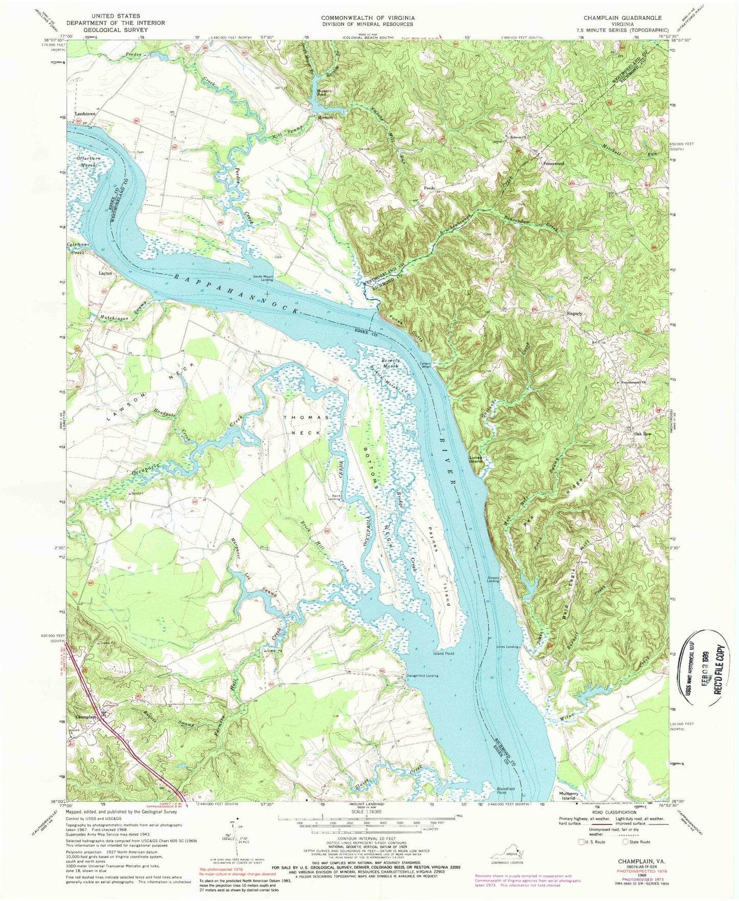
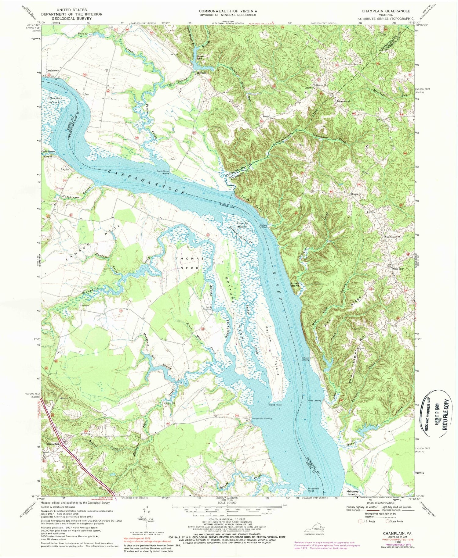
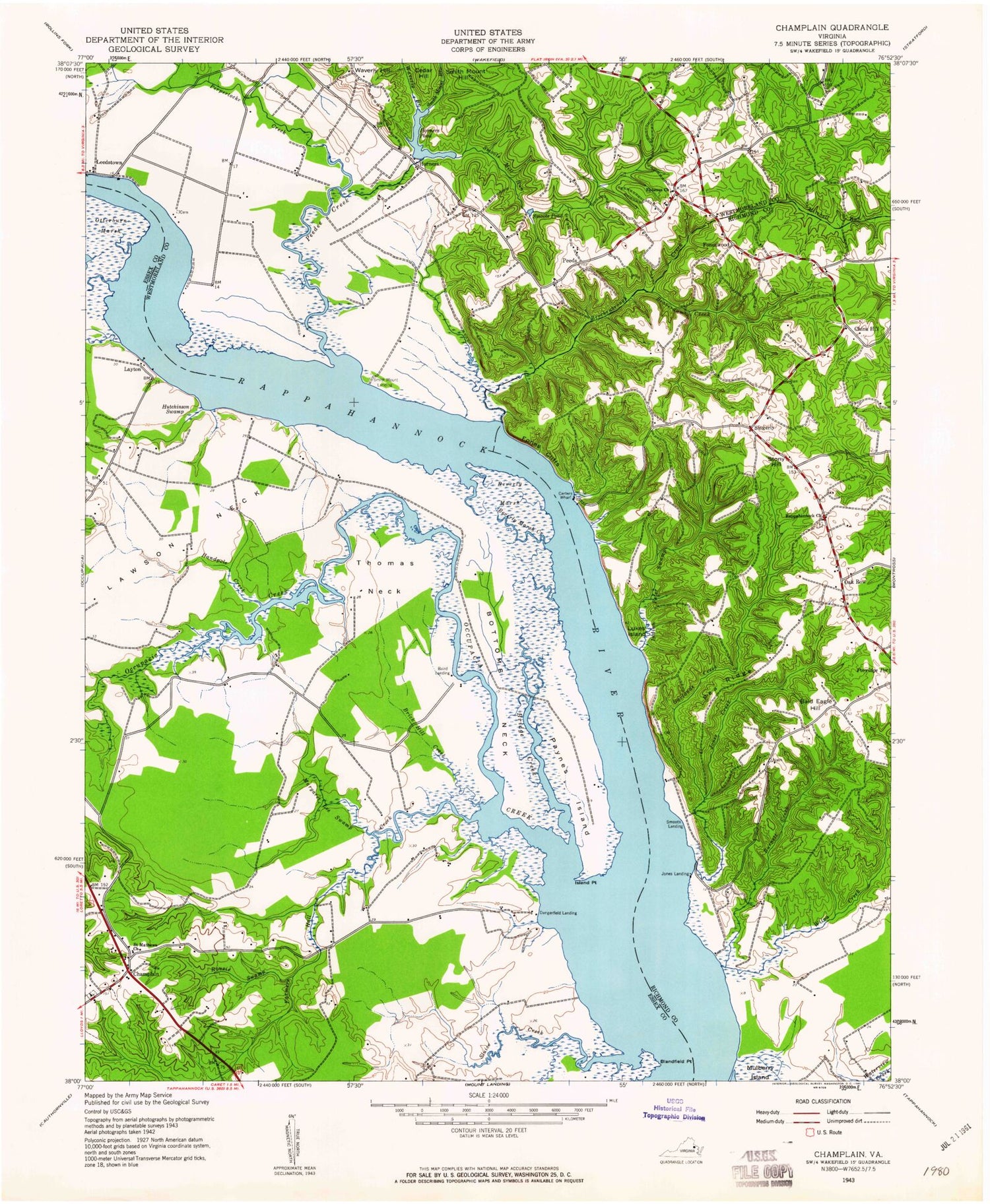
Classic USGS Champlain Virginia 7.5'x7.5' Topo Map
Couldn't load pickup availability
Historical USGS topographic quad map of Champlain in the state of Virginia. Map scale may vary for some years, but is generally around 1:24,000. Print size is approximately 24" x 27"
This quadrangle is in the following counties: Essex, Richmond, Westmoreland.
The map contains contour lines, roads, rivers, towns, and lakes. Printed on high-quality waterproof paper with UV fade-resistant inks, and shipped rolled.
Contains the following named places: Antioch Church, Baird Landing, Bald Eagle Hill, Beaverdam Creek, Beverly Marsh, Beverly Marsh Creek, Blandfield Point, Bottoms Neck, Brick Hill Creek, Bridge Creek, Brockenbrough Creek, Burnett Creek, Carters Wharf, Carters Wharf Landing, Champlain, Champlain Post Office, Chance Post Office, China Hill, China Hill Forks School, Clift Creek, Colemans Creek, Daingerfield Landing, Ephesus Church, Farmers Hall Creek, Fones Cliffs, Foneswood, Foneswood School, Garlands Creek, Handpole Creek, Horners, Horners Dam, Horners Pond, Hundley Dam, Hundley Pond, Hutchinson Swamp, Island Point, Jones Creek, Jones Landing, Lawson Neck, Layton, Layton Reach, Leedstown, Lindsay Hall Farm, Lukes Island, Malvale Farm, Margaret Lee Swamp, Marriner Run, Mill Swamp, Mud Hole Swamp, Oak Row, Occupacia Creek, Otterburn Marsh, Paynes Island, Pea Ridge, Peedee Creek, Peeds, Rappahannock Baptist Church Cemetery, Rappahannock Church, Rouzie Swamp, Saint Mathews Church, Singerly, Sluice Creek, Smith Mount Branch, Smith Mount Hill, Smith Mount Landing, Smoots Landing, Smoots Mill, Smoots Mill Run, Smoots Pond, Thomas Neck, Waverly Branch, Waverly Hill, Wilna Creek, ZIP Code: 22438