
MyTopo
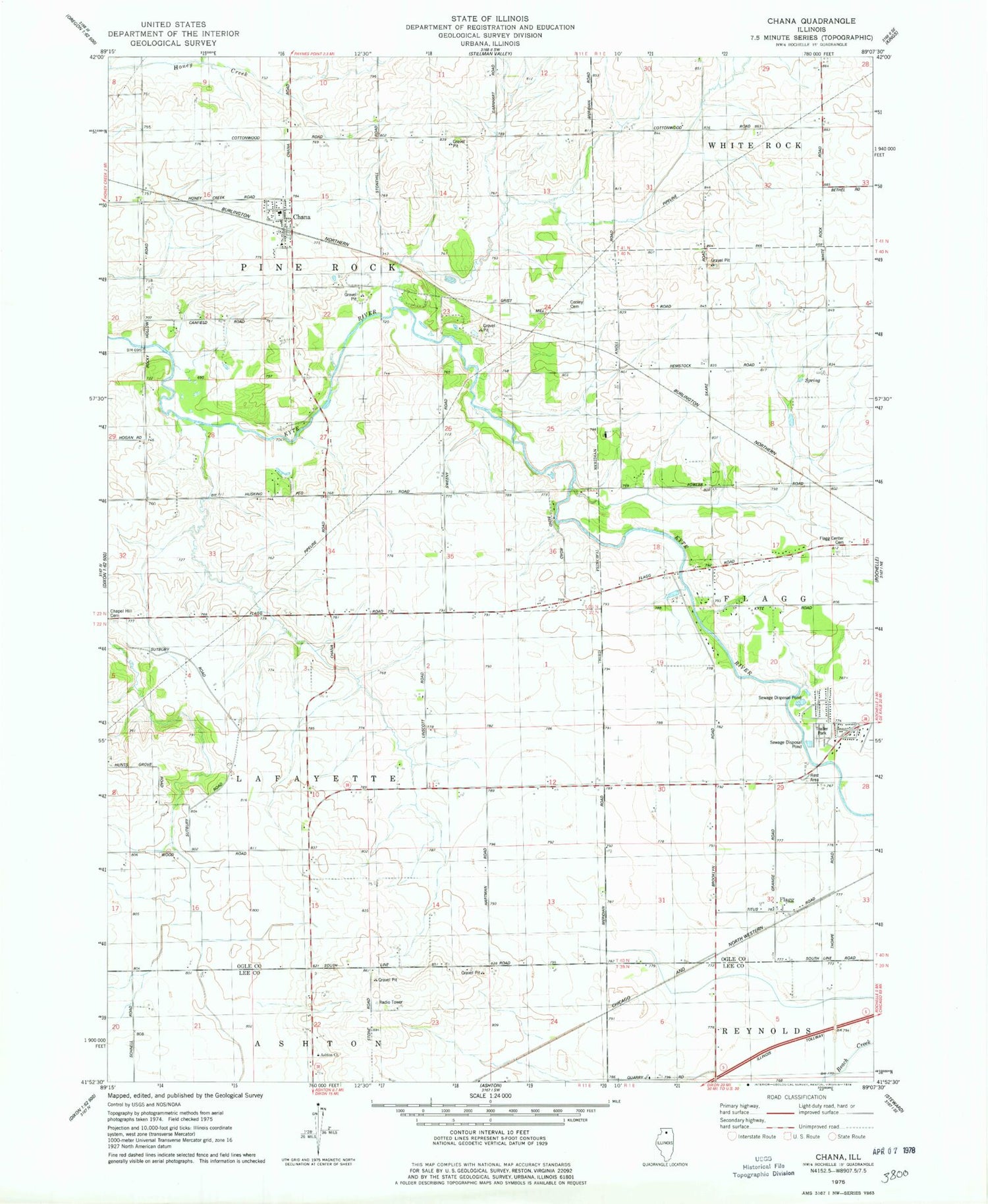
Classic USGS Chana Illinois 7.5'x7.5' Topo Map
Couldn't load pickup availability
Historical USGS topographic quad map of Chana in the state of Illinois. Map scale may vary for some years, but is generally around 1:24,000. Print size is approximately 24" x 27"
This quadrangle is in the following counties: Lee, Ogle.
The map contains contour lines, roads, rivers, towns, and lakes. Printed on high-quality waterproof paper with UV fade-resistant inks, and shipped rolled.
Contains the following named places: Antioch School, Ashton Church, Chana, Chana Post Office, Chana United Methodist Church, Chapel Hill Cemetery, Childers Acres, Cooley Cemetery, Crestwood Acres, Cyclone School, Fischer School, Flagg, Flagg Center Cemetery, Frahms Country Acres, Hemstock School, Hickory Ridge, Kyte Side Estates, Prairieview Estates, Reinke Airport, Skare Estates, Stonehill School, Township of Lafayette, Township of Pine Rock, Union School, Woodland Acres, Yorty School, ZIP Code: 61015


