
MyTopo
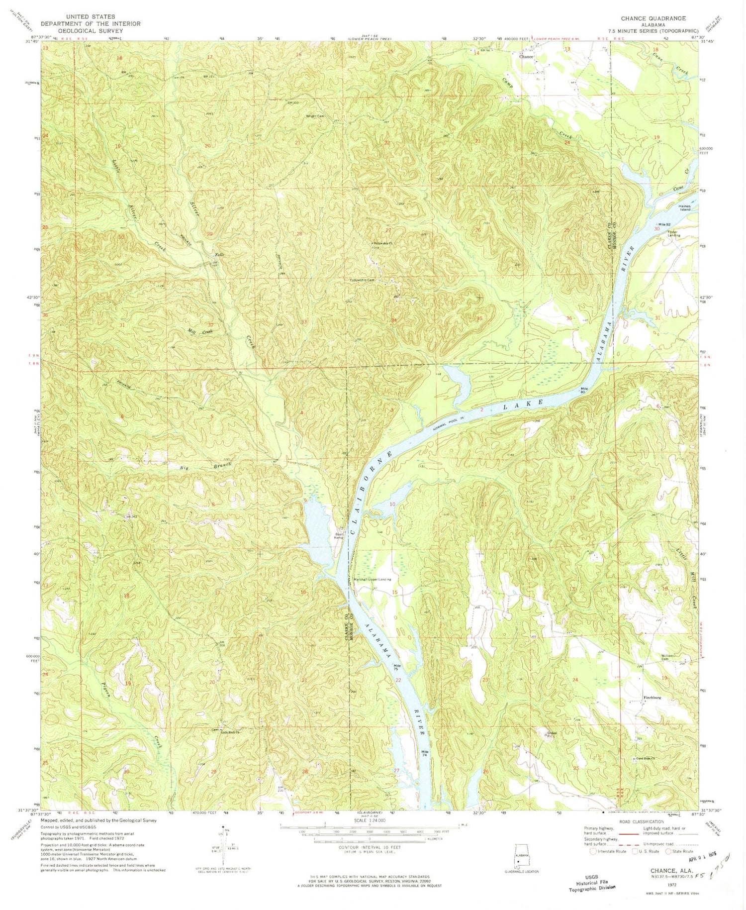
Classic USGS Chance Alabama 7.5'x7.5' Topo Map
Couldn't load pickup availability
Historical USGS topographic quad map of Chance in the state of Alabama. Map scale may vary for some years, but is generally around 1:24,000. Print size is approximately 24" x 27"
This quadrangle is in the following counties: Clarke, Monroe.
The map contains contour lines, roads, rivers, towns, and lakes. Printed on high-quality waterproof paper with UV fade-resistant inks, and shipped rolled.
Contains the following named places: Big Branch, Camp Creek, Cane Creek, Chance, Chance Church, Cobb Landing, Fellowship Cemetery, Fellowship Church, Finchburg, Finchburg Landing, Foster Landing, Good Hope Church, Hendersons Landing, Isaac Creek, Little Rock Church, Little Silver Creek, Maiben Creek, Maiben Landing, Marshall Upper Landing, Mill Creek, Presnall Landing, Silver Creek, Silver Creek Park, Silver Creek Shoal, Swanson, Turkey Shoals, Williams Cemetery, Williams Chapel, Williams Lake, Williams Lake Dam, Williams Store, Williamsons Store, Wright Cemetery


