MyTopo
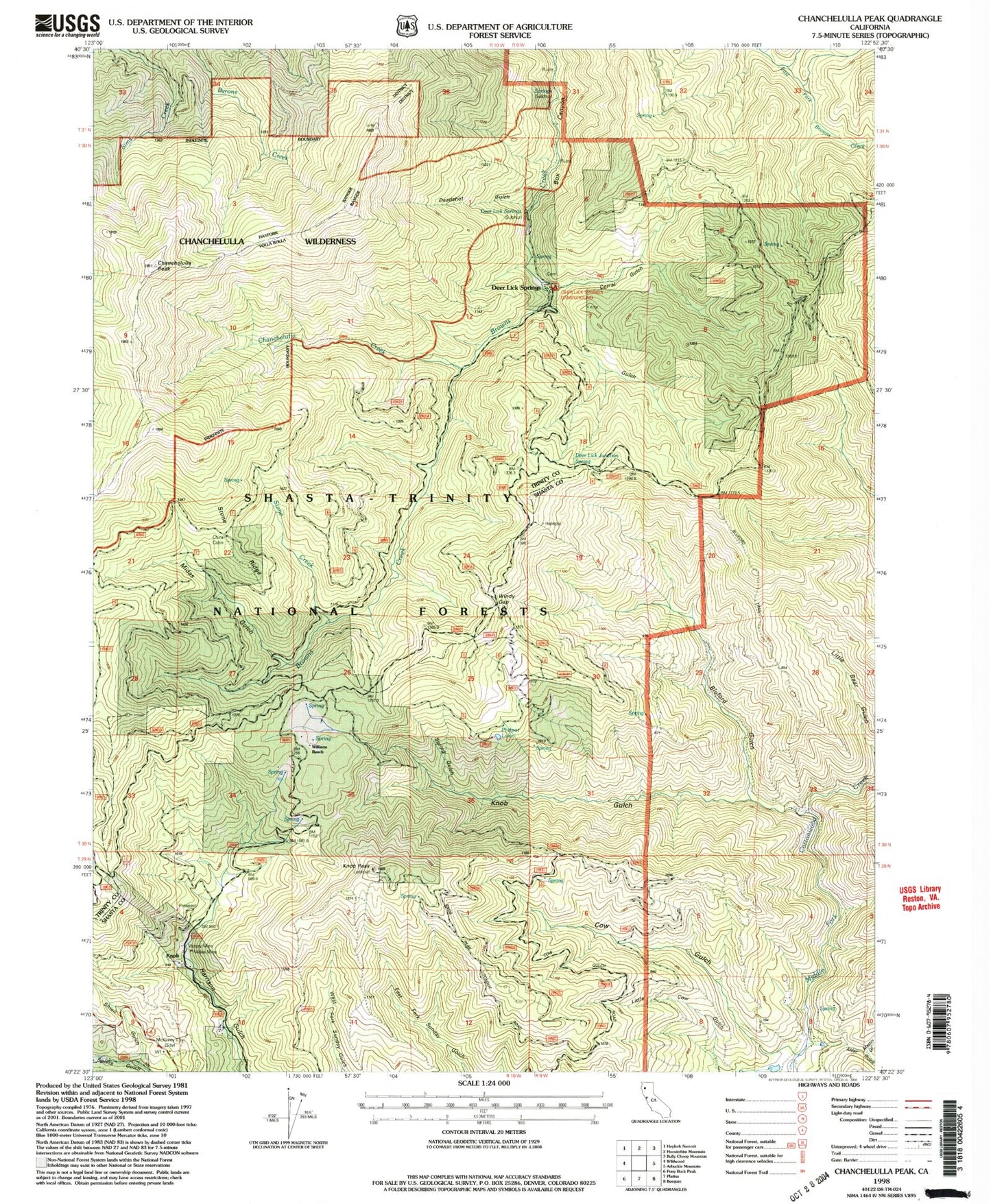
Classic USGS Chanchelulla Peak California 7.5'x7.5' Topo Map
Couldn't load pickup availability
Historical USGS topographic quad map of Chanchelulla Peak in the state of California. Map scale may vary for some years, but is generally around 1:24,000. Print size is approximately 24" x 27"
This quadrangle is in the following counties: Shasta, Trinity.
The map contains contour lines, roads, rivers, towns, and lakes. Printed on high-quality waterproof paper with UV fade-resistant inks, and shipped rolled.
Contains the following named places: Alder Gulch, Anderson Spring Ridge, Bluford Gulch, Bluford Trail, Chanchelulla Creek, Chanchelulla Peak, Chanchelulla Wilderness, Corral Gulch, Cow Gulch, Deadshot Gulch, Deer Lick Guard Station, Deer Lick Springs, Fox Gulch, Knob, Knob Gulch, Knob Peak, Little Bark Shanty Creek, Martin Gulch, Midas Gulch, Midas Mine, Philpot Lake, Shiell Gulch, Spring Gulch, Stone Creek, Stone Ridge, Williams Ranch, ZIP Code: 96076