MyTopo
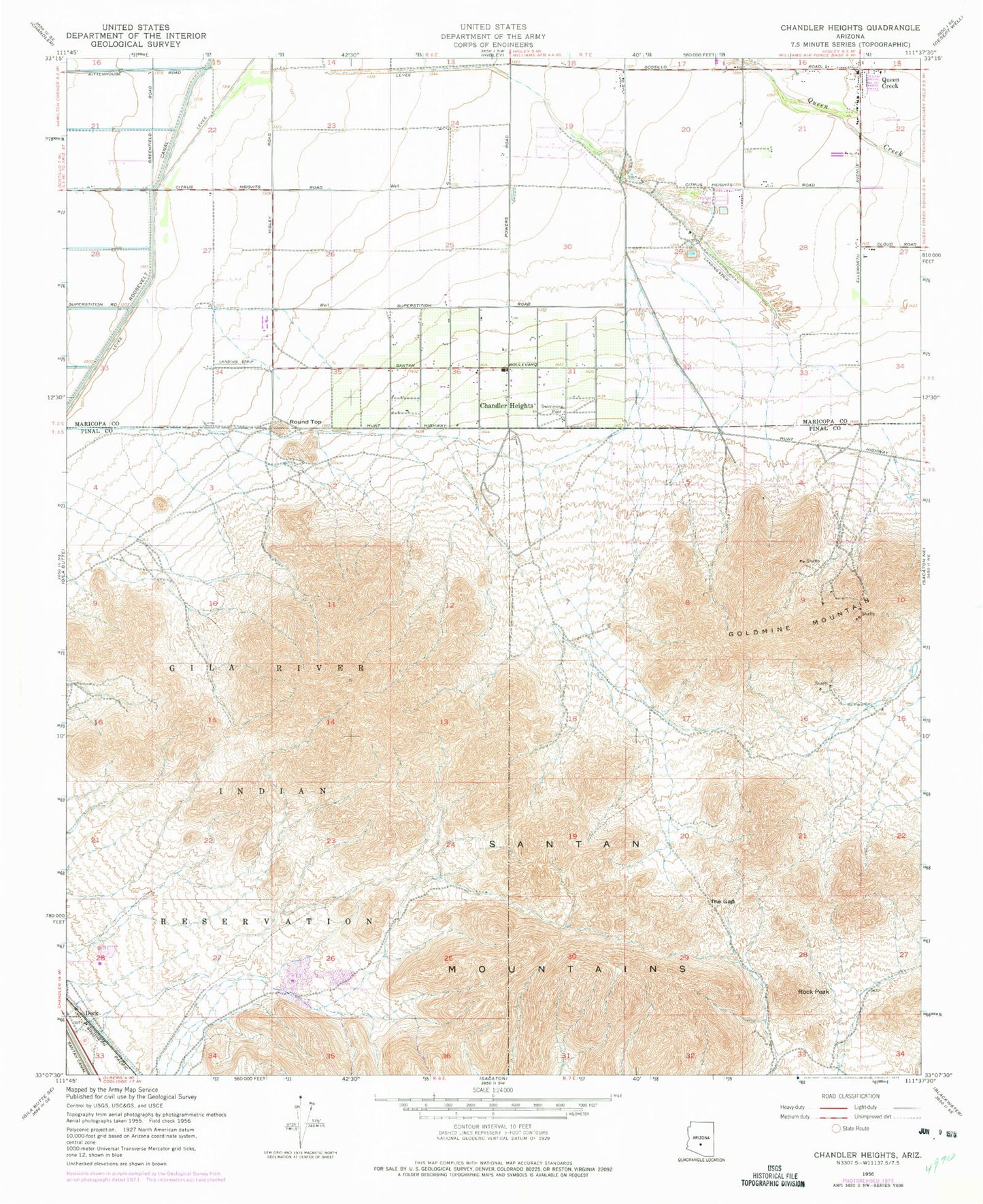
Classic USGS Chandler Heights Arizona 7.5'x7.5' Topo Map
Couldn't load pickup availability
Historical USGS topographic quad map of Chandler Heights in the state of Arizona. Typical map scale is 1:24,000, but may vary for certain years, if available. Print size: 24" x 27"
This quadrangle is in the following counties: Maricopa, Pinal.
The map contains contour lines, roads, rivers, towns, and lakes. Printed on high-quality waterproof paper with UV fade-resistant inks, and shipped rolled.
Contains the following named places: Chandler Heights, Dock, Goldmine Mountain, Queen Creek, Queen Creek Elementary School, Rock Peak, Round Top, Santan Canal, Santan Mountains, The Gap, Chandler Heights School, Rittenhouse Substation, Dock Railroad Station, Malpais Hills, Santan Mountain, Sanokai Village, Queen Creek Post Office, San Tan Mountain Regional Park, Patriot Academy, Desert Mountain Elementary School, Chandler Traditional Academy - Freedom Campus, Charlotte Upham Patterson Elementary School, Payne Junior High School, Riggs Elementary School, Newell Barney Junior High School, Queen Creek Town Hall, Queen Creek Community Center, Seville Golf and Country Club, Calvary Chapel of Queen Creek, Desert Mountain Bible Fellowship, Family of Faith Fellowship, The Church of Jesus Christ of Latter Day Saints, The Church of Jesus Christ of Latter Day Saints, Our Lady of Guadalupe Catholic Church, The Church of Jesus Christ of Latter Day Saints, The Church of Jesus Christ of Latter Day Saints, Queen Creek Fire Department Station 411, Gilbert Fire Department Station 11, Queen Creek Fire Department Station 412, Maricopa County Sheriff's Office District 6