MyTopo
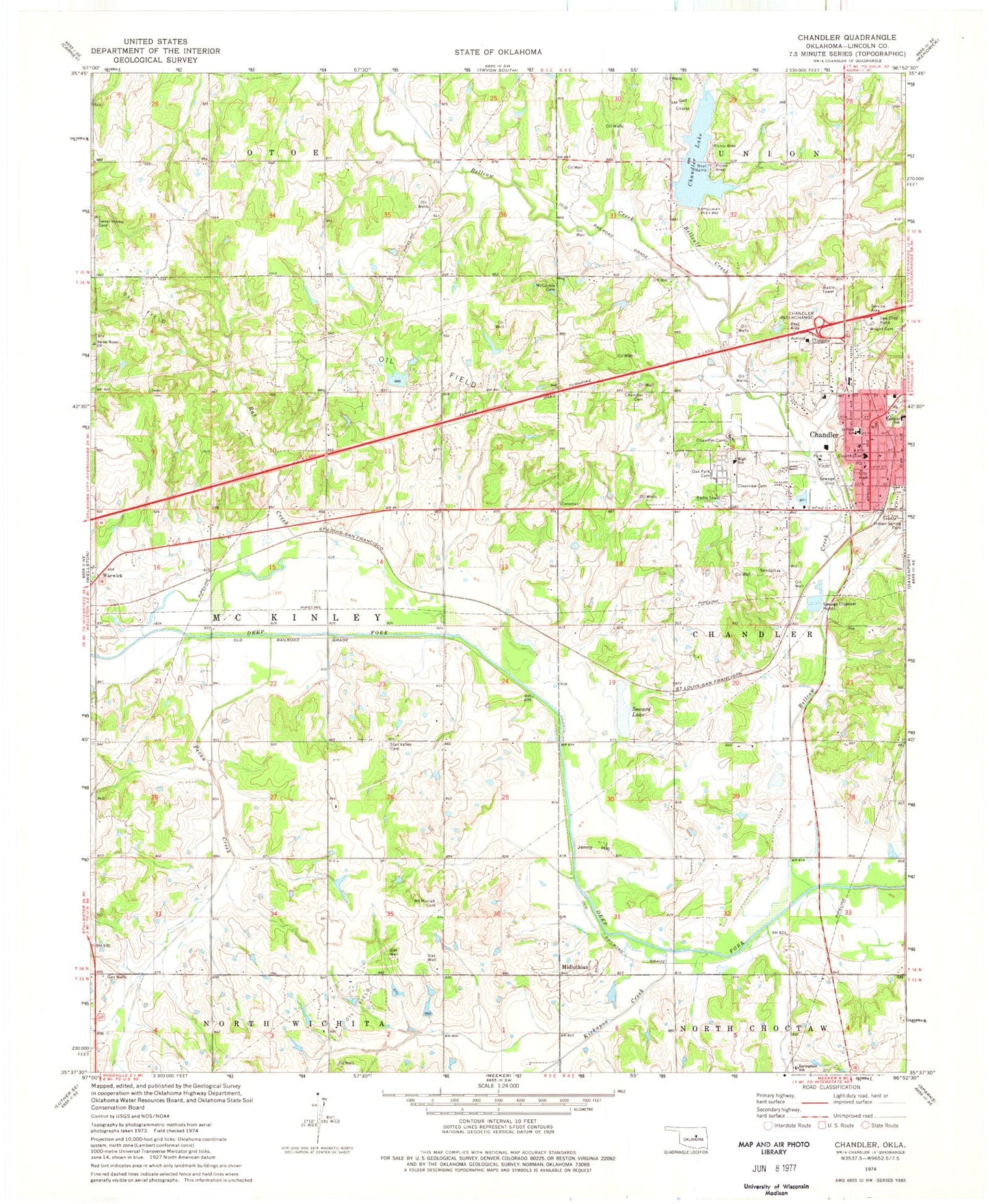
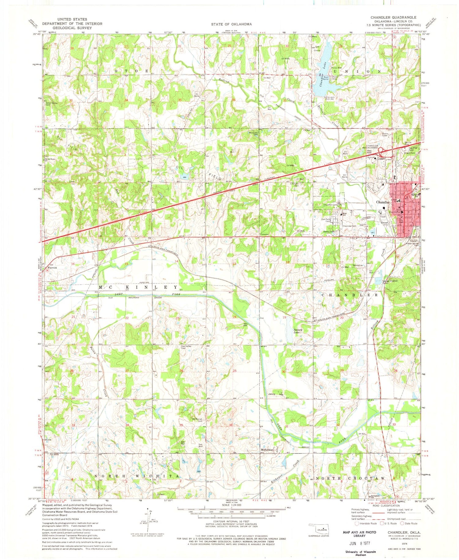
Classic USGS Chandler Oklahoma 7.5'x7.5' Topo Map
Couldn't load pickup availability
Historical USGS topographic quad map of Chandler in the state of Oklahoma. Map scale may vary for some years, but is generally around 1:24,000. Print size is approximately 24" x 27"
This quadrangle is in the following counties: Lincoln.
The map contains contour lines, roads, rivers, towns, and lakes. Printed on high-quality waterproof paper with UV fade-resistant inks, and shipped rolled.
Contains the following named places: Bell Cow Lake, Bellcalf Creek, Bellcow Creek, Chandler, Chandler Ambulance, Chandler Camp, Chandler Dam, Chandler Fire Department Station 1, Chandler High School, Chandler Junior High School, Chandler Lake, Chandler Police Department, Chandler Post Office, City of Chandler, Clearview Cemetery, East Side Elementary School, First Baptist Church, First Church-Christ Scientist, Indian Spring Park, Jenny Hill, Kickapoo Creek, Lincoln County, Lincoln County Jail, Lincoln County Sheriff, McCorkle Cemetery, Midlothian, Mount Moriah Cemetery, Oak Park Cemetery, Oknoname 08104 Dam, Oknoname 08104 Reservoir, Oknoname 111001 Dam, Oknoname 111001 Reservoir, Otoe Creek, Our Lady of Sorrows Catholic Cemetery, Park Road Elementary School, Pecan Creek, Rat Creek, Soward Lake, Springdale School, Star Valley Cemetery, Sweet Home Cemetery, Sweet Home Church, Township of Chandler, Township of McKinley, United Methodist Church, Wright Cemetery, ZIP Code: 74834