MyTopo
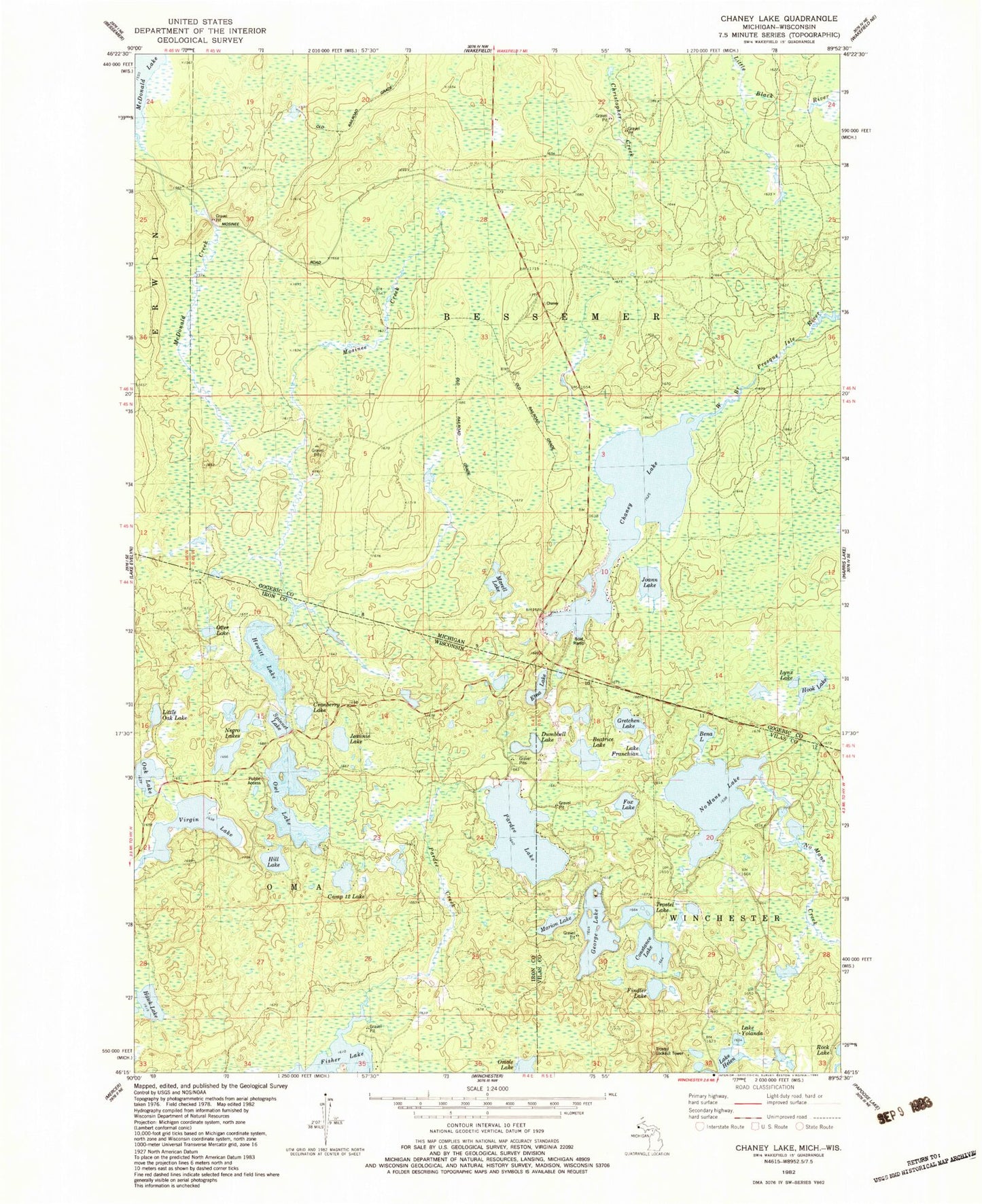
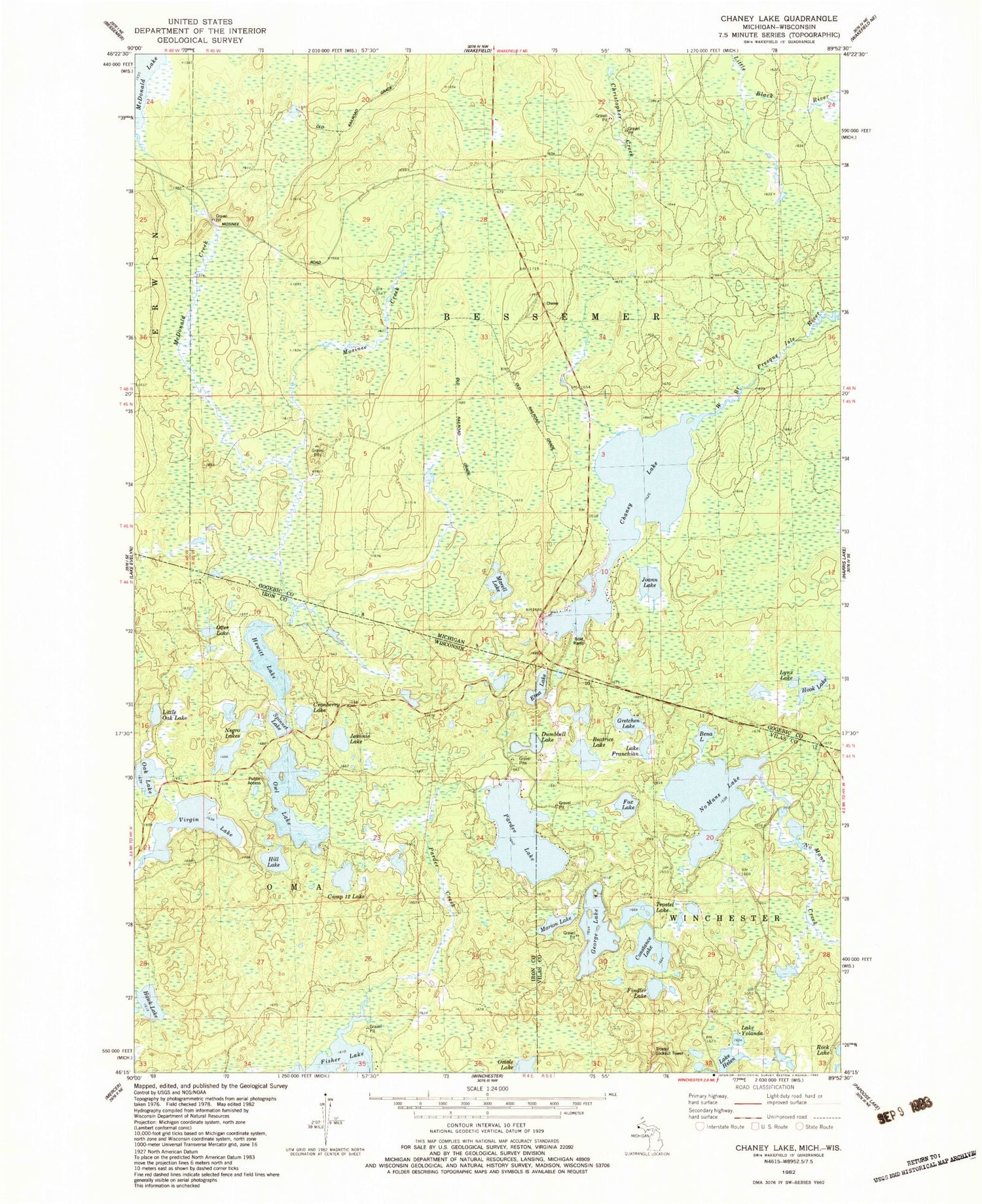
Classic USGS Chaney Lake Michigan 7.5'x7.5' Topo Map
Couldn't load pickup availability
Historical USGS topographic quad map of Chaney Lake in the states of Michigan, Wisconsin. Typical map scale is 1:24,000, but may vary for certain years, if available. Print size: 24" x 27"
This quadrangle is in the following counties: Gogebic, Iron, Vilas.
The map contains contour lines, roads, rivers, towns, and lakes. Printed on high-quality waterproof paper with UV fade-resistant inks, and shipped rolled.
Contains the following named places: Chaney Lake, Hook Lake, Joann Lake, Lynx Lake, Marell Lake, Mosinee Creek, Christopher Creek, Beatrice Lake, Bena Lake, Camp Twelve Lake, Constance Lake, Cranberry Lake, Etna Lake, Findler Lake, Fox Lake, Lake Franchian, George Lake, Gretchen Lake, Hawk Lake, Lake Helen, Hewitt Lake, Hill Lake, Jeannie Lake, Little Oak Lake, Marion Lake, Negro Lakes, No Mans Lake, Oak Lake, Otter Lake, Owl Lake, Pardee Creek, Pardee Lake, Spinnet Lake, Trostel Lake, Virgin Lake, Lake Yolanda, No Mans Creek, Troste Lookout Tower, McFadyen Dam, Dumbell Lake, Mary Lake, Mary Lake State Natural Area, Lake Rose, Swamp Lake, Woods Lake