
MyTopo
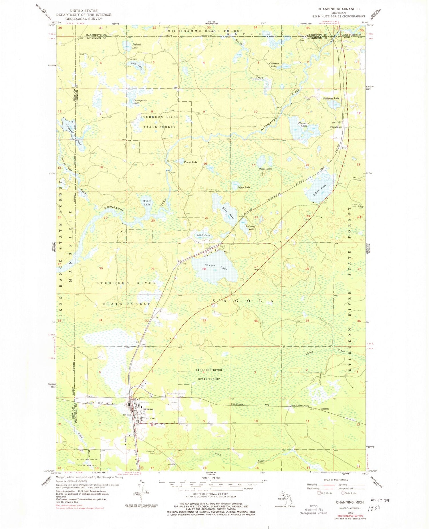
Classic USGS Channing Michigan 7.5'x7.5' Topo Map
Couldn't load pickup availability
Historical USGS topographic quad map of Channing in the state of Michigan. Typical map scale is 1:24,000, but may vary for certain years, if available. Print size: 24" x 27"
This quadrangle is in the following counties: Dickinson, Iron, Marquette.
The map contains contour lines, roads, rivers, towns, and lakes. Printed on high-quality waterproof paper with UV fade-resistant inks, and shipped rolled.
Contains the following named places: Michigamme State Forest, Cameron Lake, Camp Floodwood, Cassagranda Lake, Channing, Channing Cemetery, Coy Lake, Crescent Pond, Crescent Pond Outlet, Doan Lakes, Edey Lake, Edgar Lake, Floodwood Lakes, Long Lake, Parlemee Lake, Pickerel Lake, Railroad Lake, Round Lake, Sawyer Lake, Silver Lake, Squaw Creek, Weber Lake, Floodwood, Golden, Silver Lake Lookout Tower, Lake Charles, Floodwood Station, Floodwood Post Office (historical), North Dickinson Branch Library, North Dickinson School, Saint Rose Church, Channing Post Office, Channing Station, Sagola Township Volunteer Fire Department, Sagola Township Area Rescue Volunteer Ambulance Service


