MyTopo
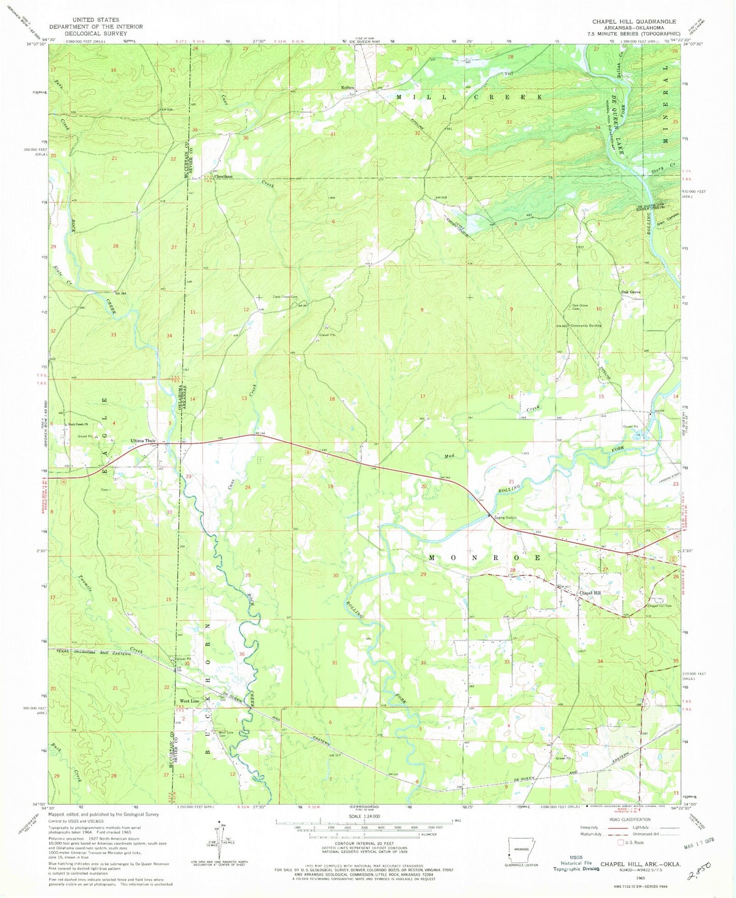
Classic USGS Chapel Hill Arkansas 7.5'x7.5' Topo Map
Couldn't load pickup availability
Historical USGS topographic quad map of Chapel Hill in the states of Arkansas, Oklahoma. Map scale may vary for some years, but is generally around 1:24,000. Print size is approximately 24" x 27"
This quadrangle is in the following counties: McCurtain, Sevier.
The map contains contour lines, roads, rivers, towns, and lakes. Printed on high-quality waterproof paper with UV fade-resistant inks, and shipped rolled.
Contains the following named places: Antrey, Bellah Creek, Buck Creek Church, Cane Creek, Cane Creek Cemetery, Cane Creek School, Chapel Hill, Chapel Hill Cemetery, Chapel Hill Church, Cheatham, Crooked Ridge School, De Queen Dam, De Queen Lake, Glen Canyon, Harris Mill Cemetery, J Lynn Helms Sevier County Airport, Johnson Bridge, Kellum, Kellum School, Morphew School, Mud Creek, Oak Grove, Oak Grove Cemetery, Pero Creek, Prairie Branch, Rock Creek, Slate Creek, Story Creek, Township of Monroe, Twomile Creek, Ultima Thule, Ultima Thule Cemetery, West Line, West Line Cemetery