MyTopo
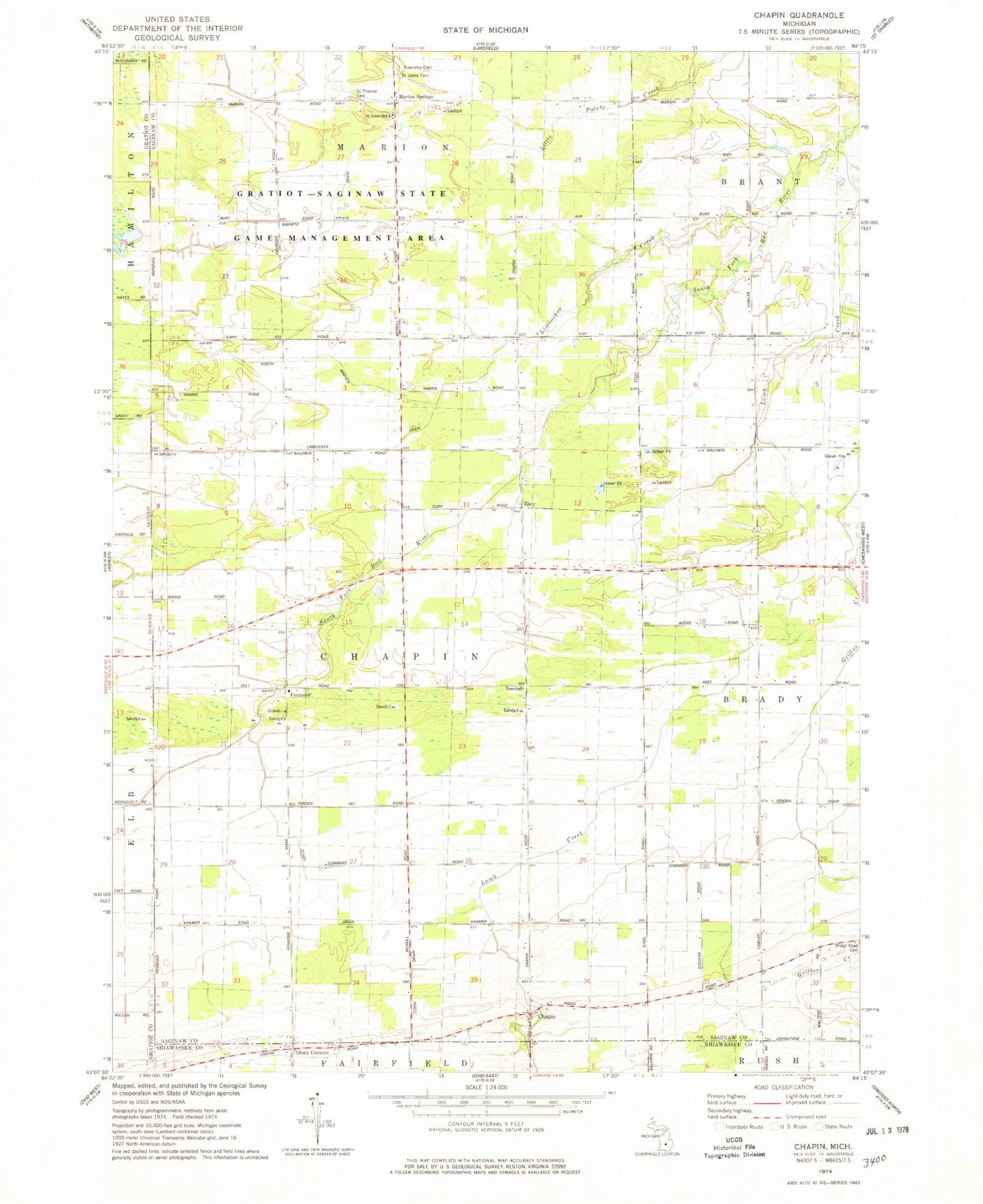
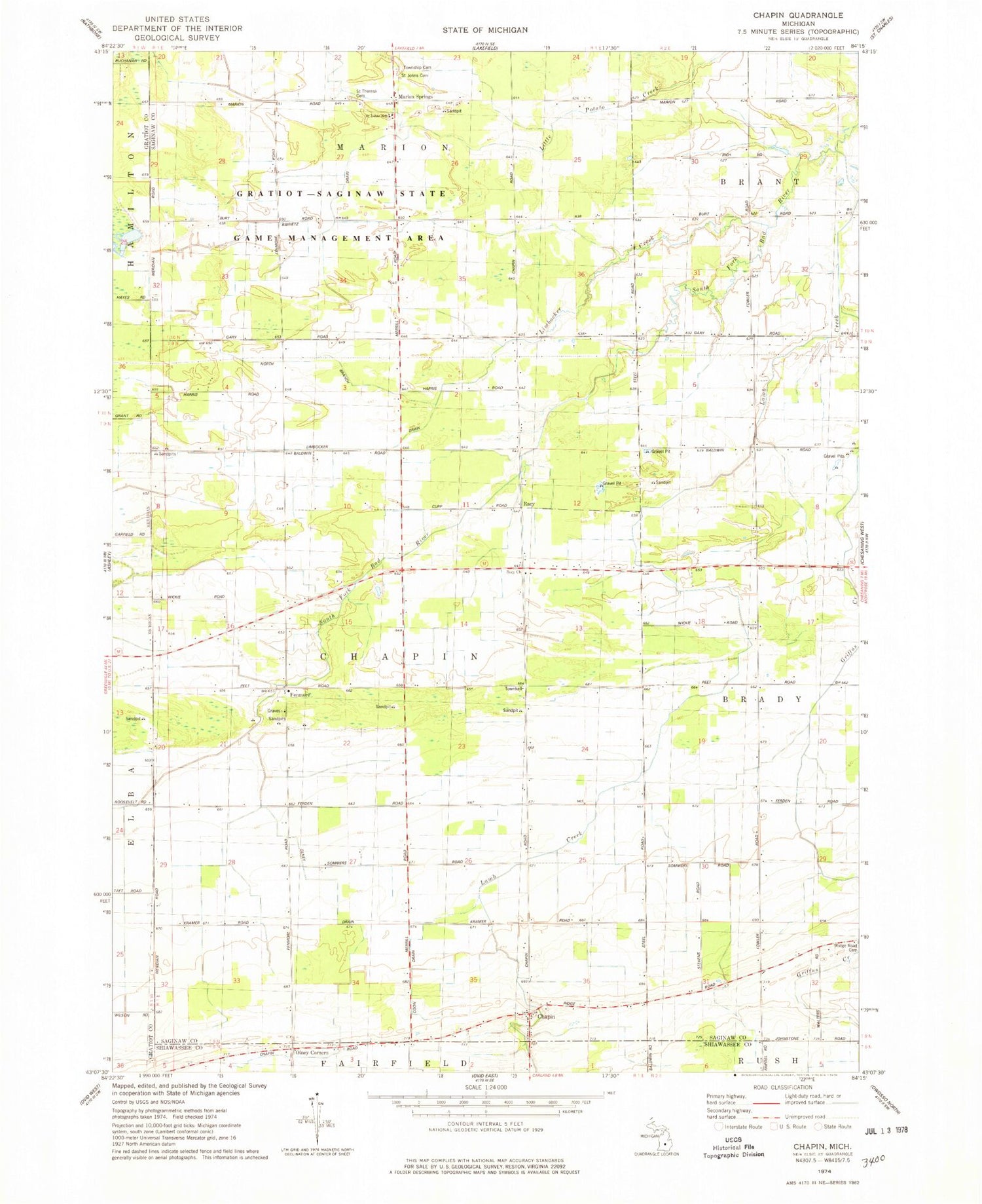
Classic USGS Chapin Michigan 7.5'x7.5' Topo Map
Couldn't load pickup availability
Historical USGS topographic quad map of Chapin in the state of Michigan. Map scale may vary for some years, but is generally around 1:24,000. Print size is approximately 24" x 27"
This quadrangle is in the following counties: Gratiot, Saginaw, Shiawassee.
The map contains contour lines, roads, rivers, towns, and lakes. Printed on high-quality waterproof paper with UV fade-resistant inks, and shipped rolled.
Contains the following named places: Amman Farm, Bibrietz Drain, Chapin, Chapin Post Office, Chapin United Methodist Church, Coon Drain, Fenmore, Fenmore Post Office, Gratiot - Saginaw State Game Management Area, Griffus Creek, Lamb Creek, Limbocker Creek, Limbocker Drain, Marion Springs, Marion Springs Post Office, Marion Township Cemetery, North Branch Limbocker Drain, Olney Corners, Olney Drain, Racy, Racy Church, Racy Post Office, Saint Johns Cemetery, Saint John's Lutheran Church, Saint Johns School, Saint Theresa Cemetery, Township of Chapin