MyTopo
Classic USGS Chapman Draw Texas 7.5'x7.5' Topo Map
Regular price
$16.95
Regular price
Sale price
$16.95
Unit price
per
Couldn't load pickup availability
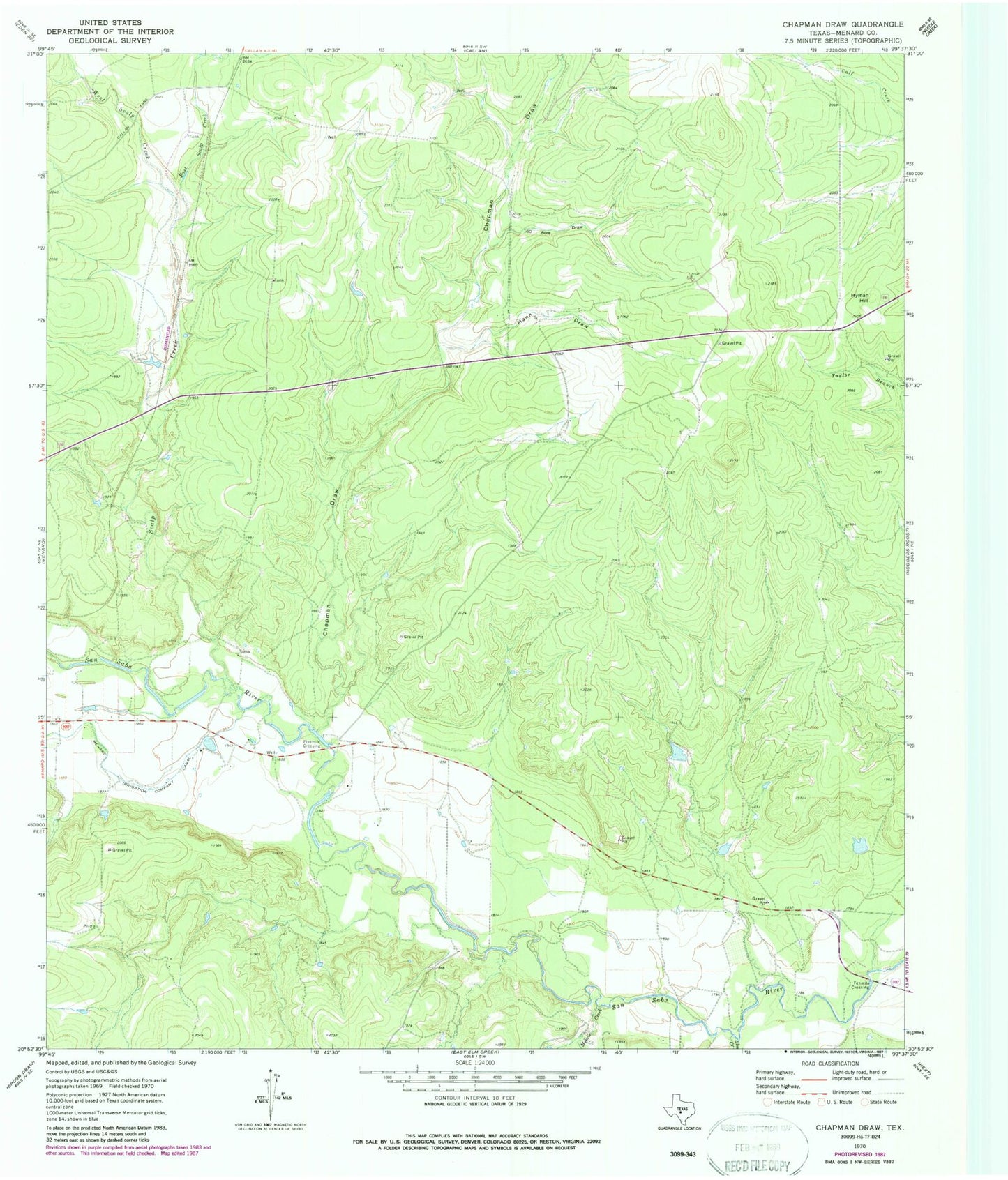
Historical USGS topographic quad map of Chapman Draw in the state of Texas. Map scale may vary for some years, but is generally around 1:24,000. Print size is approximately 24" x 27"
This quadrangle is in the following counties: Menard.
The map contains contour lines, roads, rivers, towns, and lakes. Printed on high-quality waterproof paper with UV fade-resistant inks, and shipped rolled.
Contains the following named places: Chapman Draw, East Scalp Creek, Elm Creek, Fivemile Crossing, Hyman Hill, M & M Land Company Airport, Mann Draw, Menard East Division, Menzie Creek, One Hundred Sixty Acre Draw, Scalp Creek, Tenmile Crossing, West Scalp Creek