MyTopo
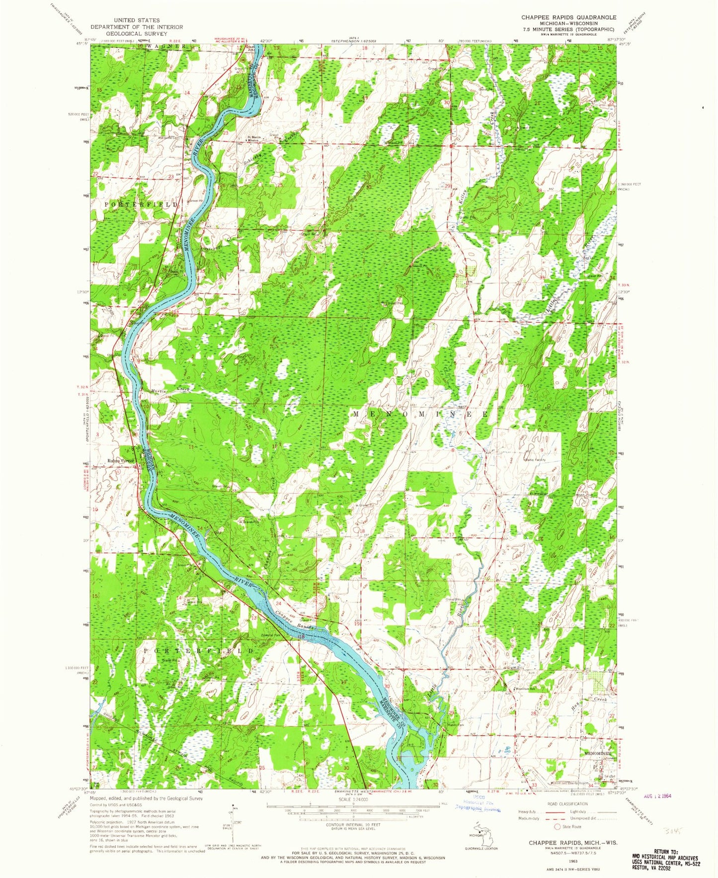
Classic USGS Chappee Rapids Michigan 7.5'x7.5' Topo Map
Couldn't load pickup availability
Historical USGS topographic quad map of Chappee Rapids in the states of Michigan, Wisconsin. Map scale may vary for some years, but is generally around 1:24,000. Print size is approximately 24" x 27"
This quadrangle is in the following counties: Marinette, Menominee.
The map contains contour lines, roads, rivers, towns, and lakes. Printed on high-quality waterproof paper with UV fade-resistant inks, and shipped rolled.
Contains the following named places: Chappee Creek, Chappee Rapids, Chappee Rapids Historical Marker, Hamilton School, Kelley Creek, Little River, Little River Post Office, Martin Creek, Mason Park, Menominee Regional Airport, Miles, Ostrango Creek, Redling School, Rubys Corner, Saint Marys Mission, Saint Mary's Mission Cemetery, Sobiesky Creek, Township of Menominee, Twin Creek, Twin Island Rapids, Winesville Cemetery, Wineville School, Ziemann Park