MyTopo
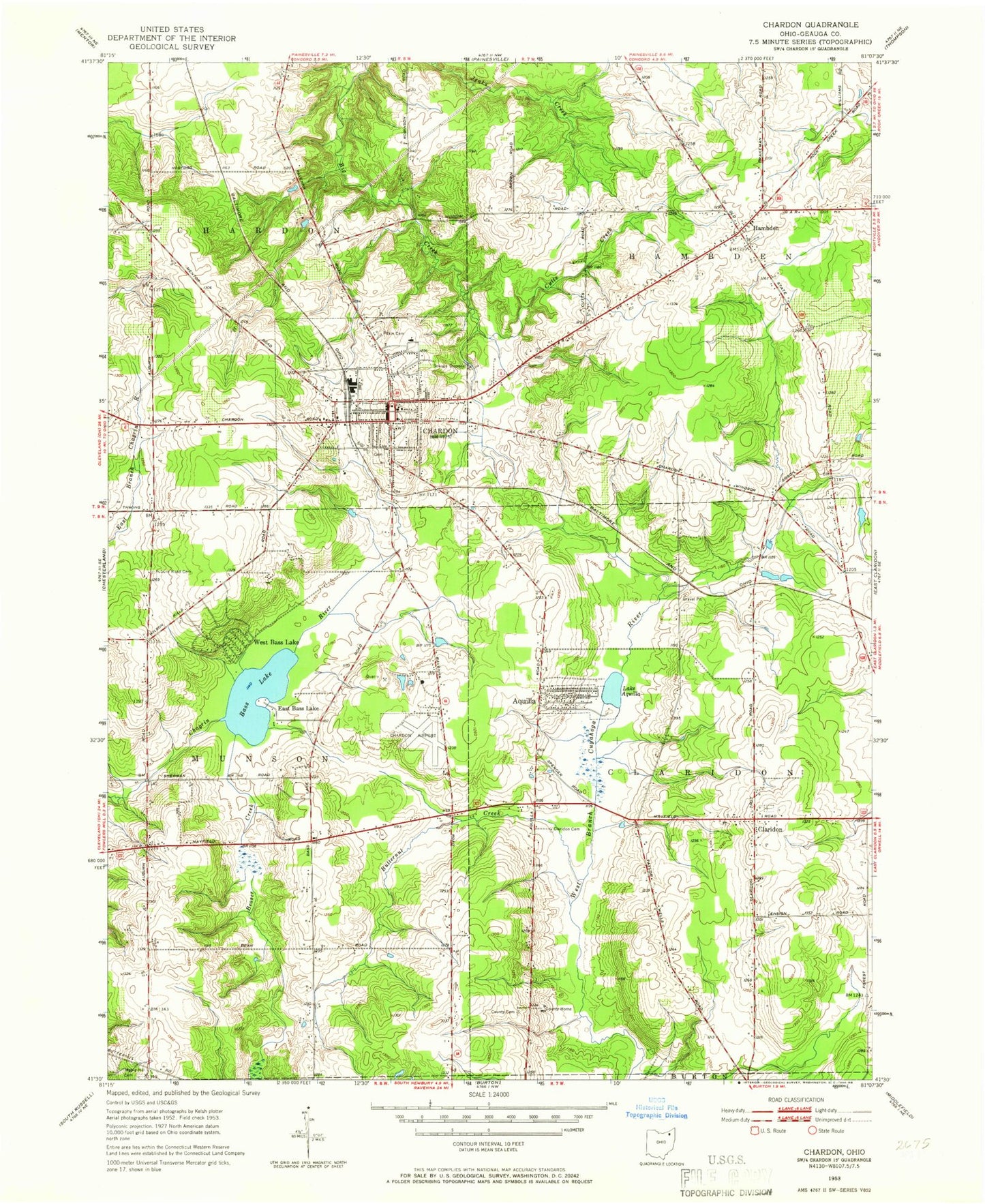
Classic USGS Chardon Ohio 7.5'x7.5' Topo Map
Couldn't load pickup availability
Historical USGS topographic quad map of Chardon in the state of Ohio. Map scale may vary for some years, but is generally around 1:24,000. Print size is approximately 24" x 27"
This quadrangle is in the following counties: Geauga.
The map contains contour lines, roads, rivers, towns, and lakes. Printed on high-quality waterproof paper with UV fade-resistant inks, and shipped rolled.
Contains the following named places: Aquilla, Aquilla Lake Wildlife Area, Aquilla Village Police Department, Ballards Hill, Bass Lake, Bass Lake Census Designated Place, Beaver Creek, Butternut Creek, Carroll Flats, Center Road, Chardon, Chardon Airfield, Chardon Centre, Chardon Courthouse Square Historic District, Chardon Fire Department, Chardon High School, Chardon Industrial Park, Chardon Middle School, Chardon Municipal Cemetery, Chardon Post Office, City of Chardon, Claridon, Claridon Cemetery, Claridon Center Cemetery, Claridon Congregational Church, Claridon Post Office, Claridon Revival Center, Clarks, County Home Cemetery, Cutts Creek, East Bass Lake, Geauga Cinema, Geauga County Courthouse, Geauga County Home, Geauga County Sheriff's Office, Grennan Mobile Village, Hambden, Hambden Elementary School, Hambden Fire Department, Hambden Township Cemetery, Hampden Post Office, Heather Hill Hospital, Jacques High Chapparal Mobile Home Park, Lake Aquilla, Leader's Mobile Home Park, Maple Elementary School, Maple Hill Cemetery, Maple Leaf Plaza Shopping Center, Mayfield Road Drive-In, Munson Fire Department, Munson Industrial Park, Ohio State Highway Patrol - Chardon Patrol Post, Parker Court Industrial Park, Peace Church, Pitkin Cemetery, Pleasant Hill Golf Course, Saint Lukes Church, Saint Marys School, Terrace Glenn Estates, Township of Chardon, Township of Claridon, Township of Hambden, Township of Munson, University Hospitals Geauga Medical Center, Village of Aquilla, WCDN-AM (Chardon), West Bass Lake, Wooddin Hill, ZIP Code: 44024