
MyTopo
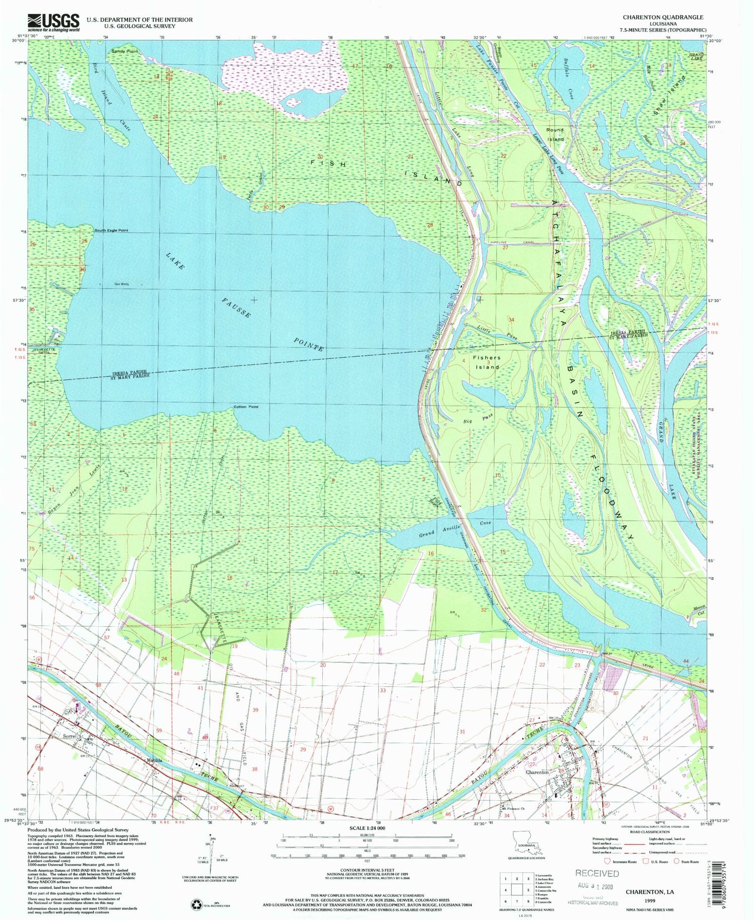
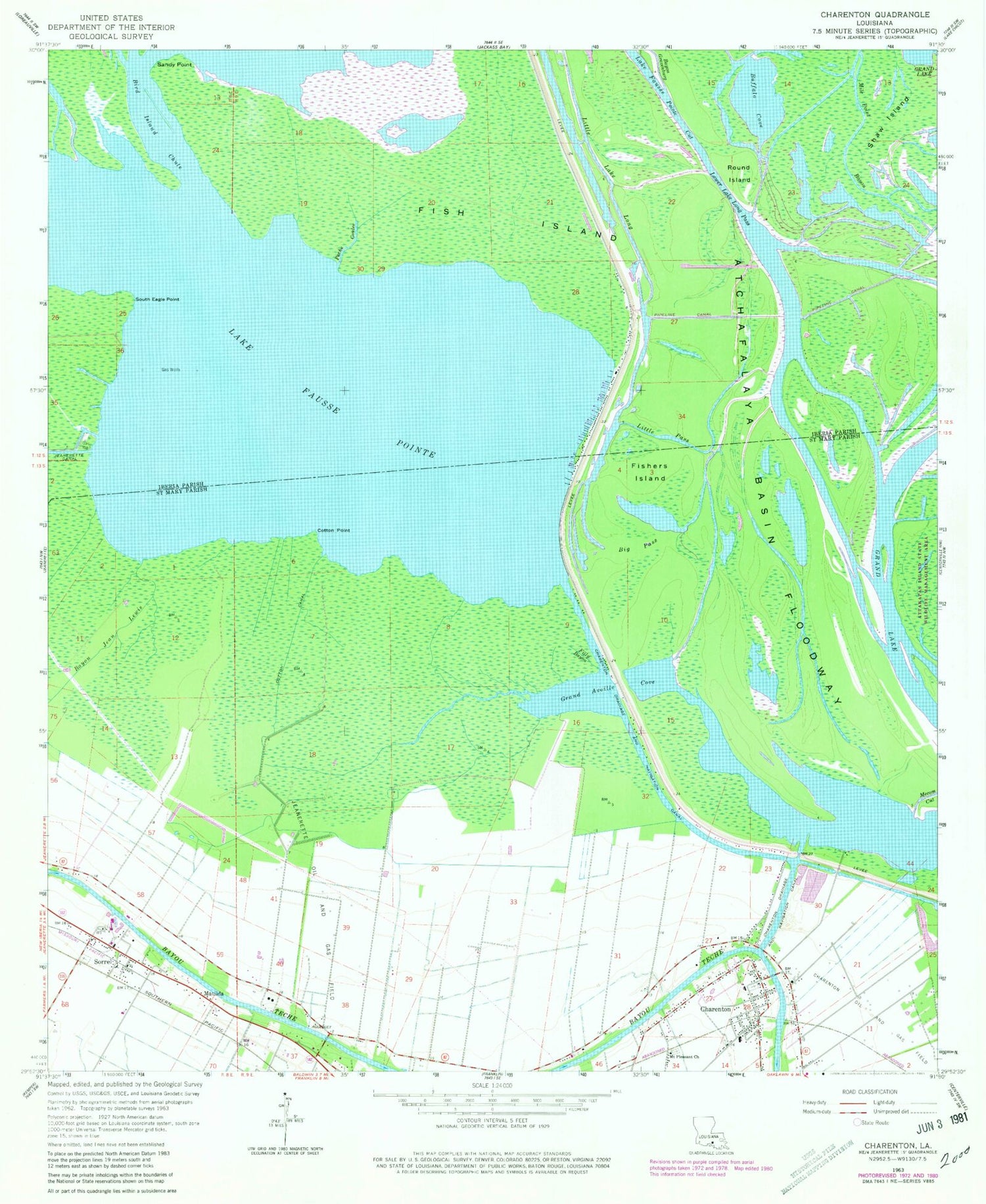
Classic USGS Charenton Louisiana 7.5'x7.5' Topo Map
Couldn't load pickup availability
Historical USGS topographic quad map of Charenton in the state of Louisiana. Map scale may vary for some years, but is generally around 1:24,000. Print size is approximately 24" x 27"
This quadrangle is in the following counties: Iberia, St. Mary.
The map contains contour lines, roads, rivers, towns, and lakes. Printed on high-quality waterproof paper with UV fade-resistant inks, and shipped rolled.
Contains the following named places: Bayou Gravenburg, Bayou Jean Lewis, Big Pass, Bird Island Chute, Buffalo Cove, Charenton, Charenton - Chitimacha Volunteer Fire Department, Charenton Bridge, Charenton Drainage and Navigation Canal, Charenton Post Office, Chitimacha Air Park, Chitimacha Reservation, Chitimacha Tribal Police Department, Chitimacha Tribal School, Cotton Canal, Cotton Point, Cypremort Post Office, Filly Bayou, Fish Island, Fishers Island, Grand Avoille Cove, Immaculate Conception Church, Indian Bend, Jeanerette Oil and Gas Field, Lake Fausse Pointe, Little Lake Long, Little Pass, Little Pass Baptist Church, Lower Lake Long Pass, Mary Hines Elementary School, Matilda, Mile Point Bayou, Mount Pleasant Church, Netpinunsh, Peche Coulee, Round Island, Saint Mary Parish Volunteer Fire Department Sorrel Community Sub Station 2, Saint Matthews Baptist Church, Saint Moses Baptist Church, Sandy Point, Shaw Island, Skerrett Point, Sorrel, Sorrel Census Designated Place, South Eagle Pointe, Victory Tabernacle, Ward One, West Fork Chicot Pass


