MyTopo
Classic USGS Charles Michigan 7.5'x7.5' Topo Map
Regular price
$16.95
Regular price
Sale price
$16.95
Unit price
per
Couldn't load pickup availability
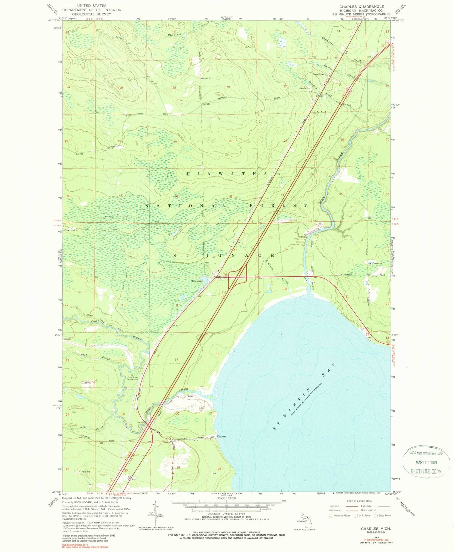
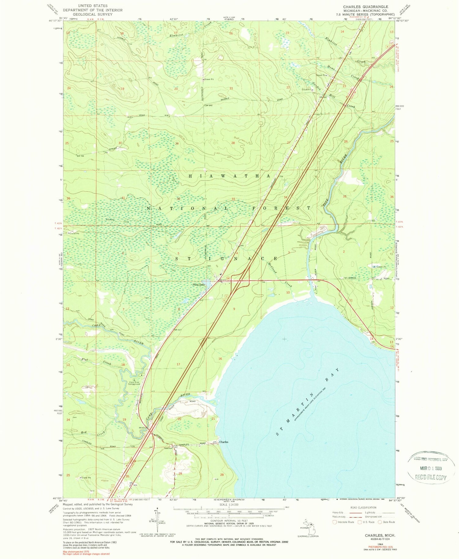
Historical USGS topographic quad map of Charles in the state of Michigan. Map scale may vary for some years, but is generally around 1:24,000. Print size is approximately 24" x 27"
This quadrangle is in the following counties: Mackinac.
The map contains contour lines, roads, rivers, towns, and lakes. Printed on high-quality waterproof paper with UV fade-resistant inks, and shipped rolled.
Contains the following named places: Carp River, Carp River Campground, Charles, Charles Post Office, Flat Creek, Garden Hill Creek, Kingdom Hall of Jehovah's Witnesses, McCloud Creek, Pine River, Platz Lake, Red Creek, Township of Saint Ignace