MyTopo
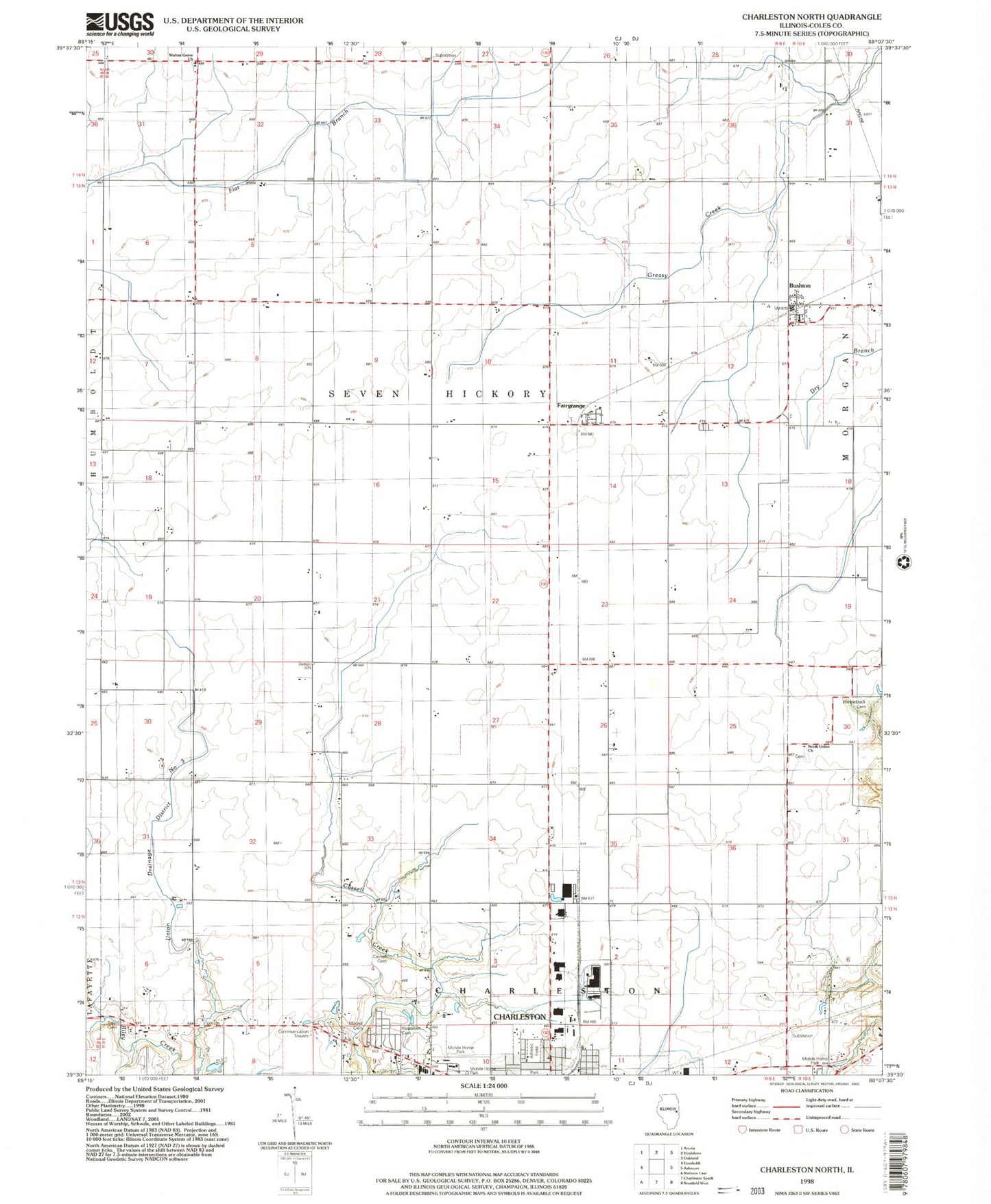
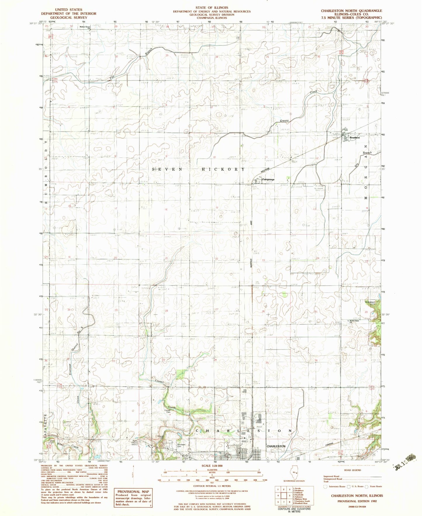
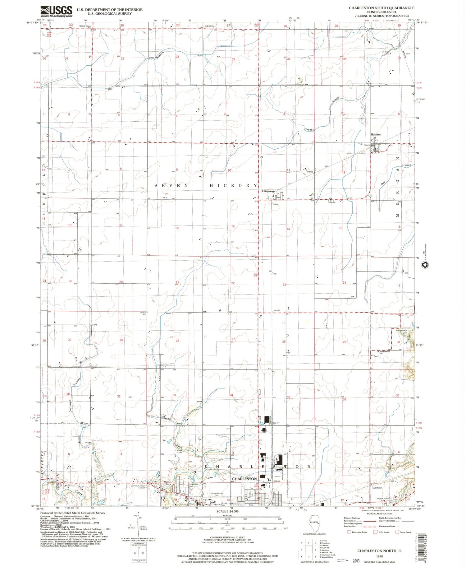
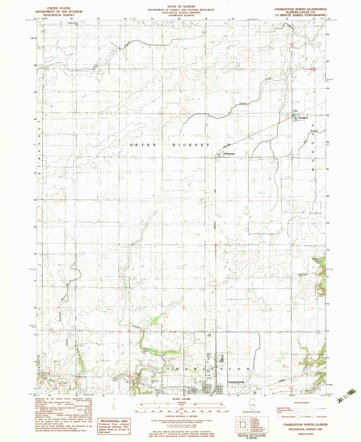
Classic USGS Charleston North Illinois 7.5'x7.5' Topo Map
Couldn't load pickup availability
Historical USGS topographic quad map of Charleston North in the state of Illinois. Map scale may vary for some years, but is generally around 1:24,000. Print size is approximately 24" x 27"
This quadrangle is in the following counties: Coles.
The map contains contour lines, roads, rivers, towns, and lakes. Printed on high-quality waterproof paper with UV fade-resistant inks, and shipped rolled.
Contains the following named places: Bunker Hill School, Bushton, Bushton Post Office, Center School, Charleston Post Office, Coles County, Contrary School, Cossel Cemetery, Craig Cemetery, Dice School, Fairgrange, First Apostolic Church, Glassco School, Grant School, Marshall School, Martin Box School, Mound Cemetery, Mullen School, North Union Church, O'Hara School, Old Salem Church, Roselawn Cemetery, Salem Cemetery, Seven Hickory - Morgan Fire Protection District, Seven Hickory School, Township of Seven Hickory, Union Drainage District Number 3, Walnut Grove Church, Walnut Grove School, WEIC-AM (Charleston), WEIC-FM (Charleston), Winkleblack Cemetery, Winkleblack School, ZIP Code: 61920