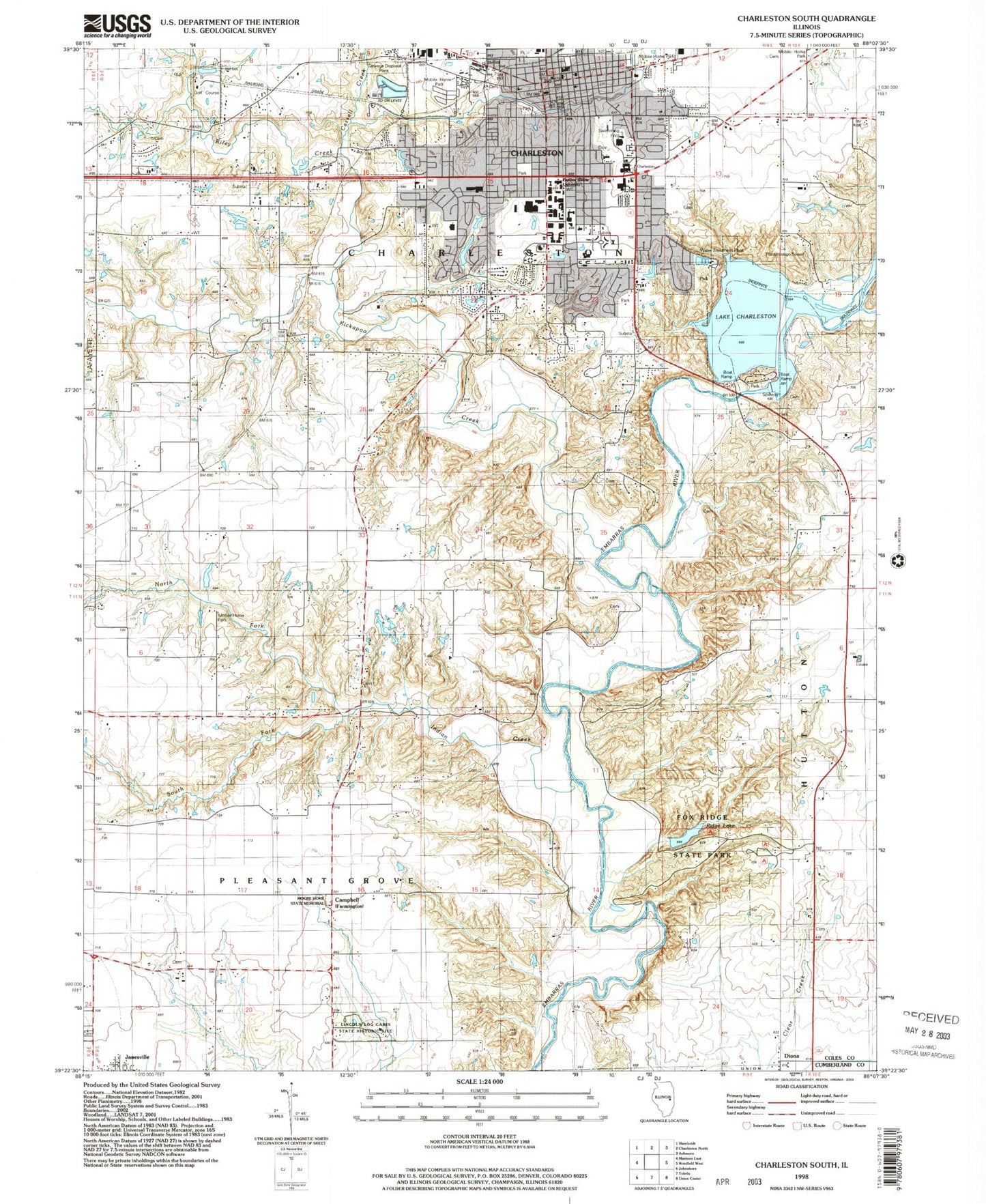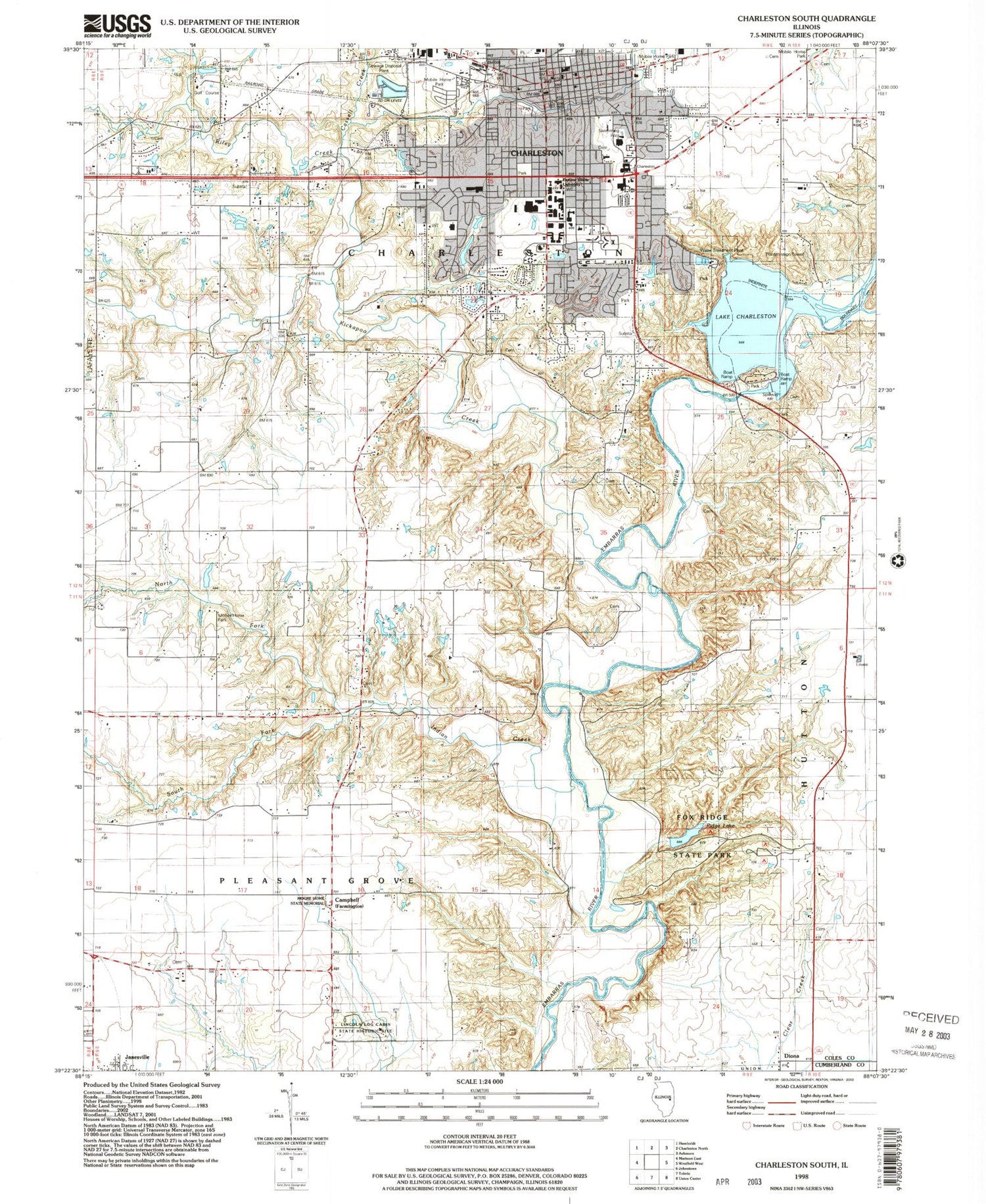
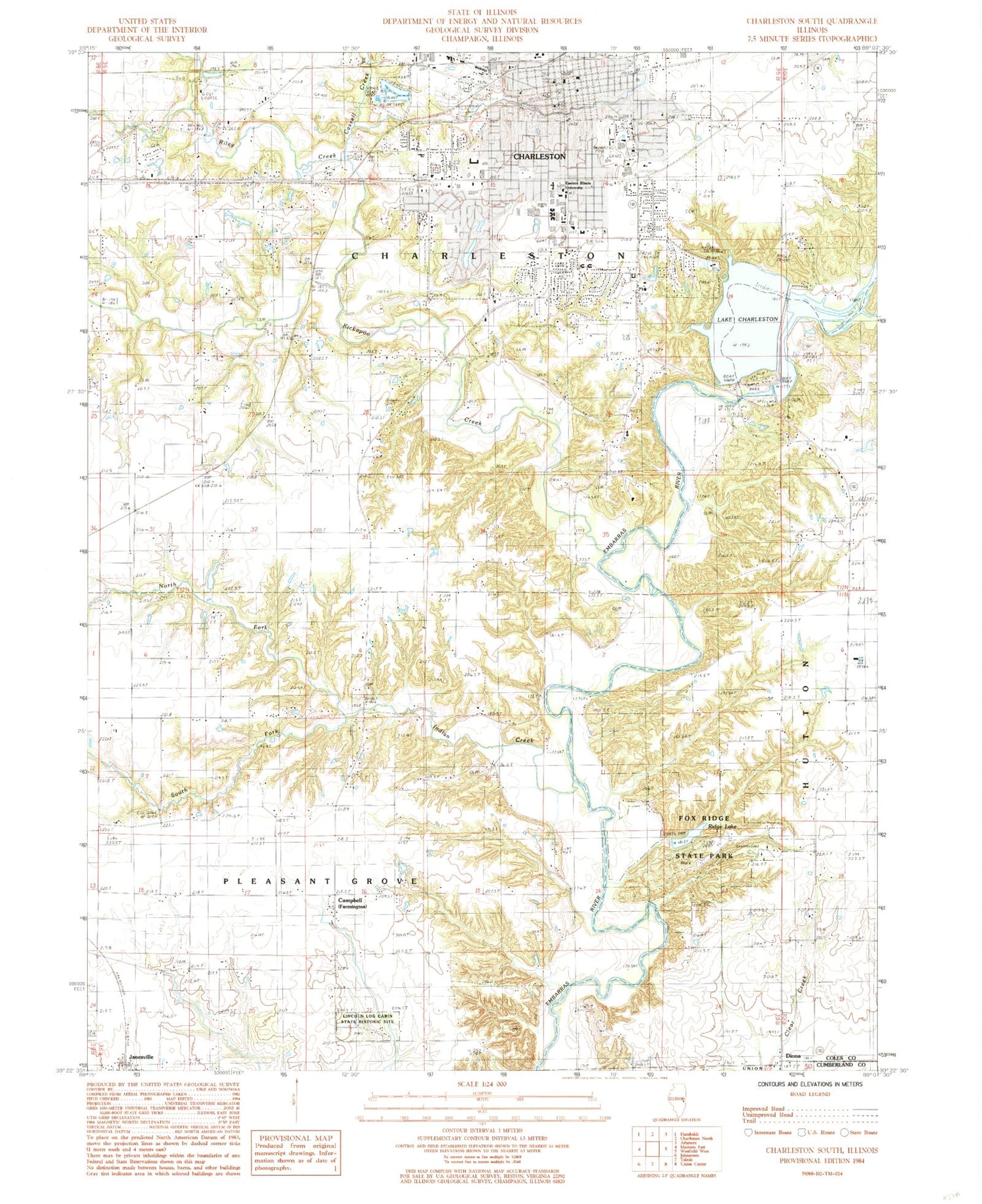
MyTopo
Classic USGS Charleston South Illinois 7.5'x7.5' Topo Map
Couldn't load pickup availability
Historical USGS topographic quad map of Charleston South in the state of Illinois. Typical map scale is 1:24,000, but may vary for certain years, if available. Print size: 24" x 27"
This quadrangle is in the following counties: Coles, Cumberland.
The map contains contour lines, roads, rivers, towns, and lakes. Printed on high-quality waterproof paper with UV fade-resistant inks, and shipped rolled.
Contains the following named places: Bails School (historical), Balch School (historical), Cassell Creek, Charleston, Clear Springs School (historical), Coffeeville Church, Doty School (historical), Campbell, Finch School (historical), Fowler School (historical), Fox Ridge, Hanley School (historical), Indian Creek, Kickapoo Creek, Leitch School (historical), Lincoln Church, Lincoln Log Cabin State Historic Site, Mount Tabor Church, Mount Zion Church, Mount Zion School (historical), North Fork Indian Creek, Oakridge School (historical), Riley Creek, Riverview Dam, Rogers School (historical), South Fork Indian Creek, Unity Chapel, Whetstone Creek, Diona, Halls Ford, Hanley Ford, Walker Ford, Charleston Country Club, WEIU-FM (Charleston), WEIU-TV (Charleston), Township of Charleston, Riverview Dam, Lake Charleston, Fox Ridge Lake Dam, Glenwood Lake Dam, Glenwood Lake, Crabill Pond Dam, Crabill Pond, Eastern Illinois University, Fox Ridge State Park, Ridge Lake, Blakemans Ford, Carl Sandburg Elementary School, Charleston High School, Charleston Junior High School, Goosenest Prairie, Jefferson Elementary School, Lincoln Elementary School, Mark Twain Elementary School, Moore Home Historic Site, Shiloh Cemetery, Andrews Hall, Booth House, Brainard House, Burl Ives Art Studio Hall, Buzzard House, Charles H Coleman Hall, Charles P Lantz Health Physical Education and Recreation Building, Florence McAfee Gymnasium, Ford Hall, Francis G Blair Hall, Greenwood School, Gregg Hall, Lawson Hall, Lincoln-Stevenson-Douglas Halls, Linder House, Livingston C Lord Administration Building, Lumpkin Hall, Martin Luther King Junior University Union, Mary J Booth Library, McKinney Hall, O'Brien Field, Pemberton Hall, Phipps Lecture Hall, Quincy V Doudna Fine Arts Center, Roberts G Buzzard Building, Tarble Arts Center, Taylor Hall, Thomas Hall, Thut Greenhouse, Walter Klehm Hall, Weller Hall, Adkins Cemetery, Fudge Cemetery, Huckaba Cemetery, Hurricane Cemetery, Janesville Cemetery, Kelley Cemetery, Kickapoo Cemetery, Leitch Cemetery, Lumbrick Cemetery, McKenzie Cemetery, Mount Tabor Cemetery, New Kelly Cemetery, Old City Cemetery, Stoner Cemetery, Unity Cemetery, Yocom Cemetery, Chambers Cemetery, Charleston Public Library, Coles County Courthouse, Coles County Jail, First Baptist Church, First Christian Church, First Church of Christ Scientist, First Church of God (historical), First Methodist Church, First Presbyterian Church, First United Brethren Church, Franklin Public School (historical), Immanuel Lutheran Church, M A Montgomery Memorial Sanitarium, Pilgrim Holiness Christian Church, Saint Charles Borromeo Church, Washington Public School (historical), Calvary Baptist Church, Central Christian Church, Church of God, First Church of God, Otterbein United Methodist Church, Praise Assembly of God Church, City of Charleston, Charleston Wastewater Treatment Plant, Charleston Fire Chief, Charleston Fire Department Station 2, Lincoln Fire Protection District Station 1, Coles County Sheriff's Office, Janesville Census Designated Place