
MyTopo
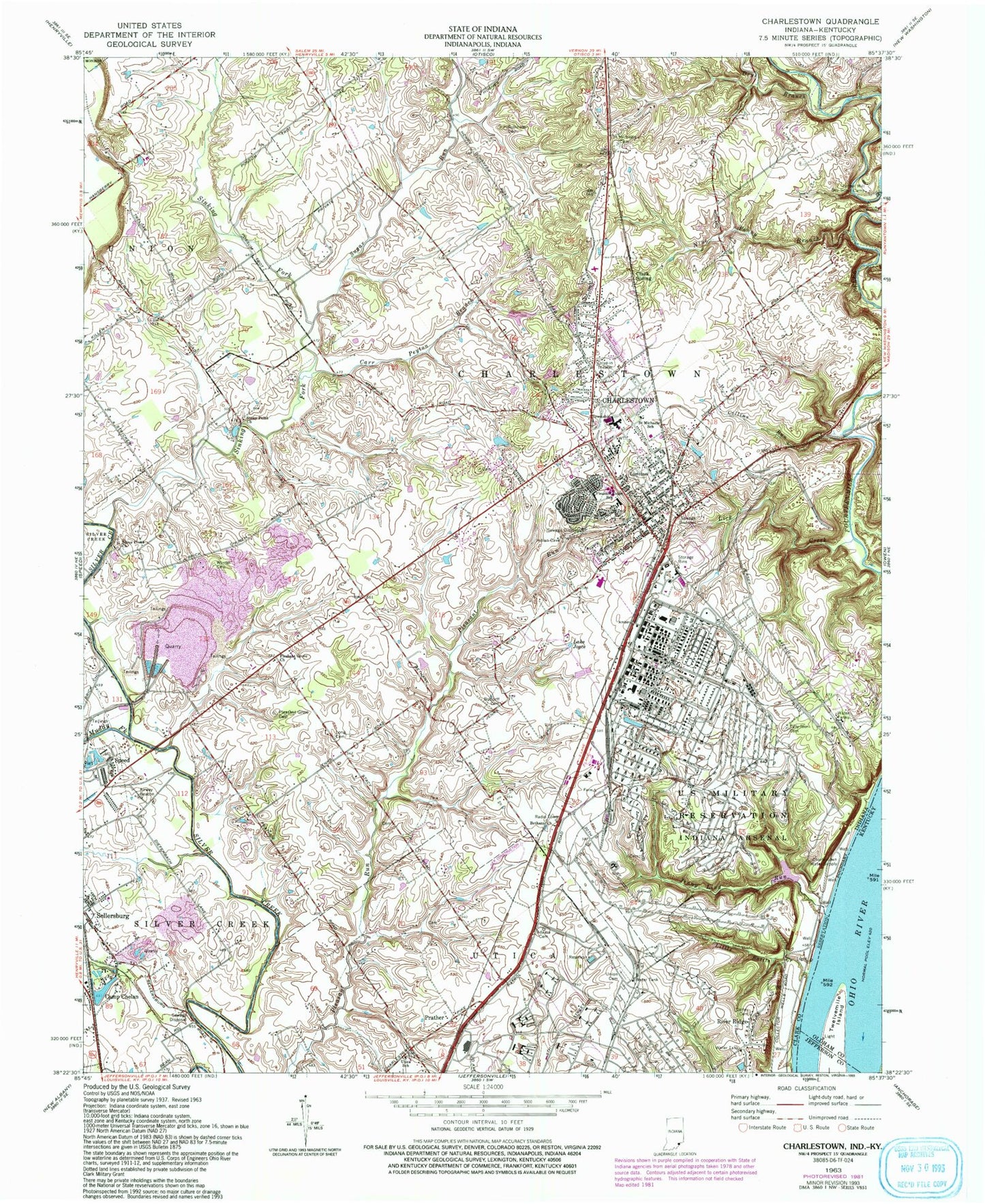
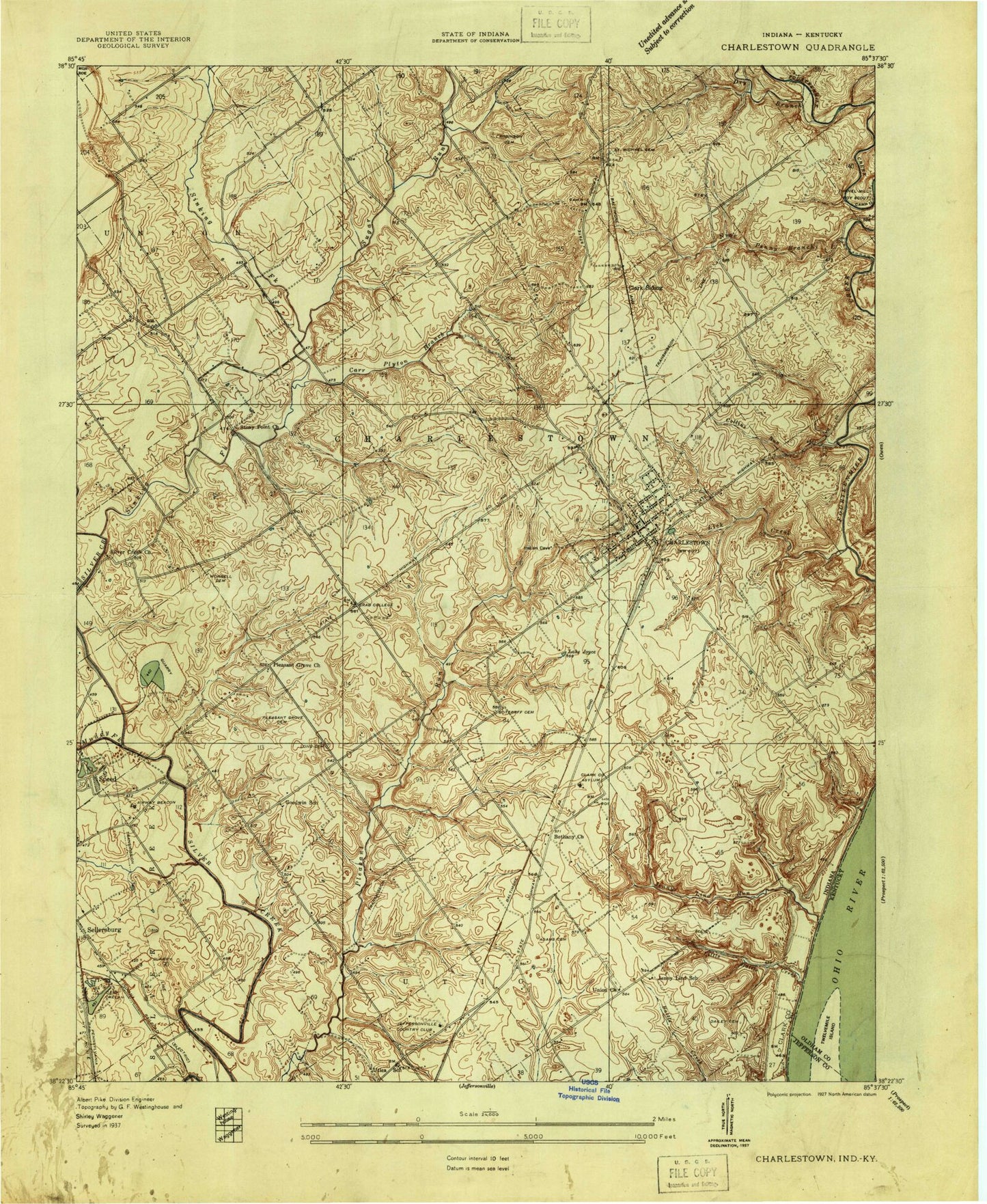
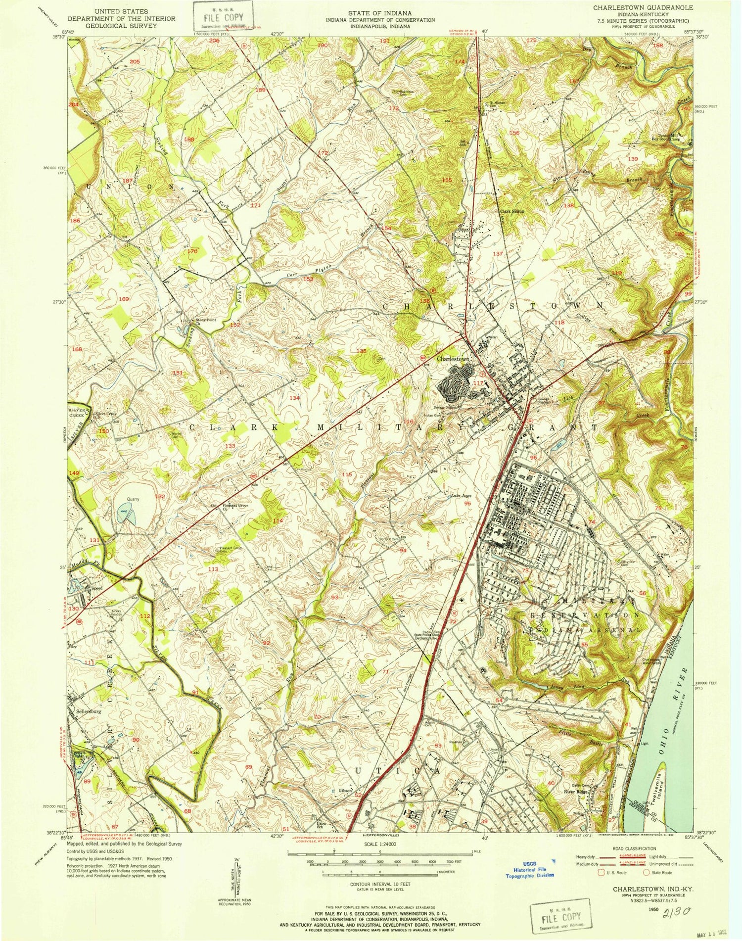
Classic USGS Charlestown Indiana 7.5'x7.5' Topo Map
Couldn't load pickup availability
Historical USGS topographic quad map of Charlestown in the states of Indiana, Kentucky. Typical map scale is 1:24,000, but may vary for certain years, if available. Print size: 24" x 27"
This quadrangle is in the following counties: Clark, Jefferson, Oldham.
The map contains contour lines, roads, rivers, towns, and lakes. Printed on high-quality waterproof paper with UV fade-resistant inks, and shipped rolled.
Contains the following named places: Barnett Cemetery, Bethany Church, Bottorff Cemetery, Camp Chelan, Camp Run, Carr Peyton Branch, Charlestown, Clark Siding, Collins Run, Friends Cemetery, Dry Branch, Baird Cemetery, Jenny Lind Run, Lake Joyce, Lick Creek, Little Battle Creek, Long Cemetery, Muddy Fork, Nine Penny Branch, Pleasant Grove Cemetery, Pleasant Grove Church, Pleasant Ridge Elementary School, Prather, River Ridge, Robinson Robertson Cemetery, Saint Michaels Cemetery, Saint Michael School, Silver Creek Church, Sinking Fork, Stony Point Church, Sugar Run, Tunnel Mill Boy Scout Camp, Union Cemetery, Utica School, Worrell Cemetery (historical), Charlestown Senior High School, Charlestown Landing, Jay C Shopping Center, Clark County, Sylvan Grove, Springville, Township of Charlestown, City of Charlestown, Saint Catherine Regional Hospital, Charlestown Post Office, Charlestown Volunteer Fire Department Station 91, Charlestown Volunteer Fire Department Station 93, Sellersburg Stone Quarry, Speed Quarry, Charlestown Police Department, Silver Creek Cemetery, Twelvemile Island, Barnett Cemetery, Bethany Church, Bottorff Cemetery, Camp Chelan, Camp Run, Carr Peyton Branch, Charlestown, Clark Siding, Collins Run, Friends Cemetery, Dry Branch, Baird Cemetery, Jenny Lind Run, Lake Joyce, Lick Creek, Little Battle Creek, Long Cemetery, Muddy Fork, Nine Penny Branch, Pleasant Grove Cemetery, Pleasant Grove Church, Pleasant Ridge Elementary School, Prather, River Ridge, Robinson Robertson Cemetery, Saint Michaels Cemetery, Saint Michael School, Silver Creek Church, Sinking Fork, Stony Point Church, Sugar Run, Tunnel Mill Boy Scout Camp, Union Cemetery, Utica School, Worrell Cemetery (historical), Charlestown Senior High School, Charlestown Landing, Jay C Shopping Center, Clark County, Sylvan Grove, Springville, Township of Charlestown, City of Charlestown, Saint Catherine Regional Hospital, Charlestown Post Office, Charlestown Volunteer Fire Department Station 91, Charlestown Volunteer Fire Department Station 93, Sellersburg Stone Quarry, Speed Quarry, Charlestown Police Department, Silver Creek Cemetery, Twelvemile Island