
MyTopo
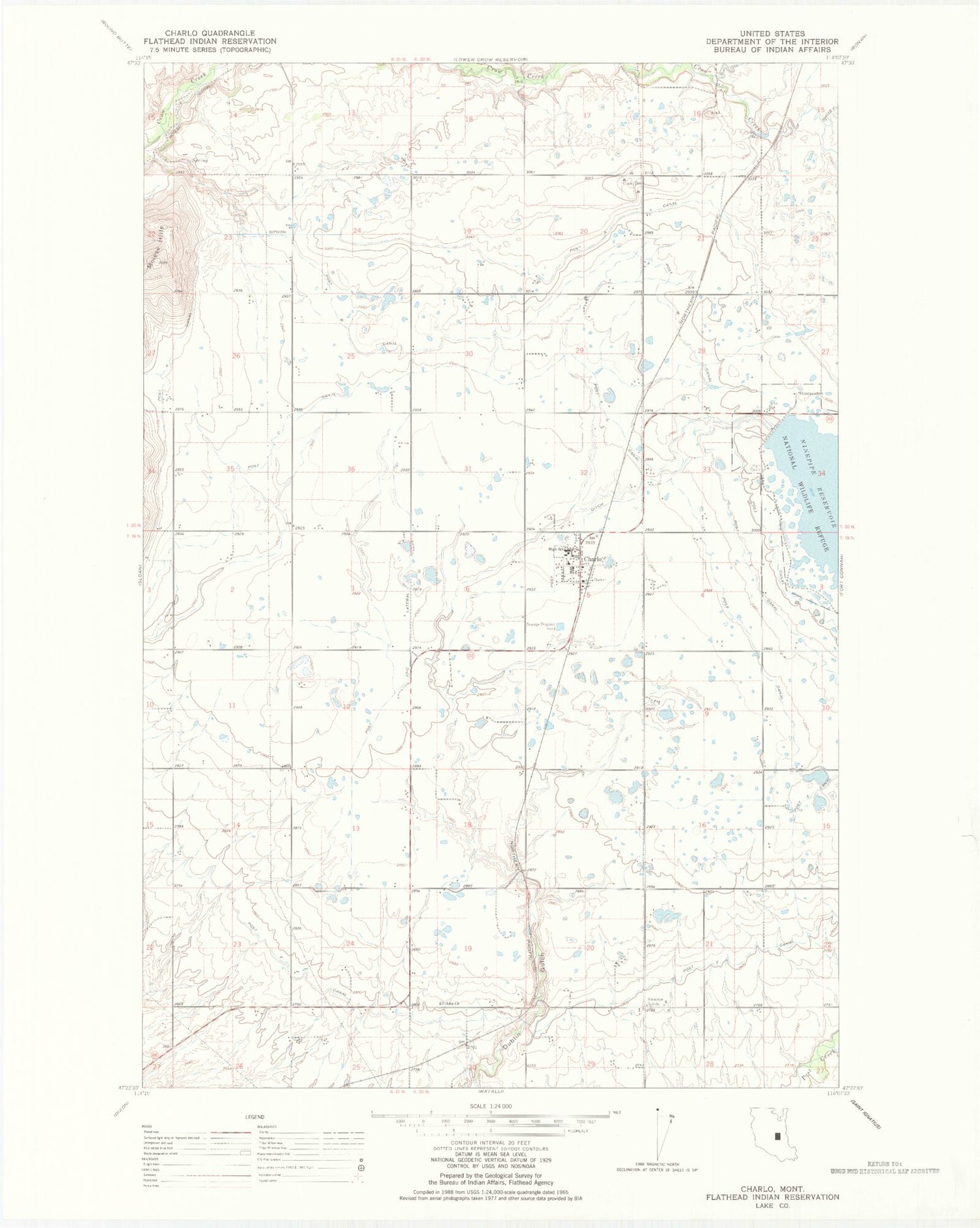
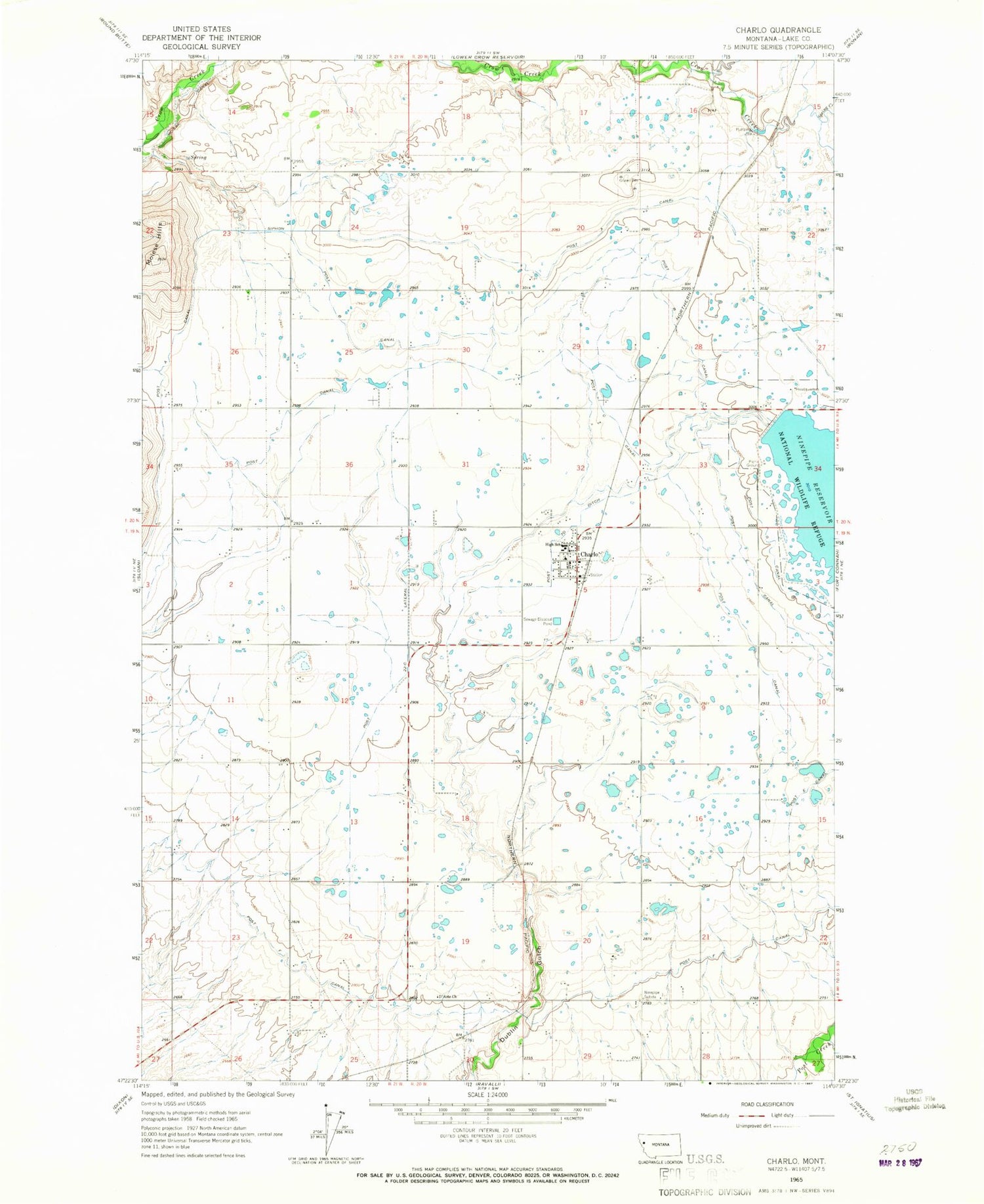
Classic USGS Charlo Montana 7.5'x7.5' Topo Map
Couldn't load pickup availability
Historical USGS topographic quad map of Charlo in the state of Montana. Map scale may vary for some years, but is generally around 1:24,000. Print size is approximately 24" x 27"
This quadrangle is in the following counties: Lake.
The map contains contour lines, roads, rivers, towns, and lakes. Printed on high-quality waterproof paper with UV fade-resistant inks, and shipped rolled.
Contains the following named places: 19N20W05BAD_01 Well, 19N20W05CDD_01 Well, 19N20W06AAA_01 Well, 19N20W10CBB_01 Well, 19N20W18AAA_01 Well, 19N20W19BABD01 Well, 19N20W22ABB_01 Well, 19N20W29ABA_01 Well, 19N20W29CBB_01 Well, 19N20W30BABC01 Well, 19N20W30BABC02 Well, 19N20W30BABC03 Well, 19N20W30BABC04 Well, 19N20W30BABC05 Well, 19N21W02ADA_01 Well, 19N21W02BAD_01 Well, 19N21W03DDA_01 Well, 19N21W10ADA_01 Well, 19N21W12BCB_01 Well, 19N21W13ADA_01 Well, 19N21W14BAA_01 Well, 19N21W14BAAA01 Well, 19N21W14DAA_01 Well, 19N21W23DDDD01 Well, 19N21W25BBA_01 Well, 19N21W25BCB_01 Well, 20N20W16ABDC01 Well, 20N20W20AADA01 Well, 20N20W20DCD_01 Well, 20N20W27CDB_01 Well, 20N20W28AAA_01 Well, 20N20W30ABB_01 Well, 20N20W30DCD_01 Well, 20N20W32DAA_01 Well, 20N21W13CCC_01 Well, 20N21W13DDD_01 Well, 20N21W16BBA_01 Well, 20N21W23ADD_01 Well, 20N21W23ADD_02 Well, 20N21W25BBCC01 Well, 20N21W25CDBD01 Well, 20N21W25CDBD02 Well, 20N21W25CDBD03 Well, 20N21W25CDBD04 Well, 20N21W25CDBD05 Well, 20N21W25CDBD06 Well, 20N21W25CDBD07 Well, 20N21W26ABAB01 Well, 20N21W27DDA_01 Well, 20N21W35CCB_01 Well, 59824, Charlo, Charlo - Moiese Volunteer Fire Department, Charlo Census Designated Place, Charlo Division, Charlo Fire Department, Charlo High School, Charlo Post Office, D'Aste, D'Aste Church, D'Aste Post Office, D'Aste School, DASTE_CANAL___ Well, HAMEL_CANAL___ Well, Lake County Waterfowl Production Area, Ninepipe Dam, Ninepipe Substation, Post 22-C Lateral, Post 7-D Ditch, Post A Canal, Post B Canal, Post C Canal, Post Canal, Post E Canal, Post F Canal, Post G Canal, Ronan District, Saint Joseph Mission, Spring Creek, Willow Creek Campground


