MyTopo
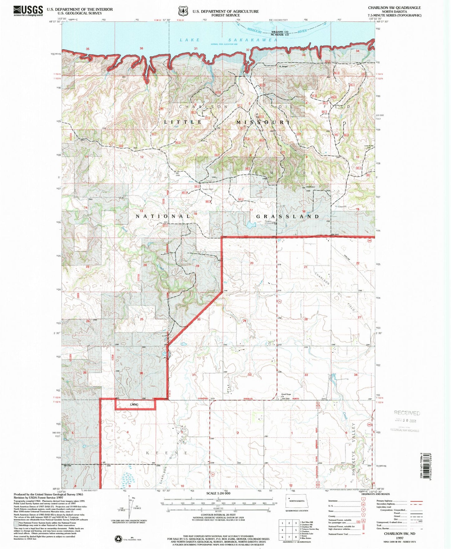
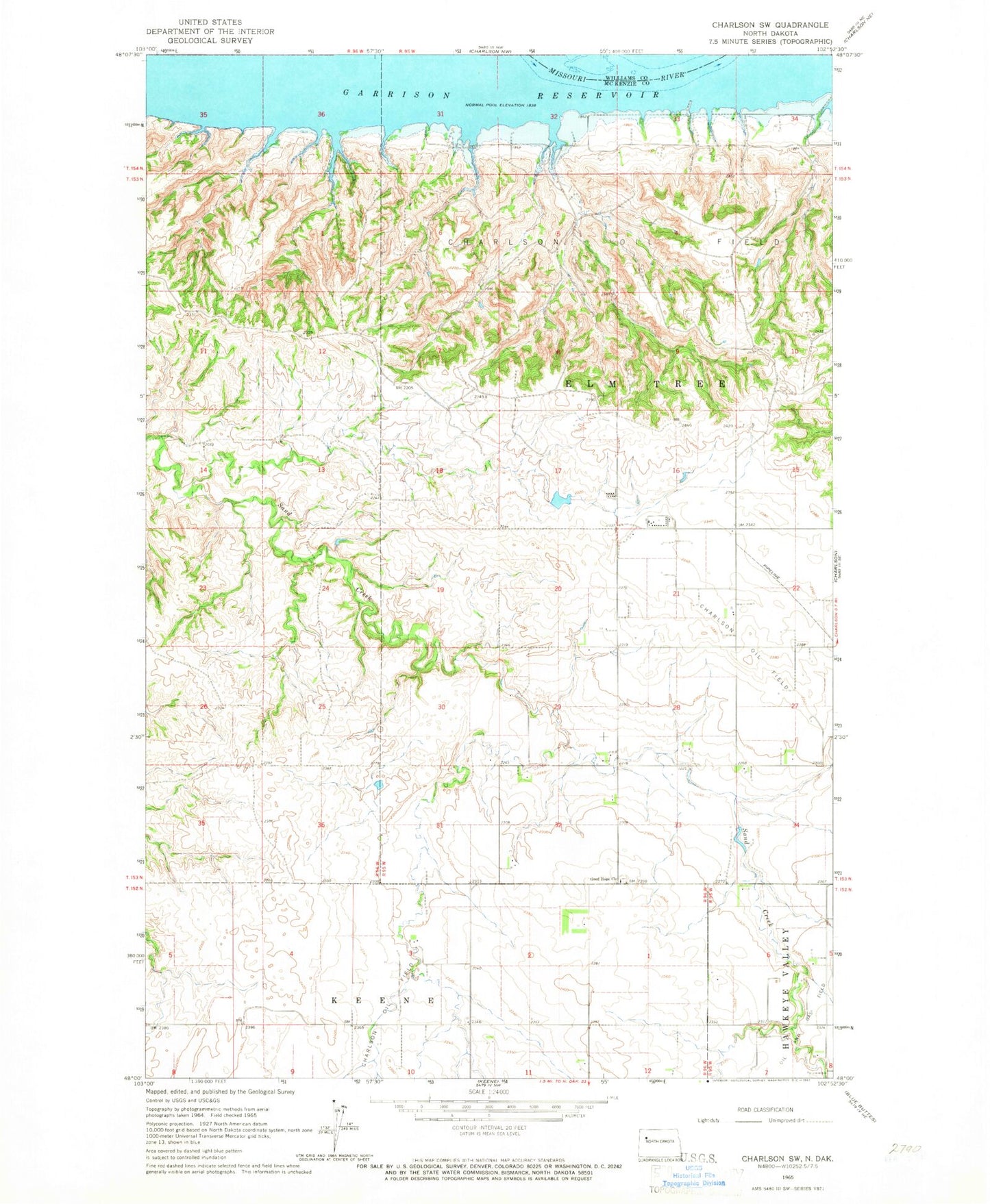
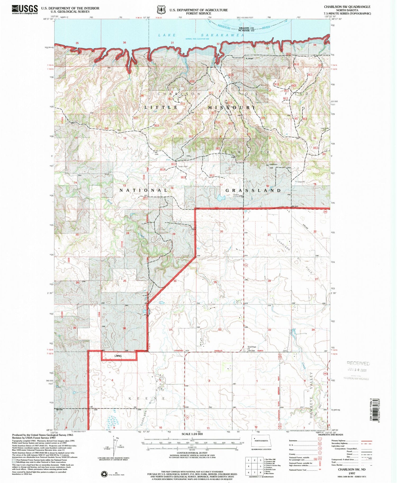
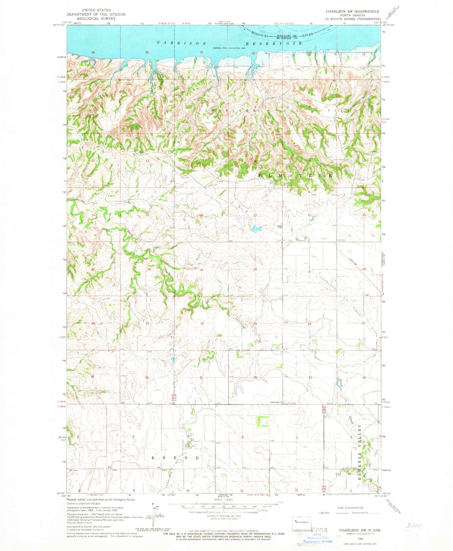
Classic USGS Charlson SW North Dakota 7.5'x7.5' Topo Map
Couldn't load pickup availability
Historical USGS topographic quad map of Charlson SW in the state of North Dakota. Map scale may vary for some years, but is generally around 1:24,000. Print size is approximately 24" x 27"
This quadrangle is in the following counties: McKenzie, Williams.
The map contains contour lines, roads, rivers, towns, and lakes. Printed on high-quality waterproof paper with UV fade-resistant inks, and shipped rolled.
Contains the following named places: Charlson Oil Field, E Norby Ranch, Good Hope Cemetery - First Lutheran Cemetery, Good Hope Church, I Thompson Ranch, L Swenson Ranch, L Wisness Ranch, Olson Private Airstrip, Prop Wash Field, R Norby Ranch, Swanson Ranch, Thompson Ranch, Thompson Ranches, Township of Elm Tree