MyTopo
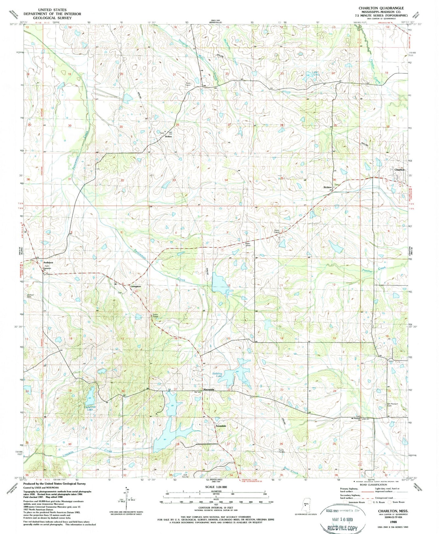
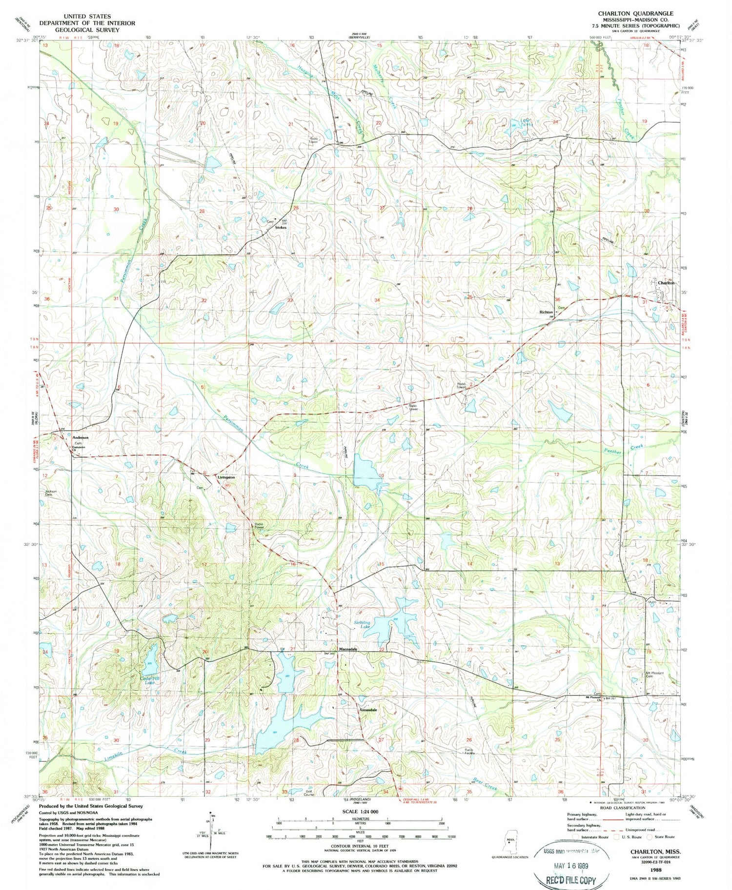
Classic USGS Charlton Mississippi 7.5'x7.5' Topo Map
Couldn't load pickup availability
Historical USGS topographic quad map of Charlton in the state of Mississippi. Map scale may vary for some years, but is generally around 1:24,000. Print size is approximately 24" x 27"
This quadrangle is in the following counties: Madison.
The map contains contour lines, roads, rivers, towns, and lakes. Printed on high-quality waterproof paper with UV fade-resistant inks, and shipped rolled.
Contains the following named places: Anderson, Anderson Cemetery, Annandale, Arbondale School, C L Hardaman Lake Dam, Cedar Hill Lake, Cedar Hill Lake Dam, Chapel of the Cross Cemetery, Charlton, Cloud 9 Airport, Damascus Baptist Cemetery, Damascus Church, G E Morgan Lake Dam, Goodloe Cemetery, Harrell-Livingston-Runnels Cemetery, Hatten Cemetery, Hopping Lake Dam, Horn Private Cemetery, J W Hartfield Lake Dam, Jackson Cemetery, Kendall Quinn Lake Dam, Lake Ta-ho, Livingston, Lowe Cemetery, Mannsdale, McMahon-Ridley Cemetery, Mount Pleasant Cemetery, Mount Pleasant Missionary Baptist Church, O J Andy Lake Dam, Persimmon-Burnt Corn Watershed Five Dam, R W Stribling Lake Dam, Richton, Stokes, Stone Plantation, Stribling Lake, Stribling Lake Dam, Supervisor District 2, Supervisor District 4, Tate Lake Dam, Tyler Chapel Cemetery, ZIP Code: 39110