MyTopo
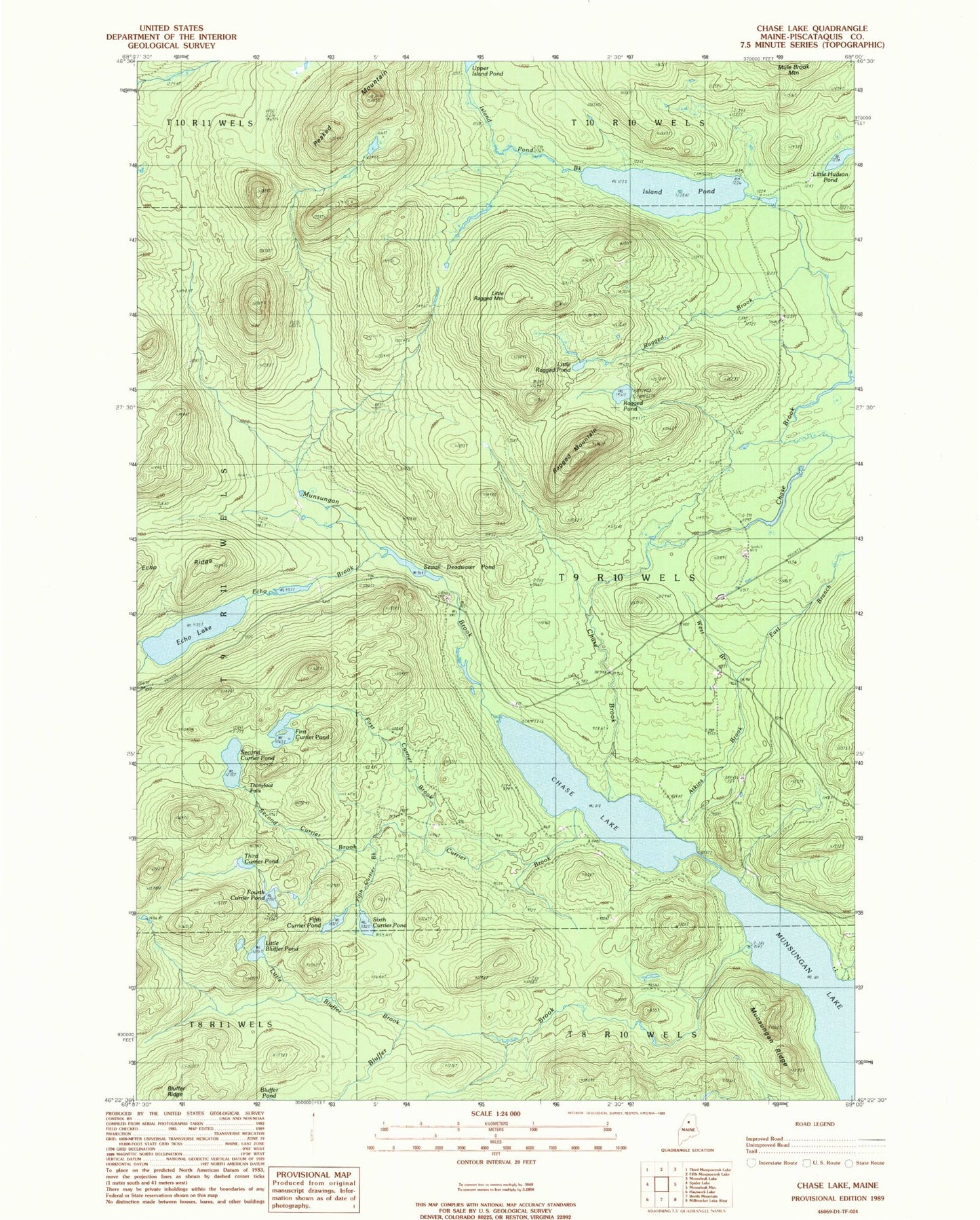
Classic USGS Chase Lake Maine 7.5'x7.5' Topo Map
Couldn't load pickup availability
Historical USGS topographic quad map of Chase Lake in the state of Maine. Typical map scale is 1:24,000, but may vary for certain years, if available. Print size: 24" x 27"
This quadrangle is in the following counties: Piscataquis.
The map contains contour lines, roads, rivers, towns, and lakes. Printed on high-quality waterproof paper with UV fade-resistant inks, and shipped rolled.
Contains the following named places: Atkins Brook, Bluffer Brook, Chase Brook, Chase Lake, Currier Brook, East Branch Atkins Brook, Echo Brook, Echo Lake, Echo Ridge, Fifth Currier Brook, Fifth Currier Pond, First Currier Brook, First Currier Pond, Fourth Currier Pond, Island Pond, Island Pond Brook, Little Bluffer Brook, Little Bluffer Pond, Little Hudson Pond, Little Ragged Mountain, Little Ragged Pond, Munsungan Brook, Munsungan Ridge, North Branch Echo Brook, Norway Brook, Peaked Mountain, Ragged Brook, Ragged Mountain, Ragged Pond, Second Currier Brook, Second Currier Pond, Sewall Deadwater Pond, Sixth Currier Pond, South Branch Echo Brook, Third Currier Pond, Thirtyfoot Falls, West Branch Atkins Brook, T9 R10 WELS