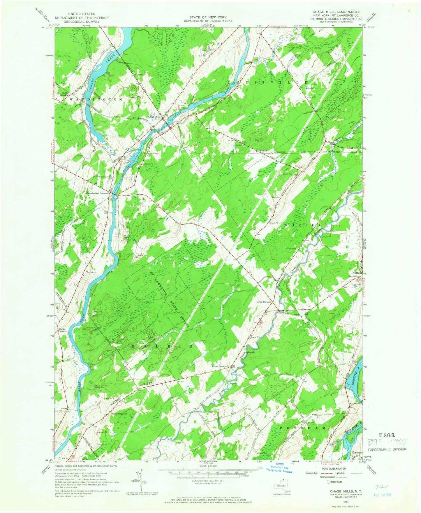
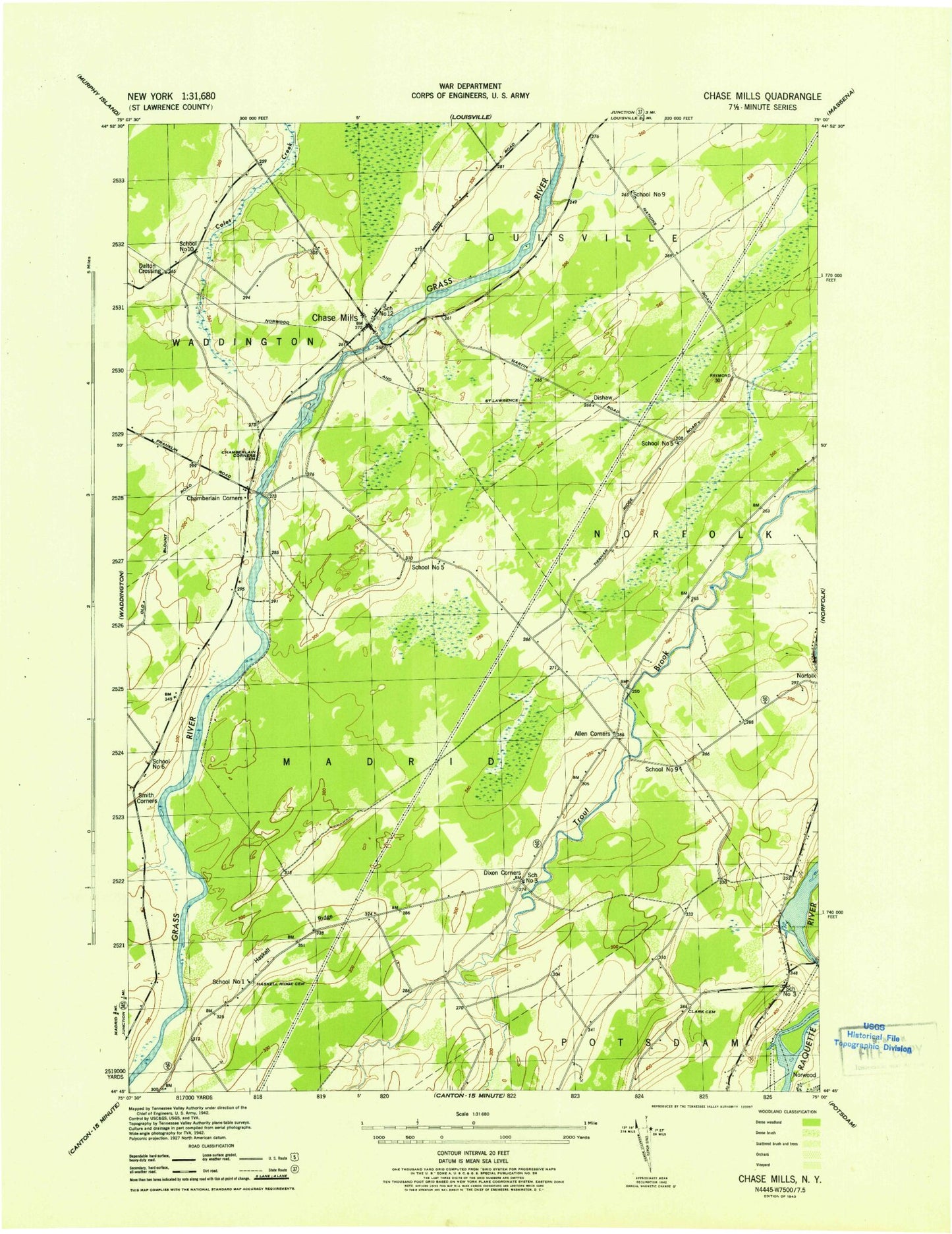
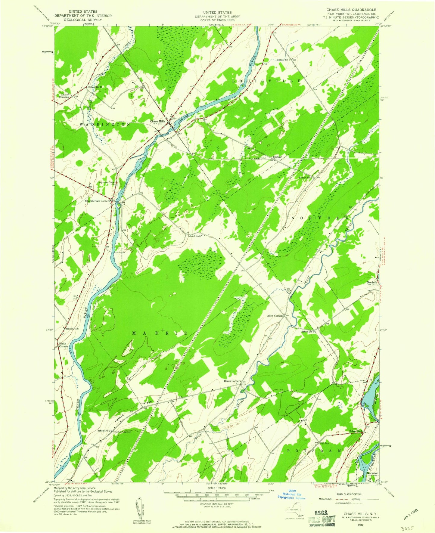
MyTopo
Classic USGS Chase Mills New York 7.5'x7.5' Topo Map
Couldn't load pickup availability
Historical USGS topographic quad map of Chase Mills in the state of New York. Map scale may vary for some years, but is generally around 1:24,000. Print size is approximately 24" x 27"
This quadrangle is in the following counties: St. Lawrence.
The map contains contour lines, roads, rivers, towns, and lakes. Printed on high-quality waterproof paper with UV fade-resistant inks, and shipped rolled.
Contains the following named places: Allen Corners, Chamberlain Corners, Chamberlain Corners Cemetery, Chase Mills, Chase Mills Post Office, Clark Cemetery, Dalton Crossing, Dishaw, Dixon Corners, Haskell Ridge, Haskell Ridge Cemetery, North Winds Farm, School Number 1, School Number 10, School Number 12, School Number 3, School Number 5, School Number 6, School Number 9, Smith Corners, Visitation Cemetery, Yaleville Road Bridge, ZIP Code: 13621