MyTopo
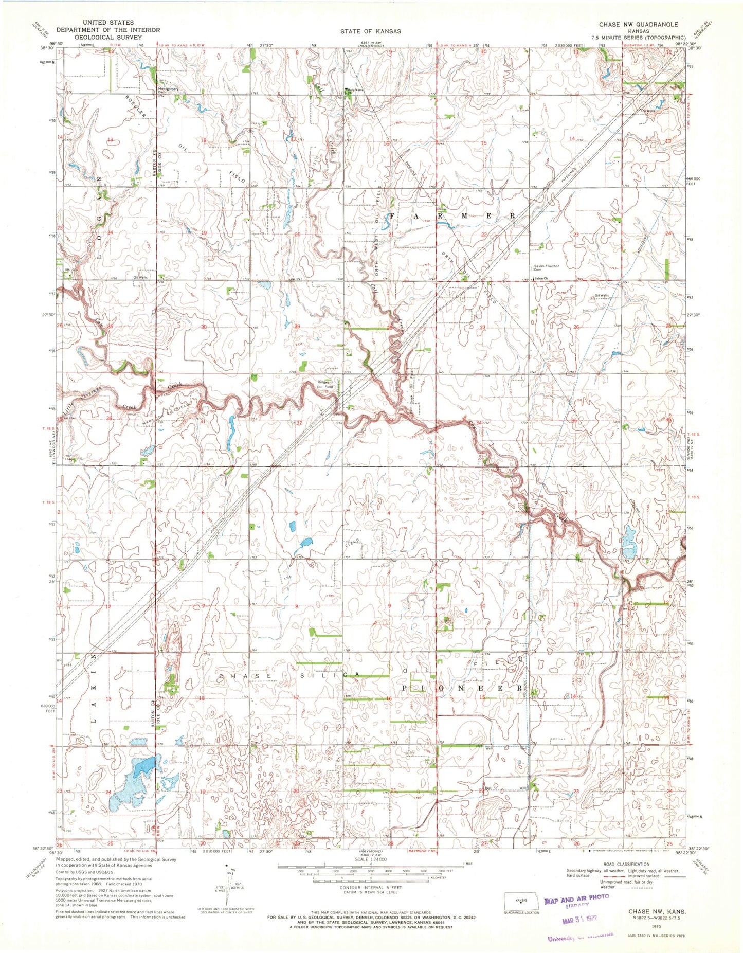
Classic USGS Chase NW Kansas 7.5'x7.5' Topo Map
Couldn't load pickup availability
Historical USGS topographic quad map of Chase NW in the state of Kansas. Map scale may vary for some years, but is generally around 1:24,000. Print size is approximately 24" x 27"
This quadrangle is in the following counties: Barton, Rice.
The map contains contour lines, roads, rivers, towns, and lakes. Printed on high-quality waterproof paper with UV fade-resistant inks, and shipped rolled.
Contains the following named places: Calf Creek, Calf Creek Oil Field, Chase-Silica Oil Field, Glen Sharrald, Holy Name Catholic Church, IXL Oil Field, Little Cheyenne Creek, Mary Ida Oil Field, Montgomery Cemetery, Orth Oil Field, Orth West Oil Field, Ringwald Oil Field, Salem - Friedhof Cemetery, Salem United Methodist Church, State of Kansas, Township of Farmer, Township of Pioneer, ZIP Code: 67427