MyTopo
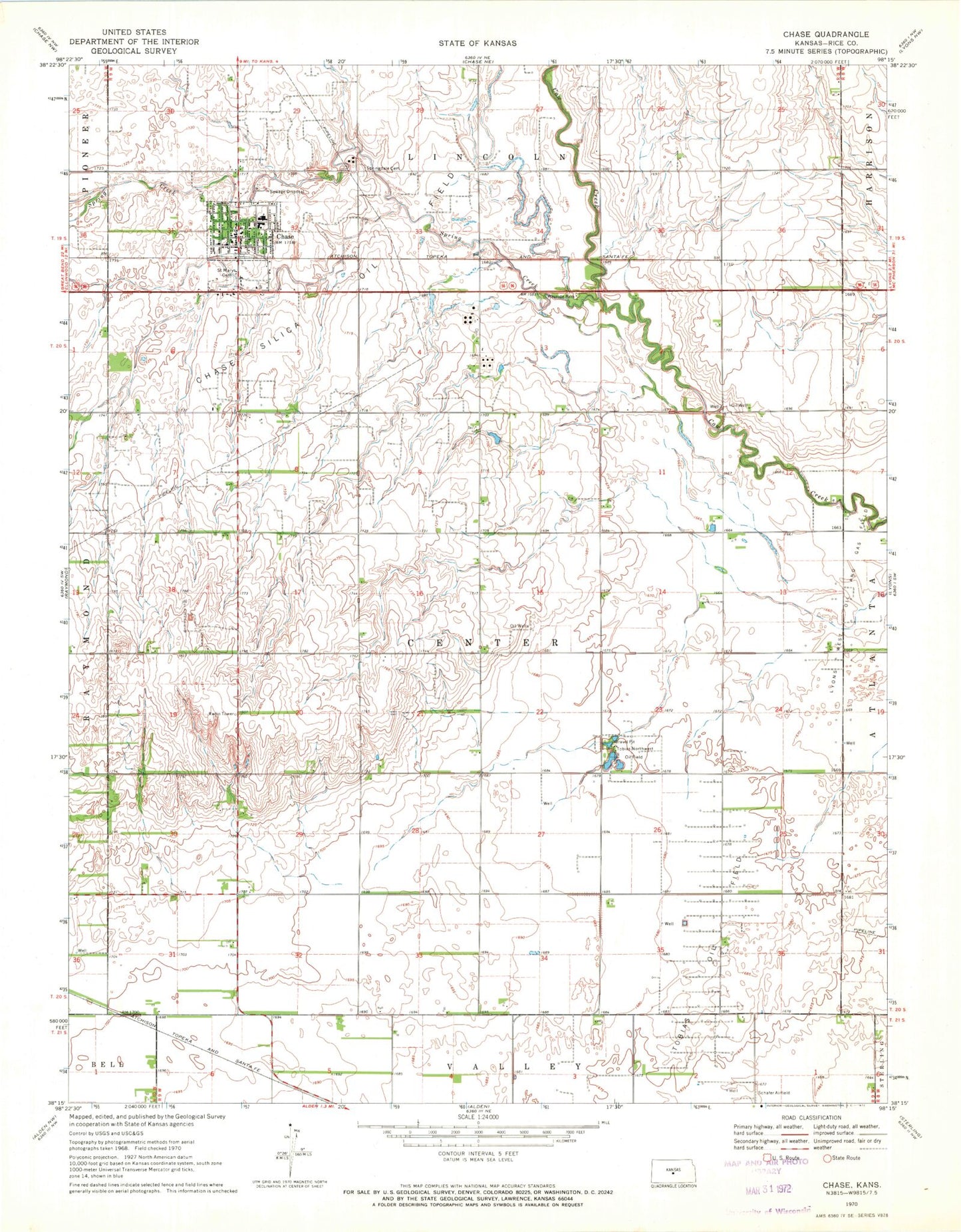
Classic USGS Chase Kansas 7.5'x7.5' Topo Map
Couldn't load pickup availability
Historical USGS topographic quad map of Chase in the state of Kansas. Map scale may vary for some years, but is generally around 1:24,000. Print size is approximately 24" x 27"
This quadrangle is in the following counties: Rice.
The map contains contour lines, roads, rivers, towns, and lakes. Printed on high-quality waterproof paper with UV fade-resistant inks, and shipped rolled.
Contains the following named places: Chase, Chase Grade School, Chase High School, Chase Police Department, Chase Post Office, Chase Sewer Treatment Plant, Chase Volunteer Fire Department, City of Chase, Community Presbyterian Church, Raymond Junior High School, Saint Mary's Cemetery, Schafer Airfield, Spring Creek, Springdale Cemetery, Tobias Northwest Oil Field, Tobias Oil Field, Township of Center, Wayside Park