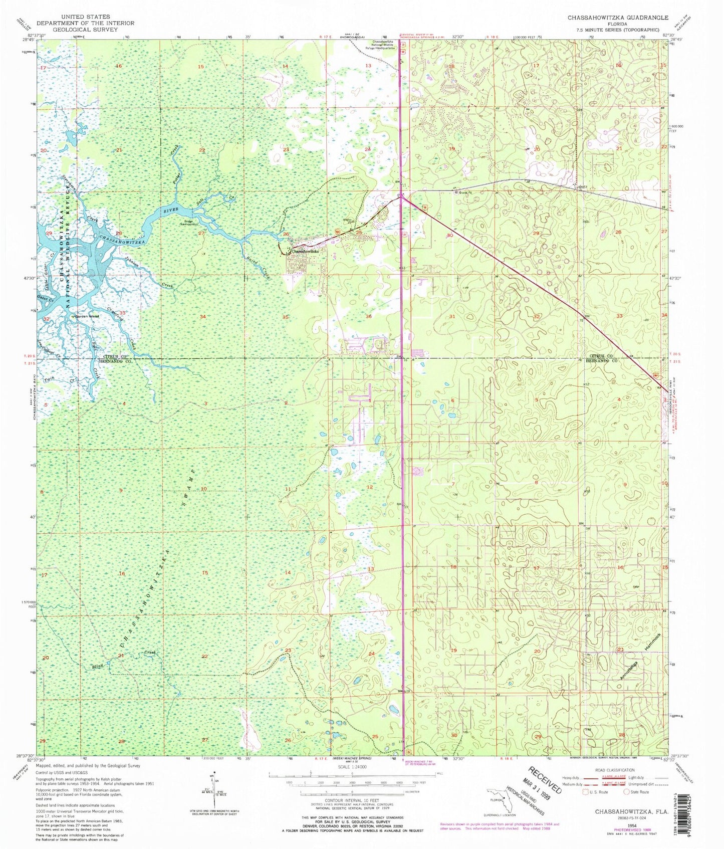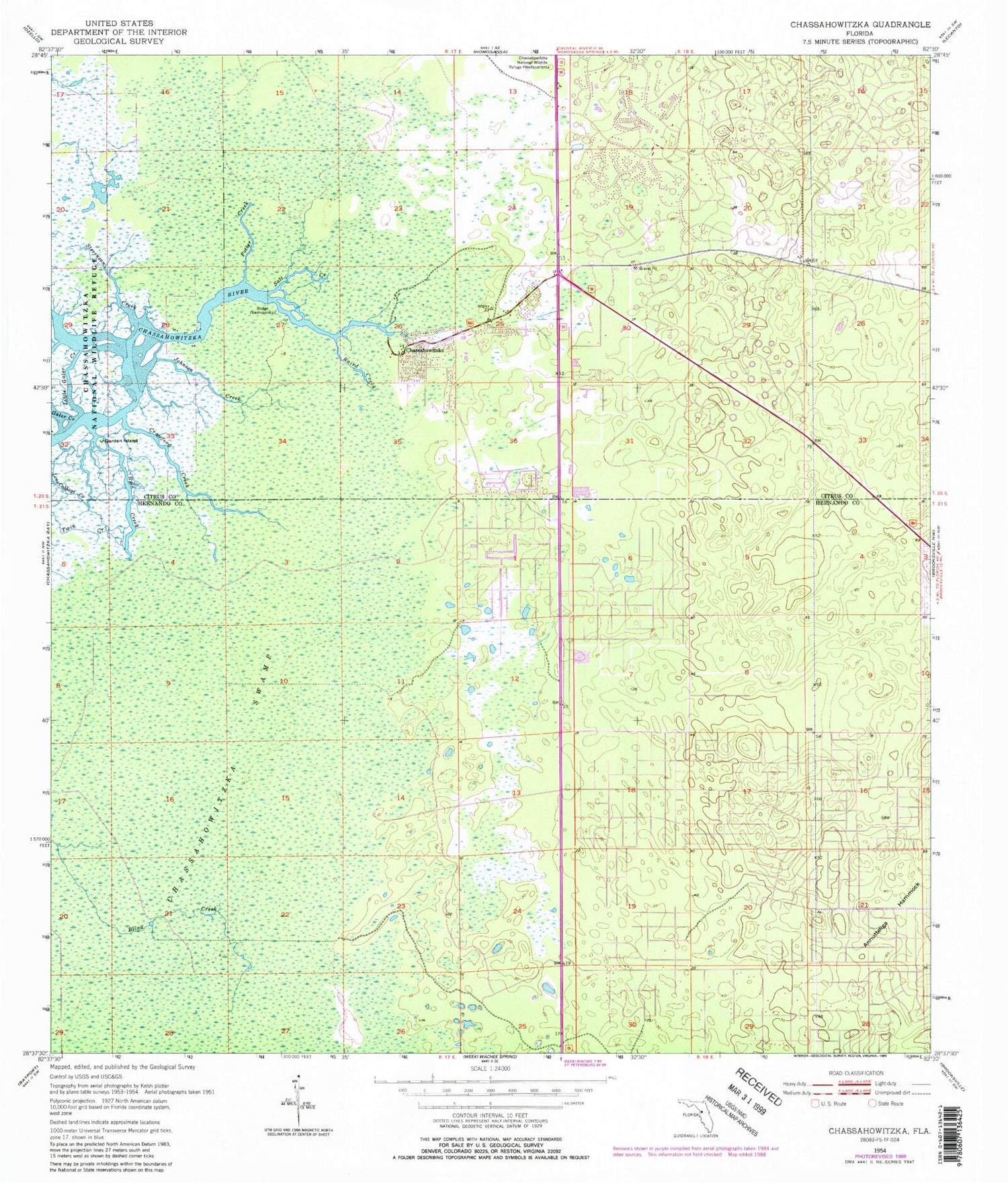
MyTopo
Classic USGS Chassahowitzka Florida 7.5'x7.5' Topo Map
Couldn't load pickup availability
Historical USGS topographic quad map of Chassahowitzka in the state of Florida. Typical map scale is 1:24,000, but may vary for certain years, if available. Print size: 24" x 27"
This quadrangle is in the following counties: Citrus, Hernando.
The map contains contour lines, roads, rivers, towns, and lakes. Printed on high-quality waterproof paper with UV fade-resistant inks, and shipped rolled.
Contains the following named places: Baird Creek, Chassahowitzka, Chassahowitzka Swamp, Crawford Creek, Garden Island, Johnson Creek, Little Gator Creek, Potter Creek, Ryle Creek, Salt Creek, Stevenson Creek, Chassahowitzka National Wildlife Refuge Headquarters, Sugarmill Woods, First Baptist Church of Chassahowitzka, E. Brittle Playground, First Christian Church of Chassahowitzka, Citrus County Fire Rescue Station 4, Sugarmill Woods Census Designated Place, Citrus County Fire Rescue Station 18