
MyTopo
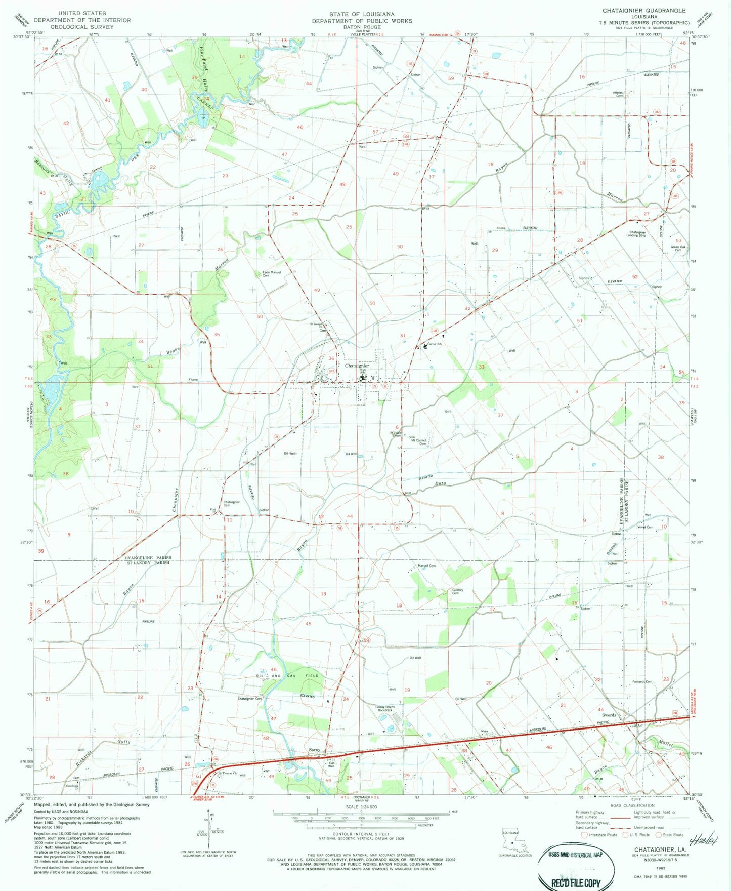
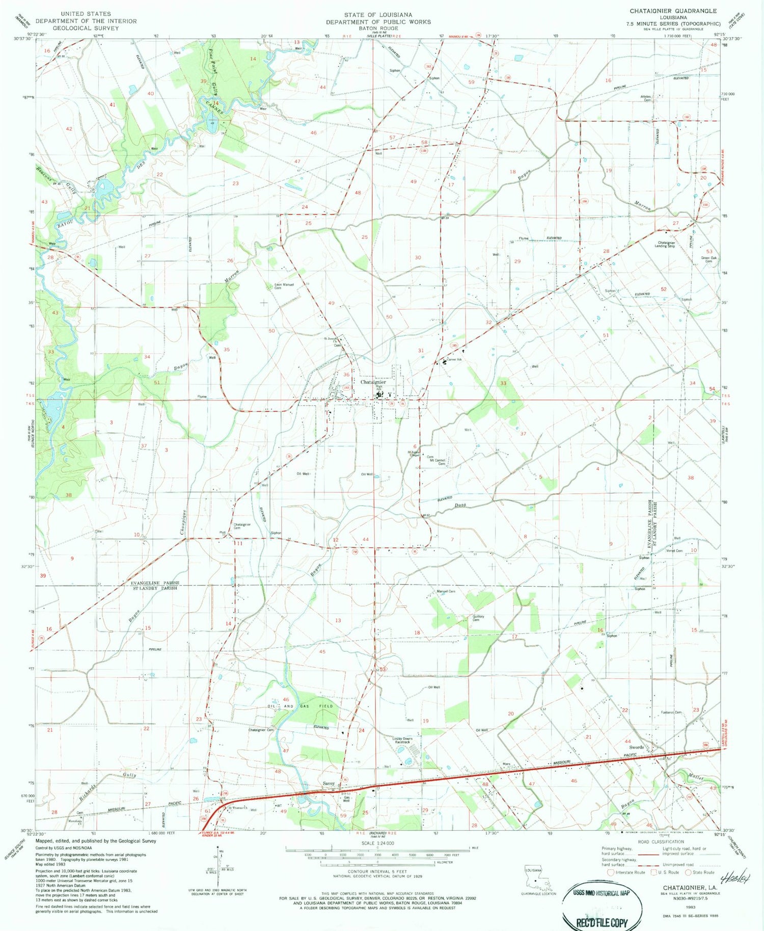
Classic USGS Chataignier Louisiana 7.5'x7.5' Topo Map
Couldn't load pickup availability
Historical USGS topographic quad map of Chataignier in the state of Louisiana. Map scale may vary for some years, but is generally around 1:24,000. Print size is approximately 24" x 27"
This quadrangle is in the following counties: Evangeline, St. Landry.
The map contains contour lines, roads, rivers, towns, and lakes. Printed on high-quality waterproof paper with UV fade-resistant inks, and shipped rolled.
Contains the following named places: Attales Cemetery, Bayou Choupique, Bayou Marron, Beacons Gully, Belleau Cemetery, Carver Elementary School, Chatagnier Volunteer Fire Department, Chataignier, Chataignier Baptist Cemetery, Chataignier Cemetery, Chataignier Church, Chataignier Elementary School, Chataignier Gas Field, Chataignier Landing Strip, Evangeline Parish Library Chataignier Branch, First Baptist Church, Fontenots Gully, Green Oak Cemetery, Guillory Cemetery, KIHG-FM (Mamou), Koch Airport, Lake Hope Recreational Park, Leon Manuel Cemetery, Linzay Downs Racetrack, Macedonia Church, Manuel Cemetery, Mount Carmel Cemetery, New Zion Church, North Savoy Oil Field, Our Lady of Mount Carmel Catholic Church, Parish Governing Authority District 1, Pine Point Gully, Saint Joseph Baptist Church, Saint Julien Chapel, Saint Mary Church, Saint Thomas Church, Savoy, Savoy Oil and Gas Field, Swords, Verret Cemetery, Village of Chataignier, ZIP Code: 70524