MyTopo
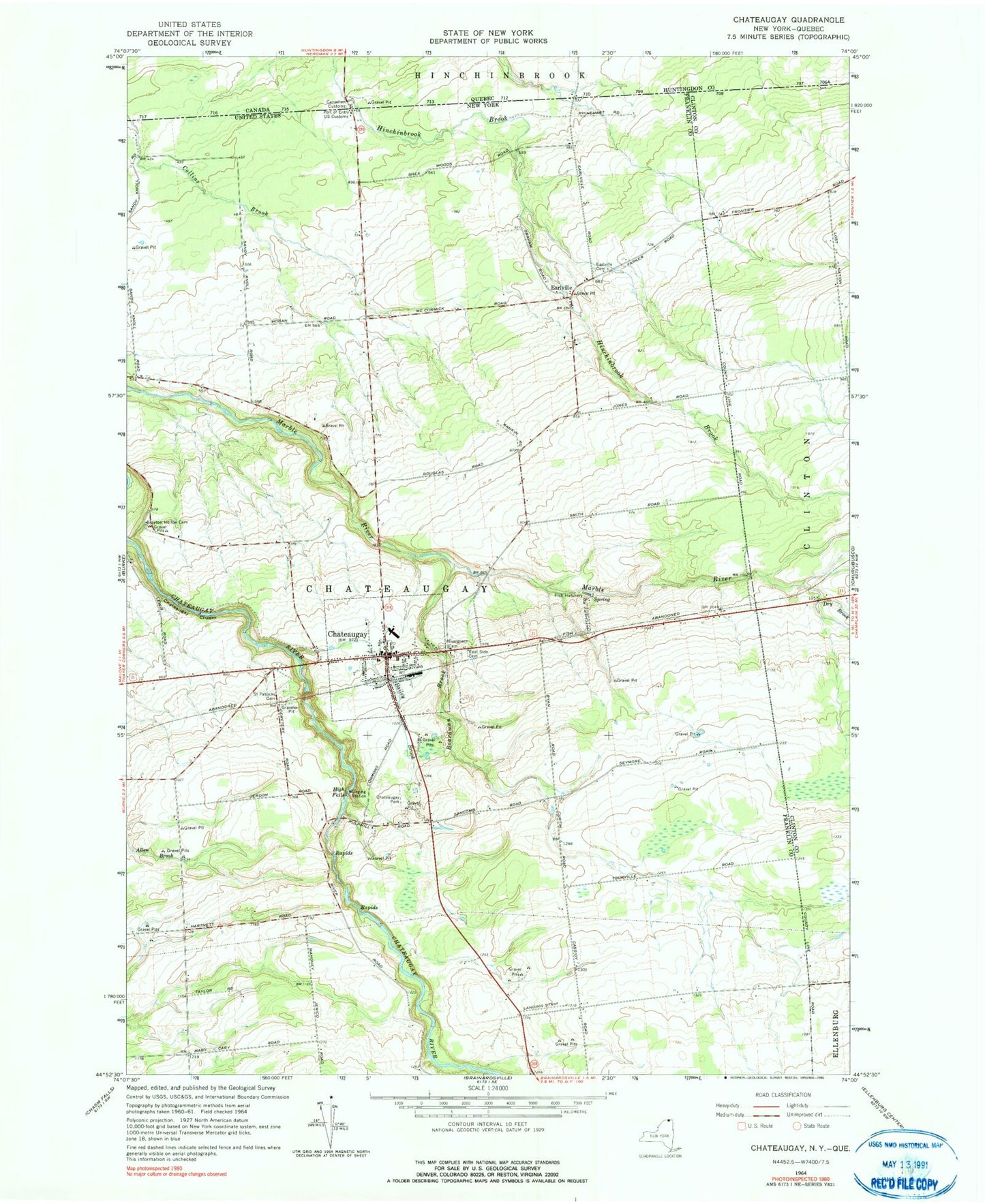
Classic USGS Chateaugay New York 7.5'x7.5' Topo Map
Couldn't load pickup availability
Historical USGS topographic quad map of Chateaugay in the state of New York. Map scale may vary for some years, but is generally around 1:24,000. Print size is approximately 24" x 27"
This quadrangle is in the following counties: Clinton, Franklin.
The map contains contour lines, roads, rivers, towns, and lakes. Printed on high-quality waterproof paper with UV fade-resistant inks, and shipped rolled.
Contains the following named places: Bailey Brook, Boardman Brook, Brayton Hollow Cemetery, Chateau Hotel, Chateaugay, Chateaugay Central School, Chateaugay Chasm, Chateaugay Correctional Facility, Chateaugay Fire Department, Chateaugay High School, Chateaugay Memorial Library, Chateaugay Park, Chateaugay Port of Entry, Chateaugay Post Office, Chateaugay State Fish Hatchery, Chateaugay Town Hall, Chateaugay Village Wastewater Treatment Plant, Dry Brook, Earlville, Earlville Cemetery, East Side Cemetery, Evergreen Cemetery, First Methodist Church of Chateaugay, First Presbyterian Church, High Falls, High Falls Park Campground, Irish School, Saint Patricks Cemetery, Saint Patrick's Roman Catholic Church, School Number 12, School Number 13, School Number 14, School Number 16, School Number 17, School Number 2, School Number 3, School Number 4, School Number 5, School Number 7, School Number 8, School Number 9, Town of Chateaugay, Village of Chateaugay, ZIP Code: 12920