MyTopo
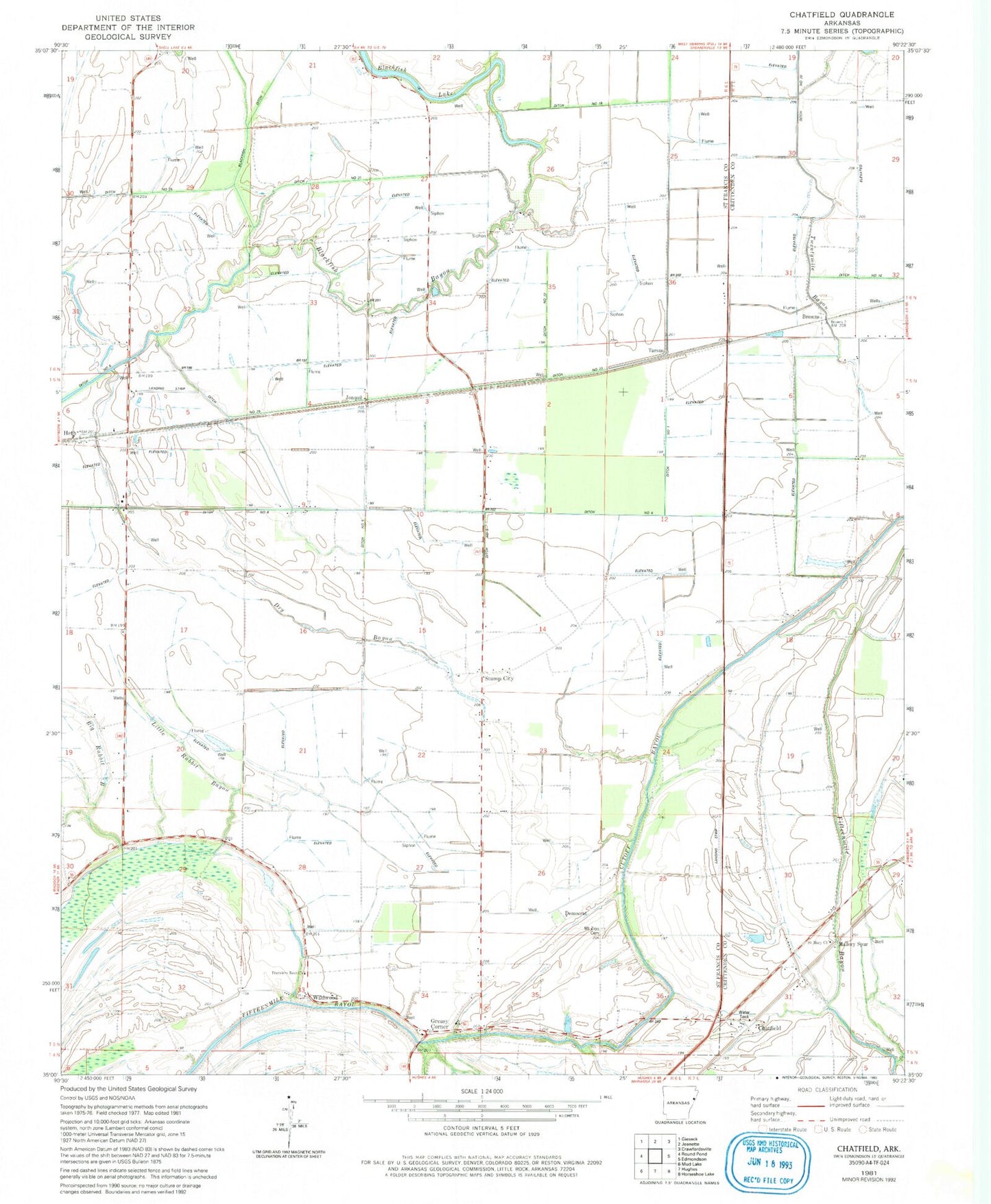
Classic USGS Chatfield Arkansas 7.5'x7.5' Topo Map
Couldn't load pickup availability
Historical USGS topographic quad map of Chatfield in the state of Arkansas. Map scale may vary for some years, but is generally around 1:24,000. Print size is approximately 24" x 27"
This quadrangle is in the following counties: Crittenden, St. Francis.
The map contains contour lines, roads, rivers, towns, and lakes. Printed on high-quality waterproof paper with UV fade-resistant inks, and shipped rolled.
Contains the following named places: Assembly of God Church, Bethel Springs Church, Blackfish Ditch, Blackfish Lake, Browns, Chatfield, Chatfield School, Davis School, Democrat, Ditch Number 1, Ditch Number 18, Ditch Number 19, Ditch Number 2, Ditch Number 20, Ditch Number 21, Ditch Number 25, Ditch Number 3, Ditch Number 4, Ditch Number 5, Ditch Number 6, Dry Bayou, Greasy Corner, Heth, Jonquil, Little Rabbit Bayou, Mallory Spur, Mount Zion Cemetery, Mount Zion Church, Myers Bridge, Saint Mary Church, Sand Pit Church, Section Thirteen School, Stump City School, Tarsus, Township of Heth, Travelers Rest Church, Wildwood, Willow Bend Church, Willow Bend School, ZIP Code: 72346