MyTopo
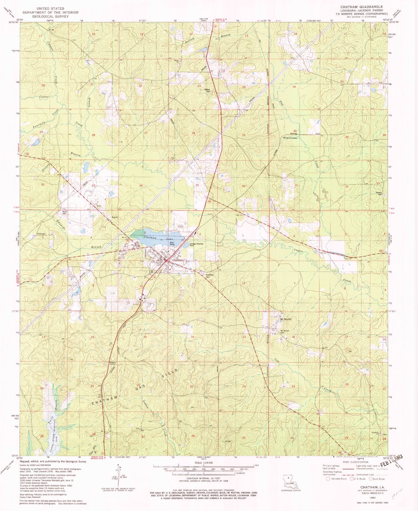
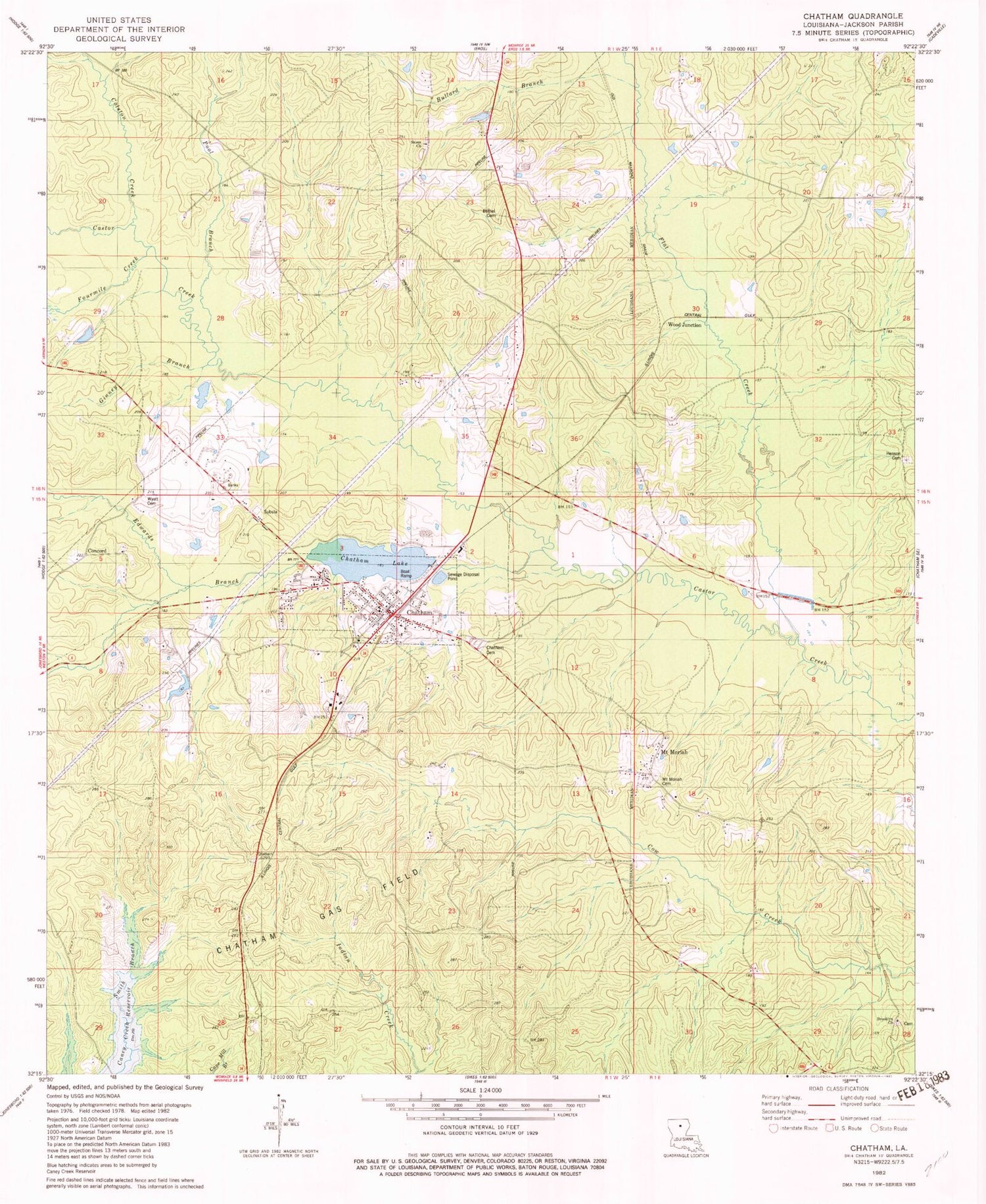
Classic USGS Chatham Louisiana 7.5'x7.5' Topo Map
Couldn't load pickup availability
Historical USGS topographic quad map of Chatham in the state of Louisiana. Map scale may vary for some years, but is generally around 1:24,000. Print size is approximately 24" x 27"
This quadrangle is in the following counties: Jackson, Ouachita.
The map contains contour lines, roads, rivers, towns, and lakes. Printed on high-quality waterproof paper with UV fade-resistant inks, and shipped rolled.
Contains the following named places: Brooklyn, Brooklyn Cemetery, Brooklyn Methodist Church, Bullard Branch, Chatham, Chatham Cemetery, Chatham Gas Field, Chatham Lake, Chatham Lake Dam, Chatham Post Office, Colston Creek, Concord, Concord Cemetery, Concord Church, Dalley, District 3 Fire Protection District - Chatham, Edwards Branch, Flat Creek, Fourmile Creek, Ginney Branch, Henderson Jasper Elementary School, Henson Cemetery, Jackson Parish Sheriff's Office, Jasper Henderson Head Start Center School, Mount Mariah Church, Mount Moriah, Mount Moriah Cemetery, Nash, Old Bethel Cemetery, Pool Branch, Salem Baptist Church, Salem Cemetery, Smith Branch, Town of Chatham, Union Hall School, Veal Farm, Ward Three, Wood Junction, Wyatt Cemetery, ZIP Codes: 71226, 71238