MyTopo
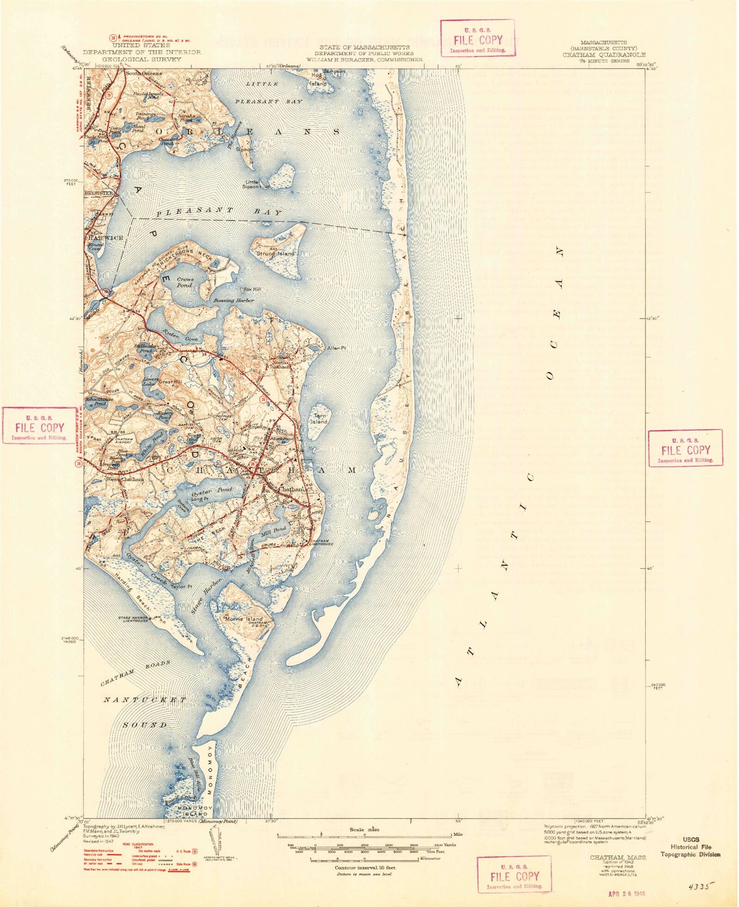
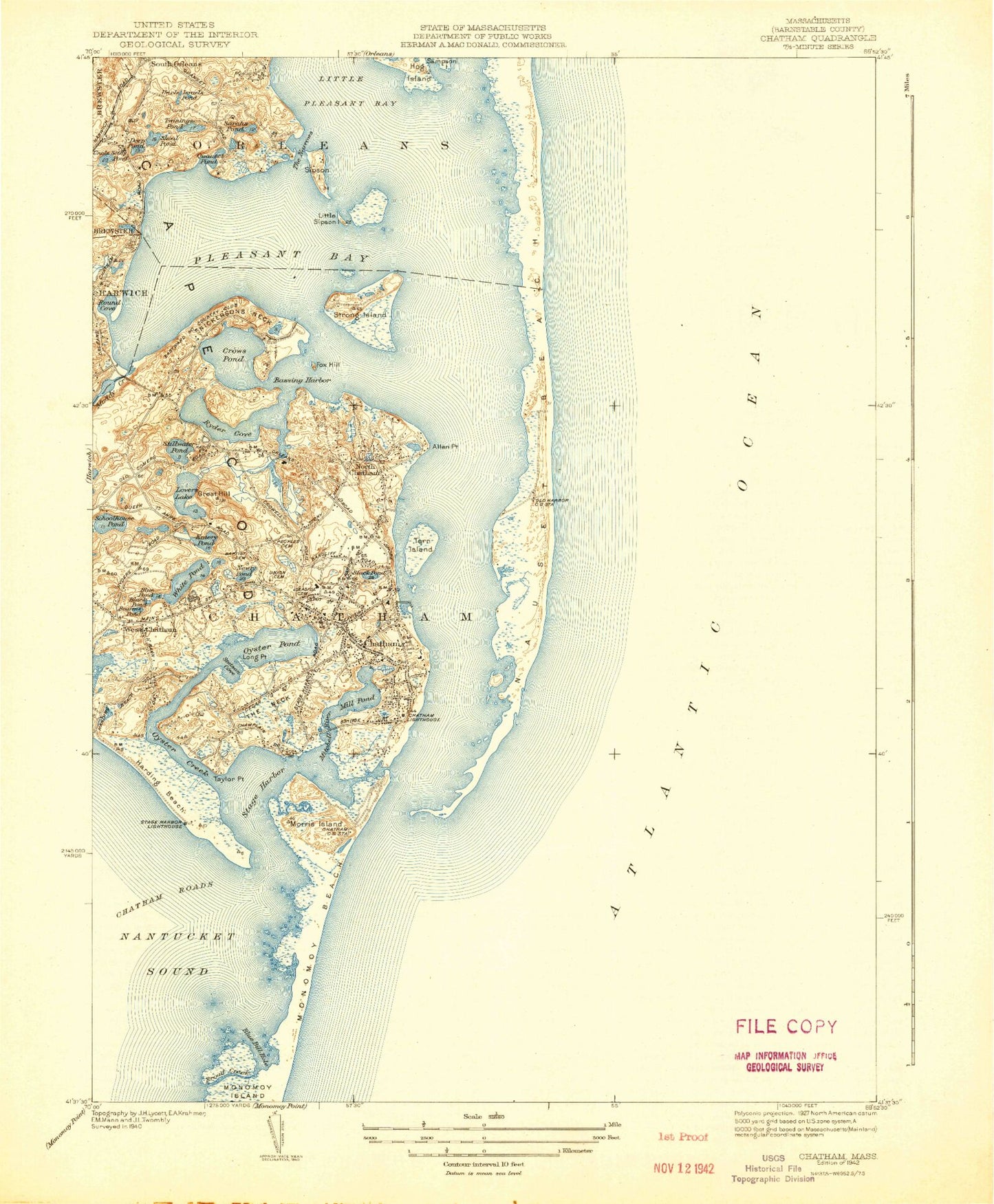
Classic USGS Chatham Massachusetts 7.5'x7.5' Topo Map
Couldn't load pickup availability
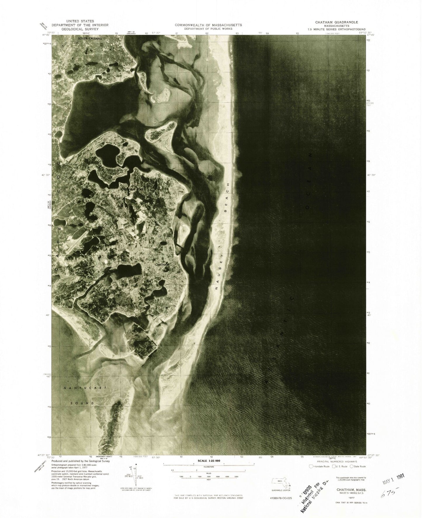
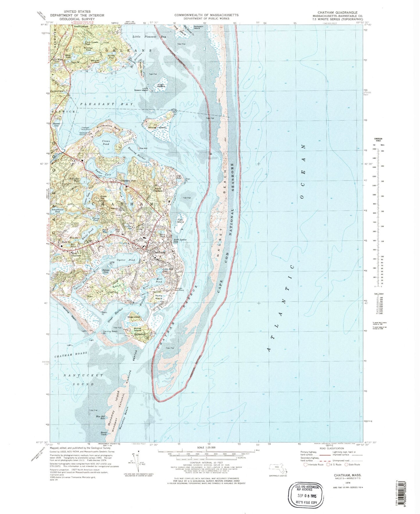
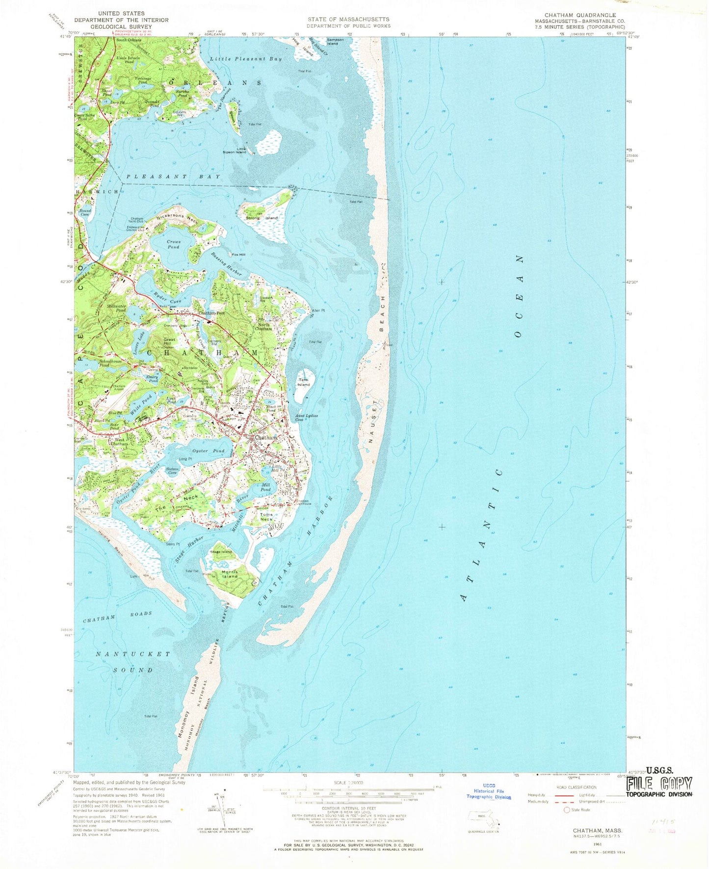
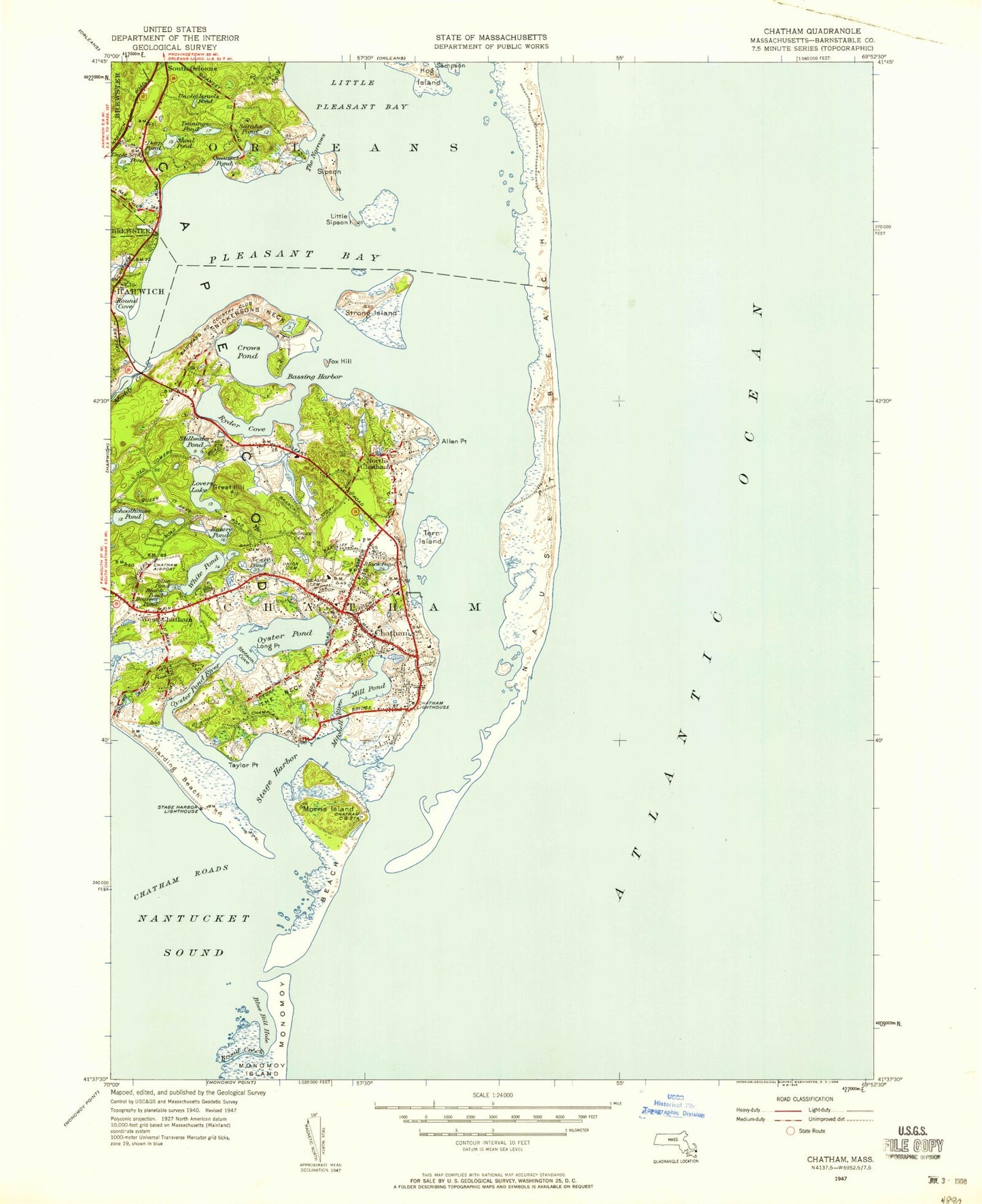
Historical USGS topographic quad map of Chatham in the state of Massachusetts. Typical map scale is 1:24,000, but may vary for certain years, if available. Print size: 24" x 27"
This quadrangle is in the following counties: Barnstable.
The map contains contour lines, roads, rivers, towns, and lakes. Printed on high-quality waterproof paper with UV fade-resistant inks, and shipped rolled.
Contains the following named places: Chatham Aero Light, Chatham Lighthouse, Stage Harbor Light, Monomoy Regional Middle School, Peoples Cemetery, Chatham Yacht Club, Eastward Ho Country Club, Seaside Cemetery, Oyster Pond River Marshes, Morris Island Marshes, Strong Island Marshes, Mitchell River Marshes, Union Cemetery, Tern Island Sanctuary, Chatham Railroad Museum, Old Grist Mill, Atwood House Museum, Eldridge Point, Howes Wharf (historical), Chatham Station (historical), Portanimicutt, Watch Hill, Indian Fort Hill, R C A Chatham Station, Chatham United States Life Saving Station (historical), Old North Cemetery, Allen Point, Bear Pond, Black Pond, Black Pond, Blue Pond, Chatham, Chatham Bar, Chatham Harbor, Chatham Port, Chatham Roads, Common Flat, Deep Pond, Emery Pond, Fox Hill, Frost Fish Creek, Great Hill, Harding Beach, Little Mill Pond, Little Pleasant Bay, Little Sipson Island, Long Point, Lovers Lake, Perch Pond, Mill Pond, Mitchell River, Morris Island, Muddy Creek, The Narrows, Nickersons Neck, North Chatham, Oyster Pond, Oyster Pond River, Pleasant Bay, Quitnesset, Sarahs Pond, Schoolhouse Pond, Sears Point, Shoal Pond, Sipson Island, Stage Harbor, Stage Island, Stillwater Pond, Strong Island, Tern Island, Toms Neck, Uncle Israels Pond, Uncle Seths Pond, West Chatham, White Pond, Monomoy Beach, Hog Island, Avalon Point, Broad Creek, The Neck, Amos Point, Cannon Hill, Eastward Point, Oyster Pond Beach, Broad Creek, Harding Beach Point, Town of Chatham, Aunt Lydias Cove, Bassing Harbor, Blue Bill Hole, Crows Pond, Quanset Pond, Round Cove, Ryder Cove, Stetson Cove, Chatham Municipal Airport, North Chatham Heliport, Sipson Meadow, Old Burying Ground, North Monomoy Island, Chatham Census Designated Place, West Chatham Census Designated Place, Old South Cemetery, Old Baptist Cemetery, Chatham Fire and Rescue Department Station 1, Chatham Police Department, North Chatham Post Office, Chatham Post Office, West Chatham Post Office, Smallpox Cemetery, Chatham Aero Light, Chatham Lighthouse, Stage Harbor Light, Monomoy Regional Middle School, Peoples Cemetery, Chatham Yacht Club, Eastward Ho Country Club, Seaside Cemetery, Oyster Pond River Marshes, Morris Island Marshes, Strong Island Marshes, Mitchell River Marshes, Union Cemetery, Tern Island Sanctuary, Chatham Railroad Museum, Old Grist Mill, Atwood House Museum, Eldridge Point, Howes Wharf (historical), Chatham Station (historical), Portanimicutt, Watch Hill, Indian Fort Hill, R C A Chatham Station, Chatham United States Life Saving Station (historical), Old North Cemetery, Allen Point, Bear Pond, Black Pond, Black Pond, Blue Pond, Chatham, Chatham Bar, Chatham Harbor, Chatham Port, Chatham Roads, Common Flat, Deep Pond, Emery Pond, Fox Hill, Frost Fish Creek, Great Hill, Harding Beach, Little Mill Pond, Little Pleasant Bay, Little Sipson Island, Long Point, Lovers Lake, Perch Pond, Mill Pond, Mitchell River, Morris Island, Muddy Creek, The Narrows, Nickersons Neck, North Chatham, Oyster Pond, Oyster Pond River, Pleasant Bay, Quitnesset, Sarahs Pond, Schoolhouse Pond, Sears Point, Shoal Pond, Sipson Island, Stage Harbor, Stage Island, Stillwater Pond, Strong Island, Tern Island, Toms Neck, Uncle Israels Pond, Uncle Seths Pond, West Chatham, White Pond, Monomoy Beach, Hog Island, Avalon Point, Broad Creek, The Neck, Amos Point, Cannon Hill, Eastward Point, Oyster Pond Beach, Broad Creek, Harding Beach Point, Town of Chatham, Aunt Lydias Cove, Bassing Harbor, Blue Bill Hole, Crows Pond, Quanset Pond, Round Cove, Ryder Cove, Stetson Cove, Chatham Municipal Airport, North Chatham Heliport, Sipson Meadow, Old Burying Ground, North Monomoy Island, Chatham Census Designated Place, West Chatham Census Designated Place, Old South Cemetery, Old Baptist Cemetery, Chatham Fire and Rescue Department Station 1, Chatham Police Department, North Chatham Post Office, Chatham Post Office, West Chatham Post Office, Smallpox Cemetery, Chatham Aero Light, Chatham Lighthouse, Stage Harbor Light, Monomoy Regional Middle School, Peoples Cemetery, Chatham Yacht Club, Eastward Ho Country Club, Seaside Cemetery, Oyster Pond River Marshes, Morris Island Marshes, Strong Island Marshes, Mitchell River Marshes, Union Cemetery, Tern Island Sanctuary, Chatham Railroad Museum, Old Grist Mill