MyTopo
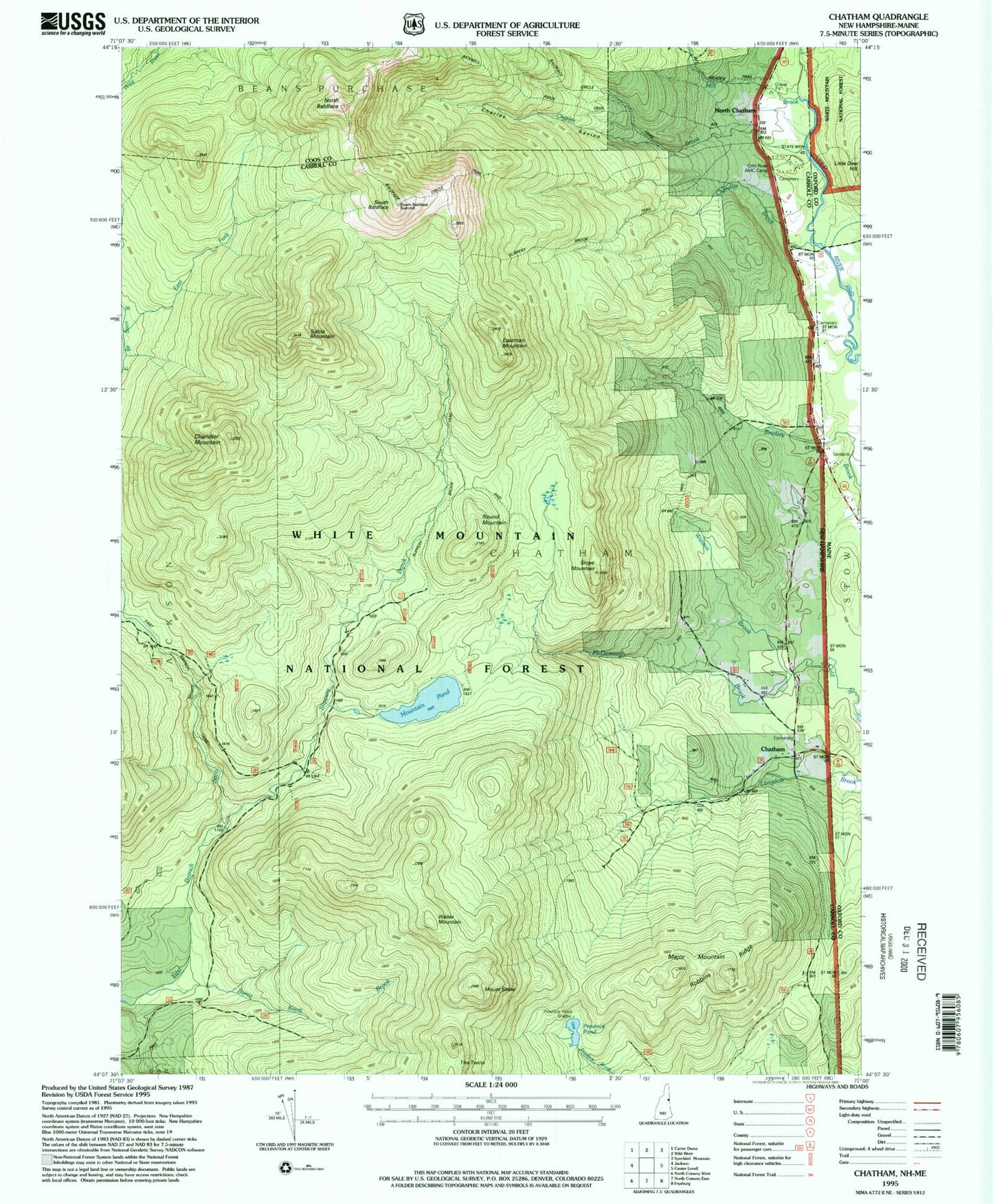
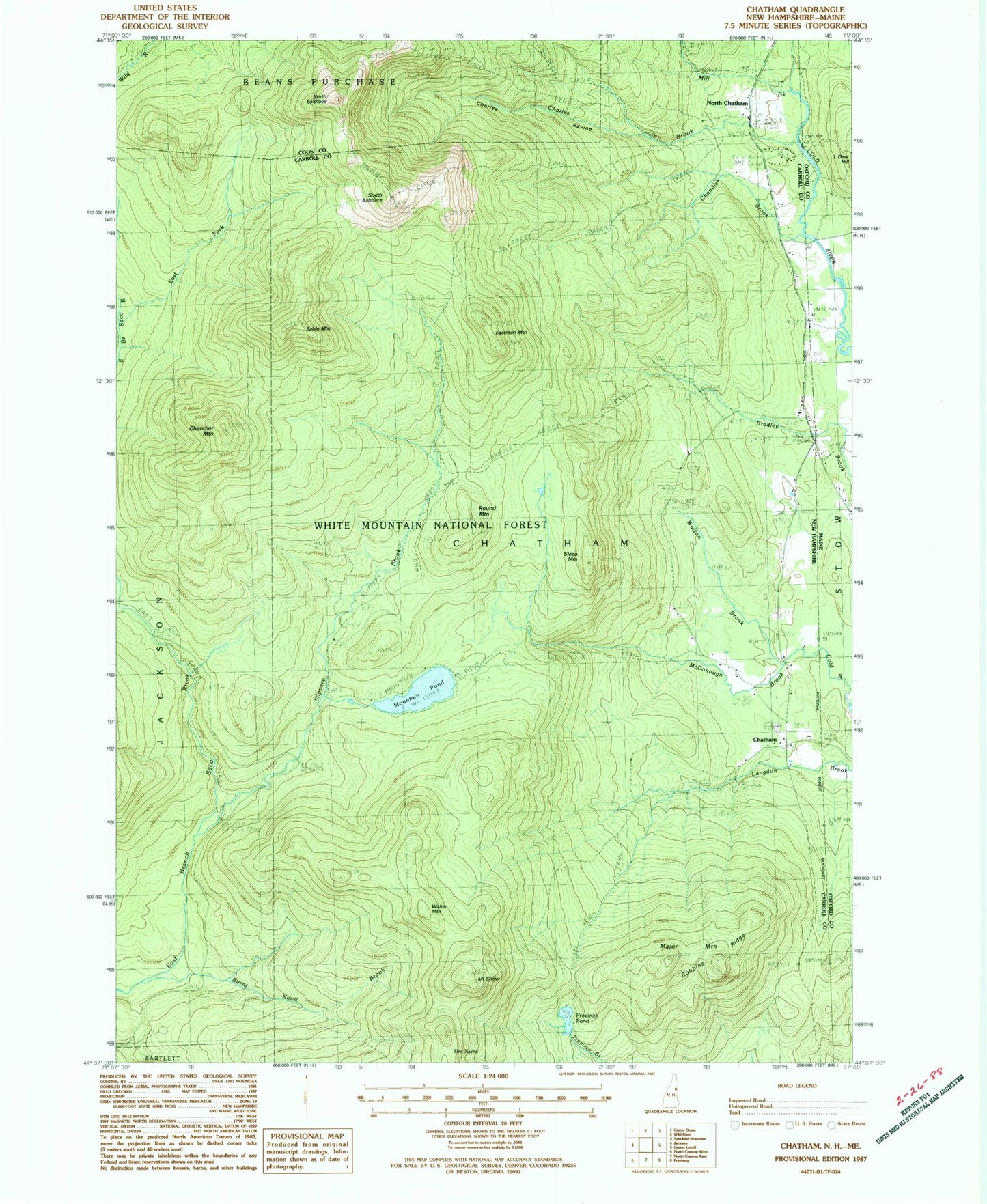
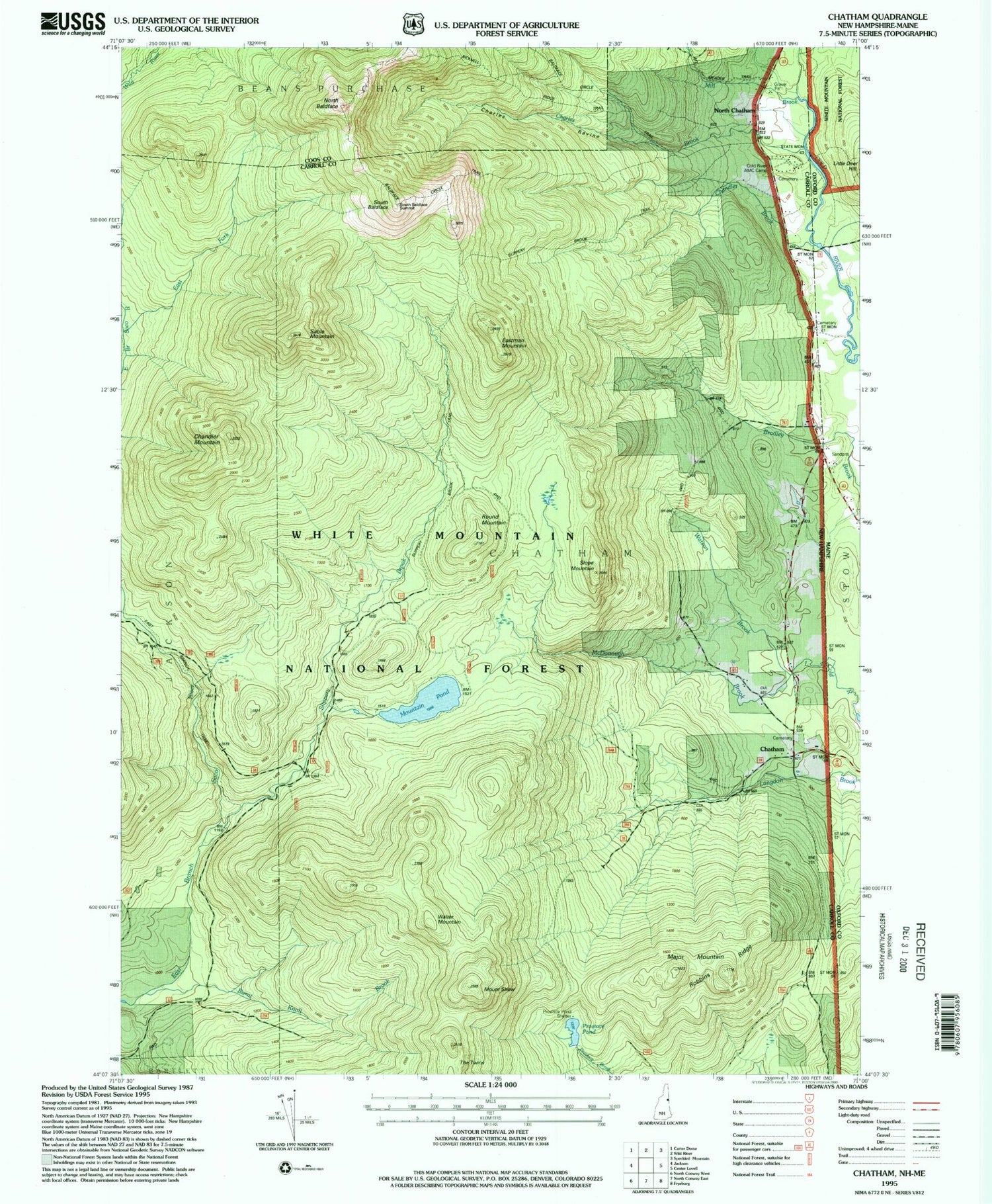
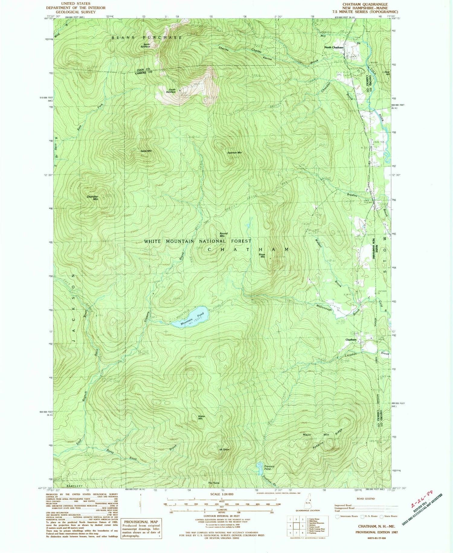
Classic USGS Chatham New Hampshire 7.5'x7.5' Topo Map
Couldn't load pickup availability
Historical USGS topographic quad map of Chatham in the states of New Hampshire, Maine. Typical map scale is 1:24,000, but may vary for certain years, if available. Print size: 24" x 27"
This quadrangle is in the following counties: Carroll, Coos, Oxford.
The map contains contour lines, roads, rivers, towns, and lakes. Printed on high-quality waterproof paper with UV fade-resistant inks, and shipped rolled.
Contains the following named places: Baldface Trail, Bradley Brook Trail, Brucknell Ridge Trail, Burnt Knoll Brook, Chandler Brook, Chandler Mountain, Charles Brook, Charles Ravine, Chatham, Cold River AMC Camp, East Fork East Branch Saco River, Eastman Mountain, Eastman School, Major Mountain, McDonough Brook, Mill Brook, Mountain Eastman Trail, Mountain Pond, Mountain Shaw, Mountain Shaw Trail, North Baldface, North Chatham, Province Pond, Robbins Ridge, Sable Mountain, Sable Mountain Trail, Slippery Brook, Slippery Brook Trail, Slope Mountain, South Baldface, Stillwater Trail, The Twins, Walter Mountain, Watson Brook, Spruce Knoll, Mountain Pond Trail, Bilknell Ridge Trail, Province Pond Shelter, Mountain Pond Shelter, Baldface Shelter, Town of Chatham, Shell Pond Brook