MyTopo
Classic USGS Chatom Alabama 7.5'x7.5' Topo Map
Couldn't load pickup availability
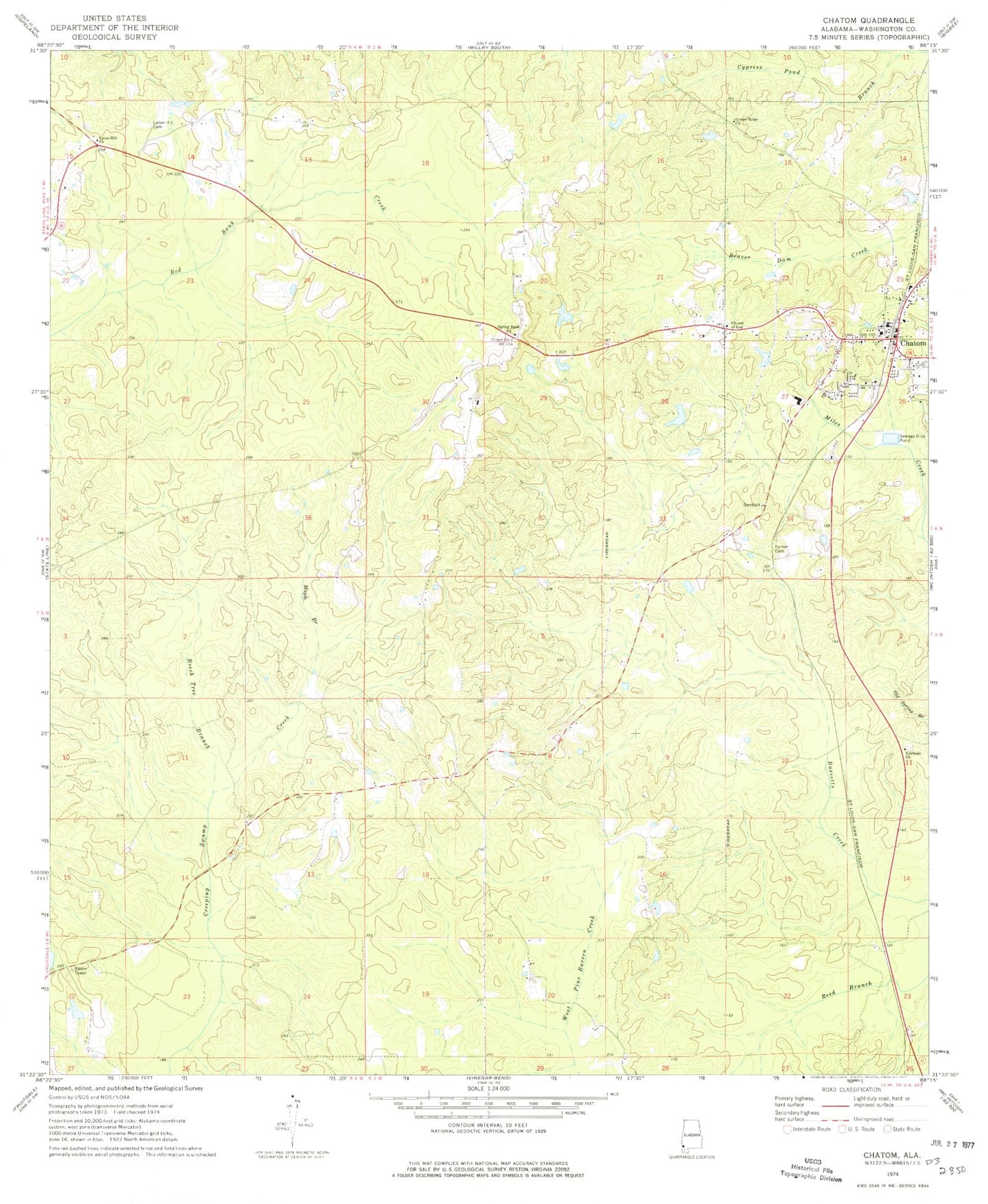
Historical USGS topographic quad map of Chatom in the state of Alabama. Map scale may vary for some years, but is generally around 1:24,000. Print size is approximately 24" x 27"
This quadrangle is in the following counties: Washington.
The map contains contour lines, roads, rivers, towns, and lakes. Printed on high-quality waterproof paper with UV fade-resistant inks, and shipped rolled.
Contains the following named places: Beech Tree Branch, Camp Chatom, Center Ridge Baptist Church, Chatom, Chatom Elementary School, Chatom Middle School, Chatom Police Department, Chatom Post Office, Chatom Volunteer Fire Department, Church of God, Fairhope Baptist Church, Fairhope Cemetery, George Keen Dam, George Keen Pond, Laton Hill, Laton Hill Baptist Church, Laton Hill Cemetery, Laton Hill Volunteer Fire Department, Maple Branch, Spring Bank Baptist Church, Spring Bank Cemetery, Turner Cemetery, Washington County Courthouse, Washington County High School, Washington County Nursing Home, Washington County Sheriff's Office, ZIP Code: 36518