MyTopo
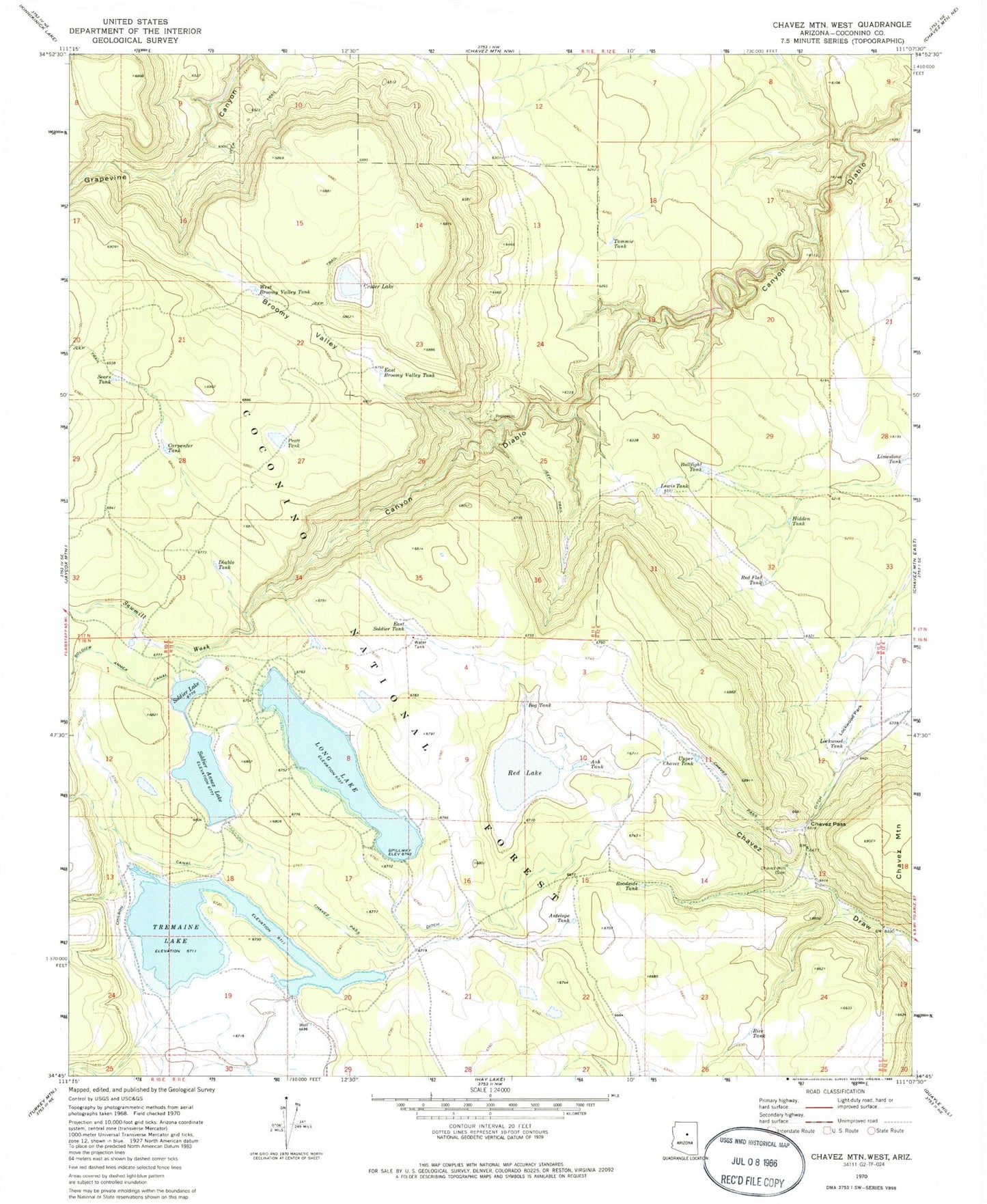
Classic USGS Chavez Mountain West Arizona 7.5'x7.5' Topo Map
Couldn't load pickup availability
Historical USGS topographic quad map of Chavez Mountain West in the state of Arizona. Typical map scale is 1:24,000, but may vary for certain years, if available. Print size: 24" x 27"
This quadrangle is in the following counties: Coconino.
The map contains contour lines, roads, rivers, towns, and lakes. Printed on high-quality waterproof paper with UV fade-resistant inks, and shipped rolled.
Contains the following named places: Antelope Tank, Ash Tank, Bog Tank, Broomy Valley, Bullfight Tank, Carpenter Tank, Chavez Pass, Chavez Well, Crater Lake, Diablo Tank, East Broomy Valley Tank, East Soldier Tank, Hidden Tank, Lewis Tank, Limestone Tank, Lockwood Park, Lockwood Tank, Long Lake, Pratt Tank, Red Flat Tank, Red Lake, Rice Tank, Roadside Tank, Sawmill Wash, Sears Tank, Soldier Annex Lake, Soldier Lake, Tommie Tank, Tremaine Lake, Upper Chavez Tank, West Broomy Valley Tank, Natural Tank, Soldier Annex Dam, Antelope Tank Ditch, Upper Diablo Tank, Borrow Tank, Long Lake South Boat Launch, Long Lake North Boat Launch