MyTopo
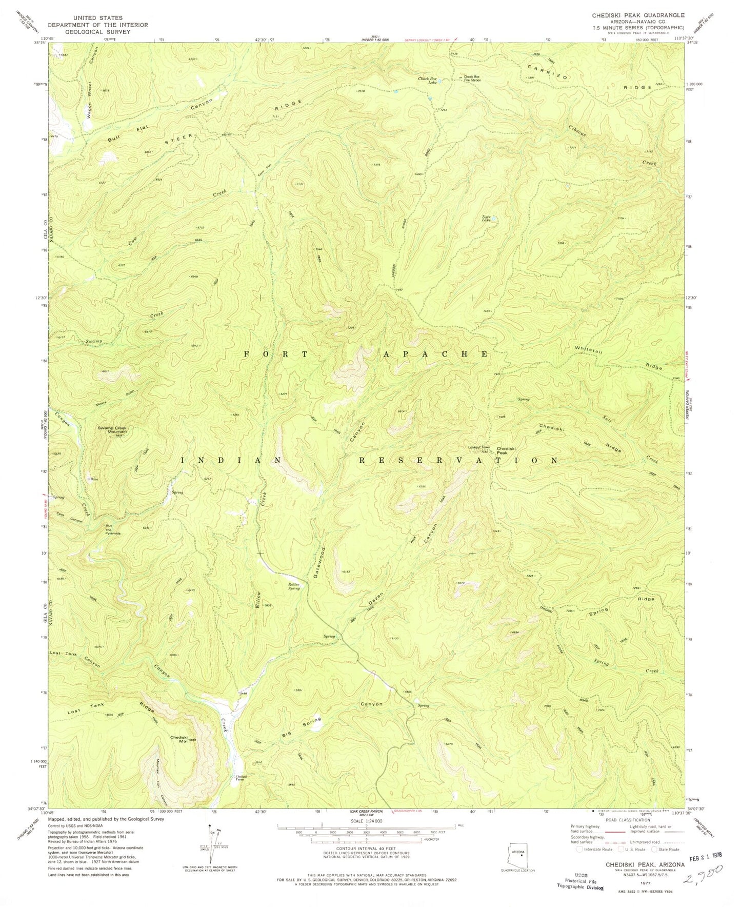
Classic USGS Chediski Peak Arizona 7.5'x7.5' Topo Map
Couldn't load pickup availability
Historical USGS topographic quad map of Chediski Peak in the state of Arizona. Map scale may vary for some years, but is generally around 1:24,000. Print size is approximately 24" x 27"
This quadrangle is in the following counties: Navajo.
The map contains contour lines, roads, rivers, towns, and lakes. Printed on high-quality waterproof paper with UV fade-resistant inks, and shipped rolled.
Contains the following named places: Bear Spring Canyon, Big Spring Canyon, Cave Canyon, Chediski Farms, Chediski Mountain, Chediski Peak, Chediski Ridge, Chuck Box Fire Station, Chuck Box Lake, Cow Flat, Dazen Canyon, Gatewood Canyon, Iron Mine, Iron Mine Camp, Lost Tank Canyon, Miners Gulch, Nyce Lake, Rotten Spring, Steer Ridge, Swamp Creek Mountain, Telephone Ridge, The Pyramids, Wagon Wheel Canyon, West Fork Bull Flat Canyon, Willow Creek