MyTopo
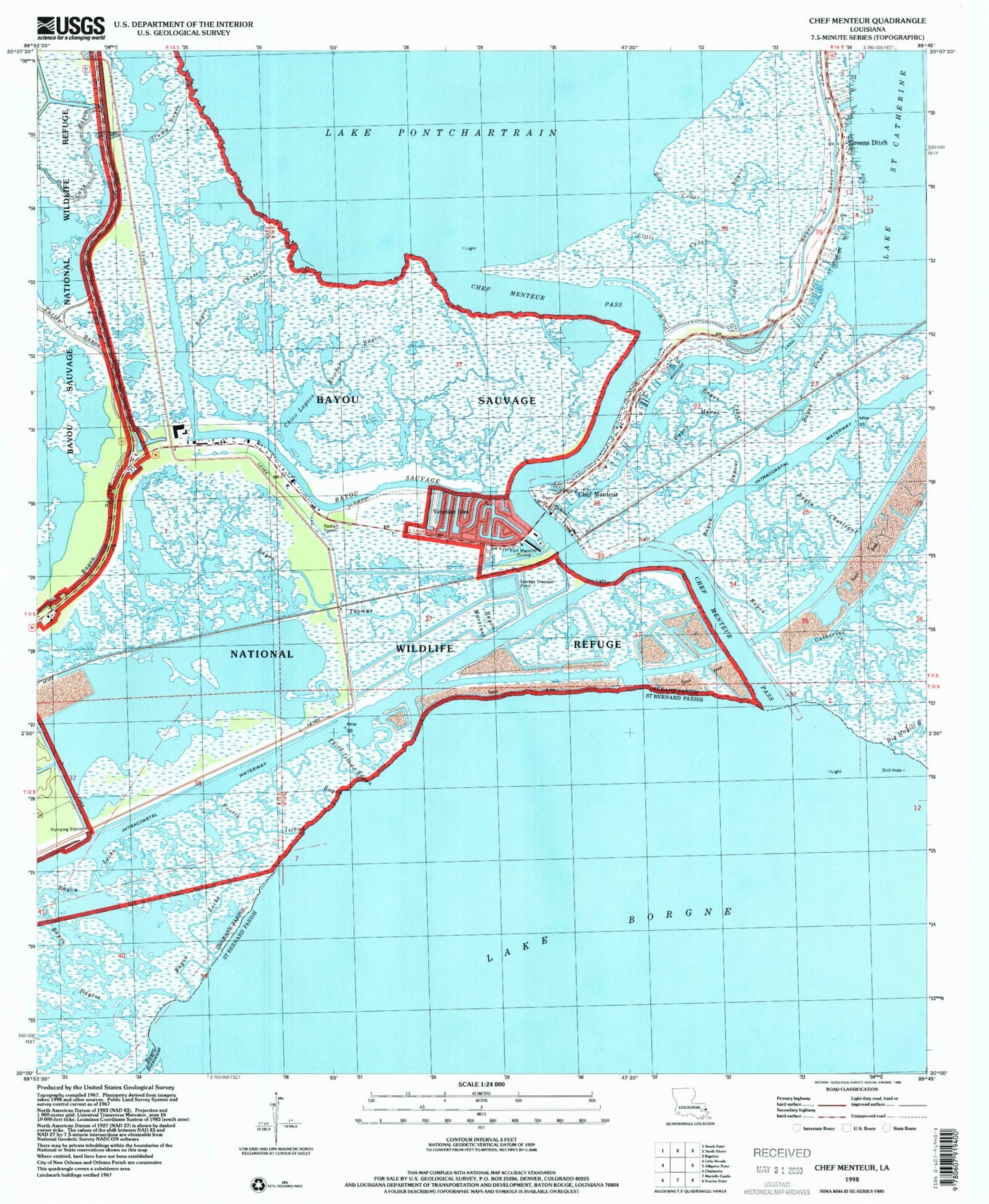
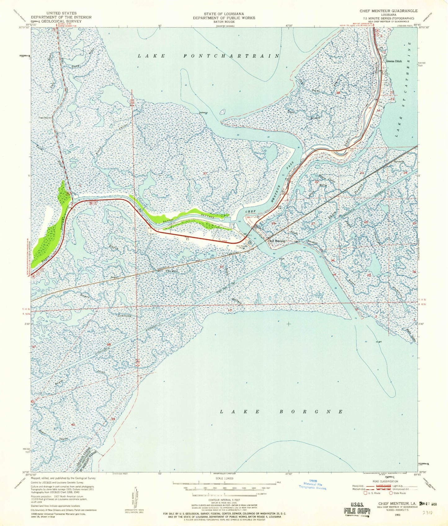
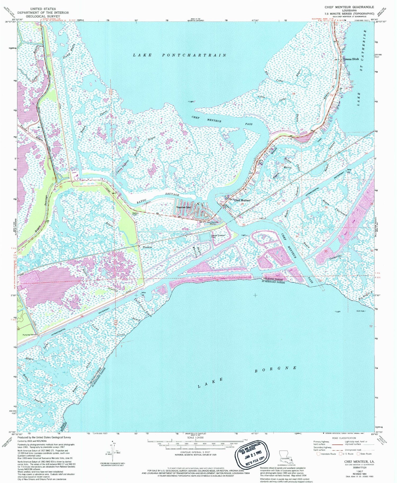
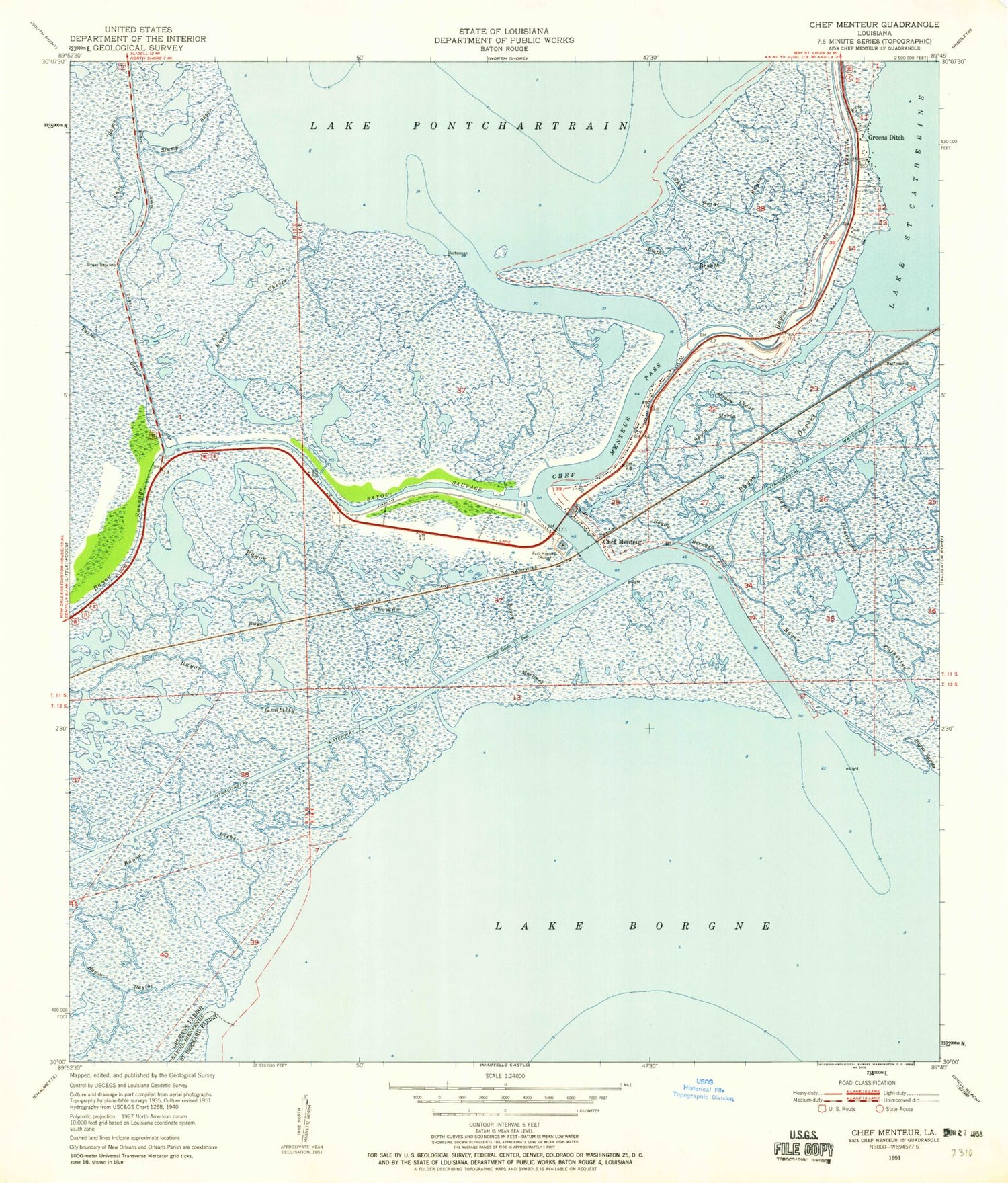
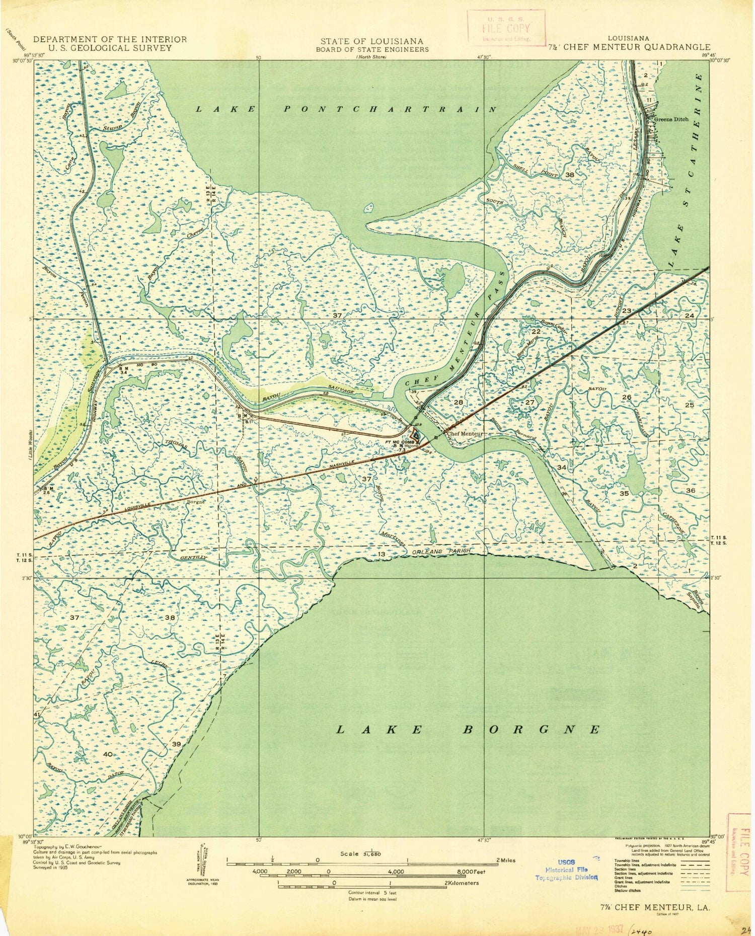
Classic USGS Chef Menteur Louisiana 7.5'x7.5' Topo Map
Couldn't load pickup availability
Historical USGS topographic quad map of Chef Menteur in the state of Louisiana. Map scale may vary for some years, but is generally around 1:24,000. Print size is approximately 24" x 27"
This quadrangle is in the following counties: Orleans, St. Bernard.
The map contains contour lines, roads, rivers, towns, and lakes. Printed on high-quality waterproof paper with UV fade-resistant inks, and shipped rolled.
Contains the following named places: Bayou Catherine, Bayou Cedar, Bayou Charleaux, Bayou Chevee, Bayou de Lesaire, Bayou Dupont, Bayou Gentilly, Bayou Leche, Bayou Maria, Bayou Martinez, Bayou Sauvage, Bayou Sauvage National Wildlife Refuge, Bayou Thomas, Big Cedar Bayou, Brothers Bayou, Chef Menteur, Chef Menteur Pass, Chico Lagoon, Fort Macomb, Fort Macomb State Historic Site, Fourth Island Bayou, Greens Ditch, Irish Bayou Canal, Little Cedar Bayou, Marquez Canal, New Orleans Fire Department Engine 31, New Orleans Police Department, Saint Catherines Island, Stump Bayou, Third Island Bayou, Venetian Isles, ZIP Code: 70129