MyTopo
Classic USGS Chelsea NW Oklahoma 7.5'x7.5' Topo Map
Regular price
$16.95
Regular price
Sale price
$16.95
Unit price
per
Couldn't load pickup availability
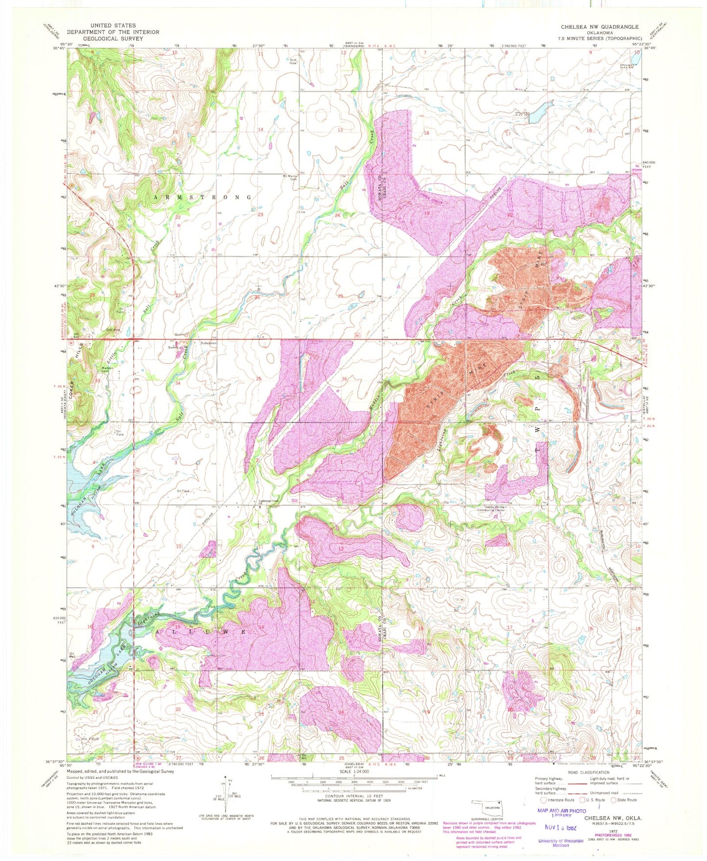
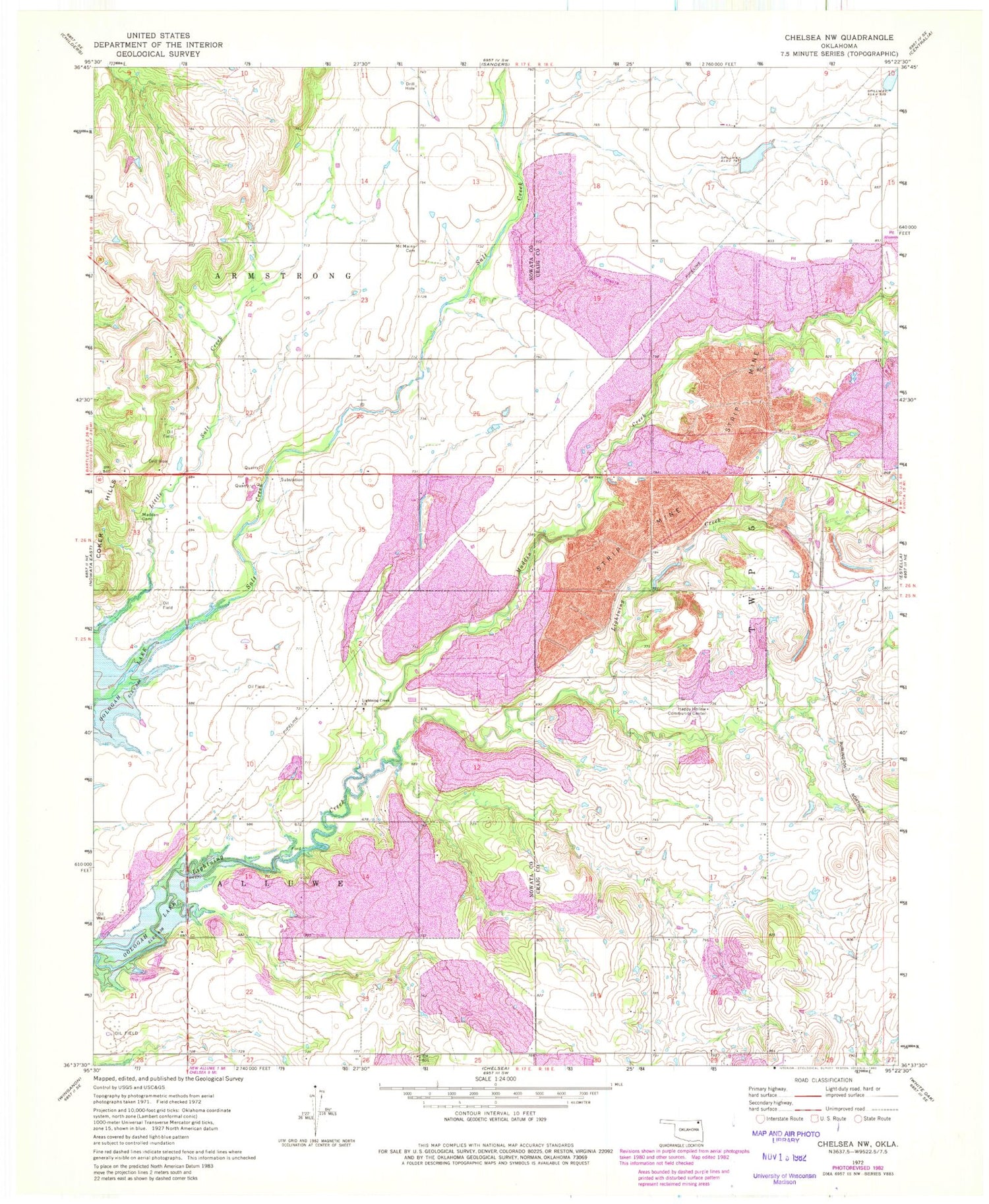
Historical USGS topographic quad map of Chelsea NW in the state of Oklahoma. Map scale may vary for some years, but is generally around 1:24,000. Print size is approximately 24" x 27"
This quadrangle is in the following counties: Craig, Nowata.
The map contains contour lines, roads, rivers, towns, and lakes. Printed on high-quality waterproof paper with UV fade-resistant inks, and shipped rolled.
Contains the following named places: Happy Hollow Community Center, Lightning Creek Church, Madden Cemetery, Madden Creek, McMains Cemetery, New Alluwe Division, Nix Cemetery, Spur Ranch Dam, Spur Ranch Reservoir, Township of Alluwe