MyTopo
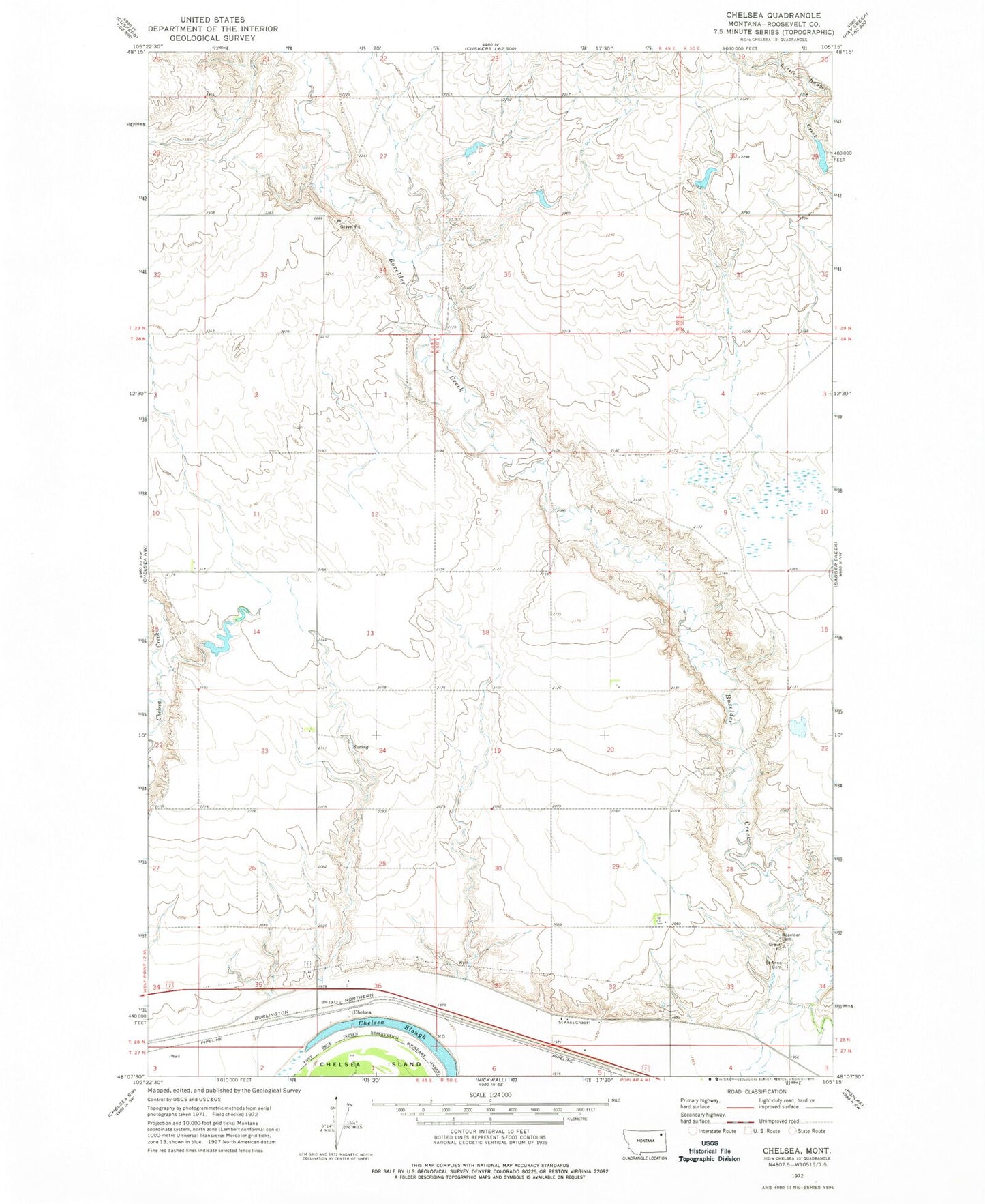
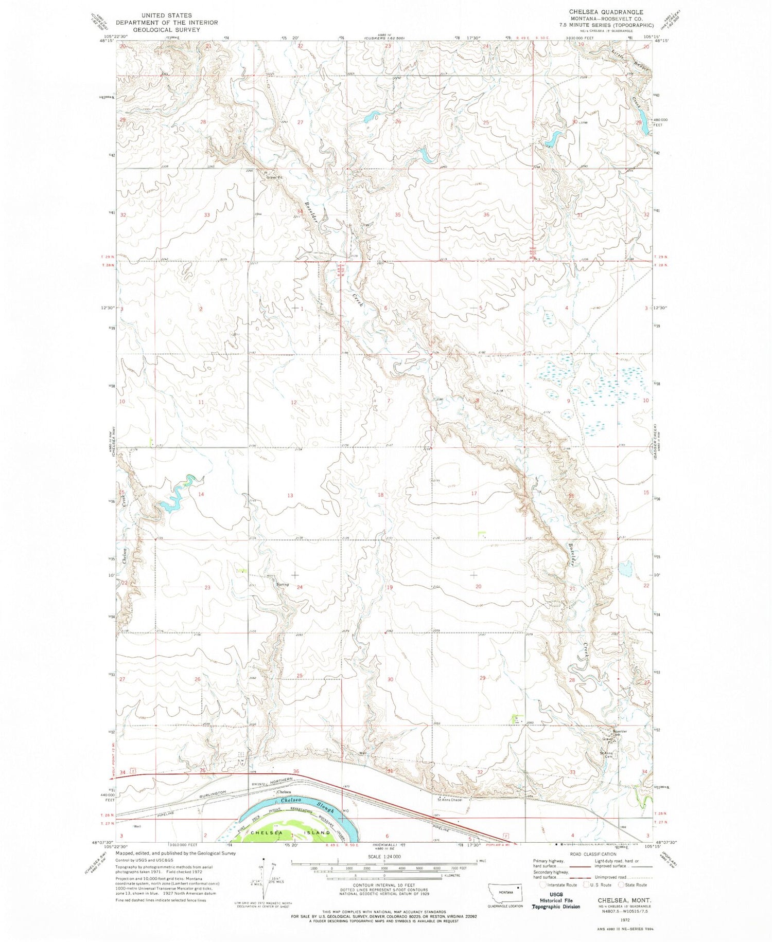
Classic USGS Chelsea Montana 7.5'x7.5' Topo Map
Couldn't load pickup availability
Historical USGS topographic quad map of Chelsea in the state of Montana. Map scale may vary for some years, but is generally around 1:24,000. Print size is approximately 24" x 27"
This quadrangle is in the following counties: Roosevelt.
The map contains contour lines, roads, rivers, towns, and lakes. Printed on high-quality waterproof paper with UV fade-resistant inks, and shipped rolled.
Contains the following named places: 27N50E04AD__01 Well, 27N50E04BB__01 Well, 28N49E01DA__01 Well, 28N49E10DD__01 Well, 28N49E12BC__01 Well, 28N49E23AD__01 Well, 28N49E24BD__01 Well, 28N49E36CA__01 Well, 28N49E36CBA_01 Well, 28N49E36CD__01 Well, 28N50E07BA__01 Well, 28N50E07BA__02 Well, 28N50E17DC__01 Well, 28N50E21AA__01 Well, 28N50E21AC__01 Well, 28N50E21AD__01 Well, 28N50E27CB__01 Well, 28N50E27CB__02 Well, 28N50E29DD__01 Well, 28N50E31BC__01 Well, 28N50E31DA__01 Well, 28N50E32CA__01 Well, 28N50E32DA__01 Well, 28N50E33DD__01 Well, 28N50E34CC__01 Well, 28N50E34CDBC01 Well, Aytolloha Number 1 Dam, Baracker Dam, Boxelder Cemetery, Burshia School, Chelsea, Chelsea Slough, Dolezilek Reservoir Dam, Fort Peck Reservation Number 22 Dam, Saint Ann's Cemetery, Saint Anns Chapel, Wilma Dam