MyTopo
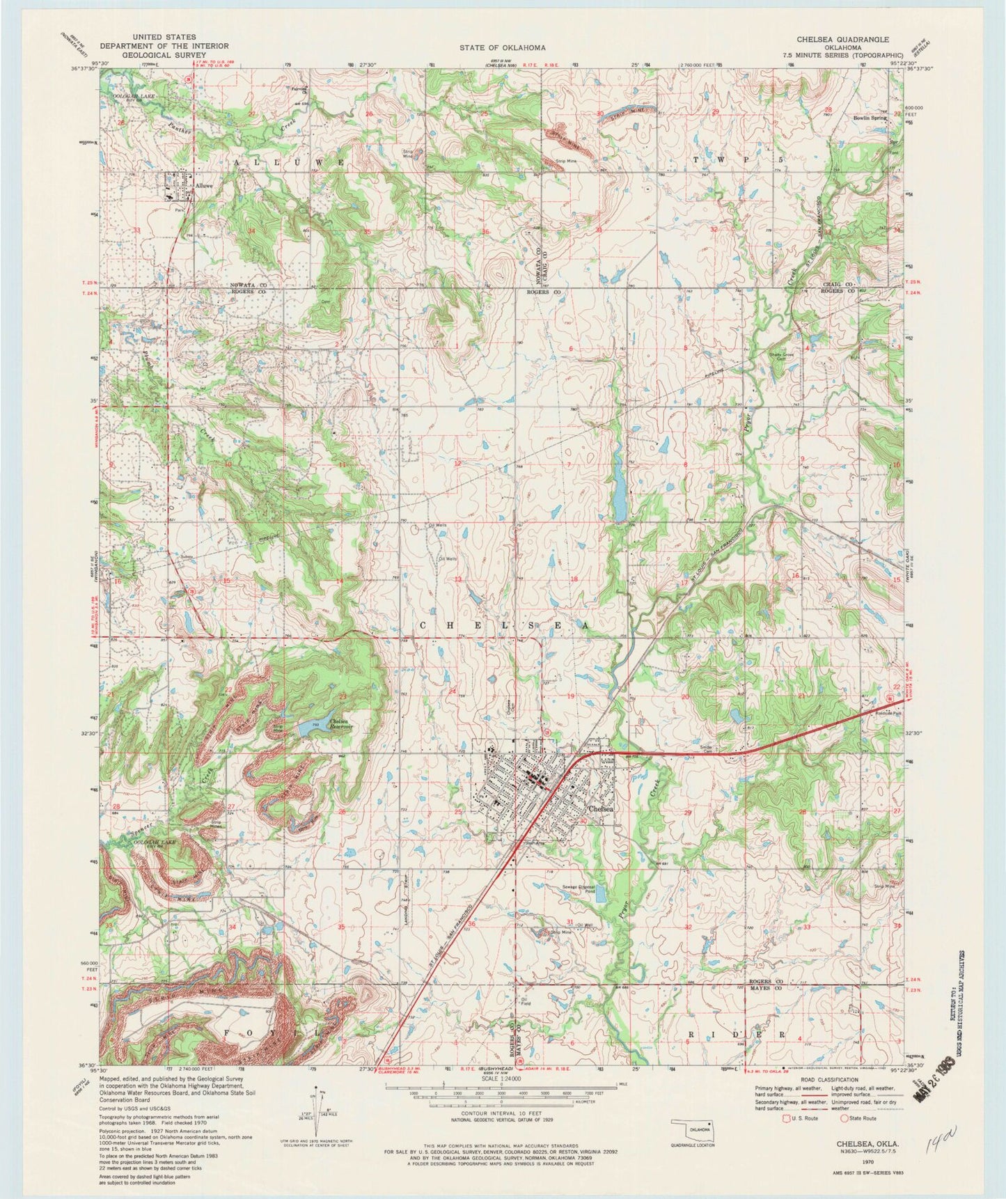
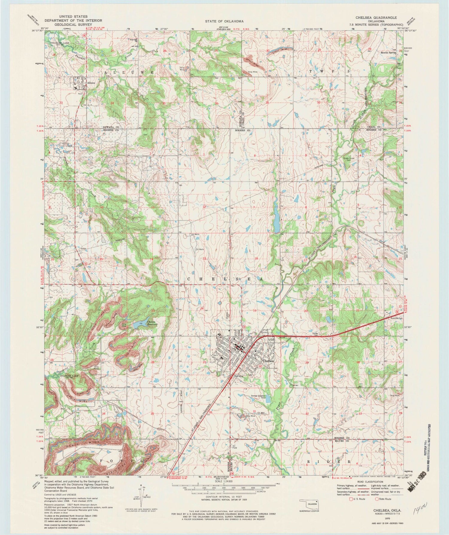
Classic USGS Chelsea Oklahoma 7.5'x7.5' Topo Map
Couldn't load pickup availability
Historical USGS topographic quad map of Chelsea in the state of Oklahoma. Map scale may vary for some years, but is generally around 1:24,000. Print size is approximately 24" x 27"
This quadrangle is in the following counties: Craig, Mayes, Nowata, Rogers.
The map contains contour lines, roads, rivers, towns, and lakes. Printed on high-quality waterproof paper with UV fade-resistant inks, and shipped rolled.
Contains the following named places: Alluwe, Art Goad Elementary School, Bowlin Spring, Bowlin Springs Fire Department, Chelsea, Chelsea Cemetery, Chelsea Division, Chelsea Fire Department, Chelsea High School, Chelsea Memorial United Methodist Church, Chelsea Middle School, Chelsea Police Department, Chelsea Post Office, Chelsea Reservoir, Chelsea Reservoir Number 1, Chelsea Reservoir Number 1 Dam, Chelsea Reservoir Number 2, Chelsea Reservoir Number 2 Dam, Delozier Airport, Fairview Church, First Baptist Church, McIntosh Elementary School, Monarch Field, New Alluwe Volunteer Fire Department, Pryor Creek Number 15 Dam, Pryor Creek Number 15 Reservoir, Pryor Creek Number 20 Dam, Pryor Creek Number 20 Reservoir, Pryor Creek Watershed Site 19 Dam, Pryor Creek Watershed Site 19 Reservoir, Pryor Creek Watershed Site 24 Dam, Pryor Creek Watershed Site 24 Reservoir, Shady Grove Cemetery, Snider Cemetery, Town of Chelsea, Town of New Alluwe, Township of Chelsea, United Pentecostal Church, ZIP Code: 74016