
MyTopo
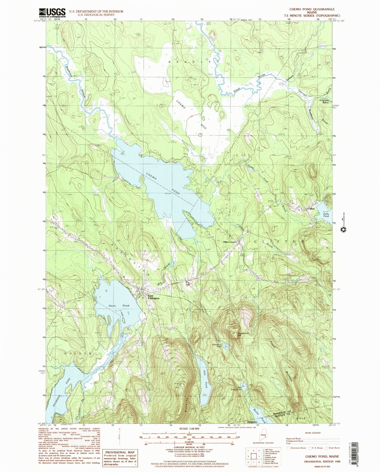
Classic USGS Chemo Pond Maine 7.5'x7.5' Topo Map
Couldn't load pickup availability
Historical USGS topographic quad map of Chemo Pond in the state of Maine. Map scale may vary for some years, but is generally around 1:24,000. Print size is approximately 24" x 27"
This quadrangle is in the following counties: Hancock, Penobscot.
The map contains contour lines, roads, rivers, towns, and lakes. Printed on high-quality waterproof paper with UV fade-resistant inks, and shipped rolled.
Contains the following named places: Blackcap, Bradbury Brook, Chemo Bog, Chemo Pond, Clifton, Clifton Corners, Davis Pond, East Eddington, East Eddington Community Church, Eddington Fire Department, Eddington Post Office, Fitts Pond, Goodwin Brook, Holbrook Pond, Intervale Brook, Kidder Brook, Little Burnt Pond, Maplewood Cemetery, Mill Brook, Mount Pleasant Cemetery, Parks Pond Brook, Parks Pond Campground, Pine Tree Cemetery, Pisgah Mountain, Roosevelt Boy Scout Camp, Sibley Brook, Snowshoe Pond, Town of Clifton, Town of Eddington, WEZQ-FM (Bangor), WMEB-TV (Orono), WMEH-FM (Bangor), Woodchuck Hill, WVII-TV (Bangor), ZIP Codes: 04411, 04428


